 |
|
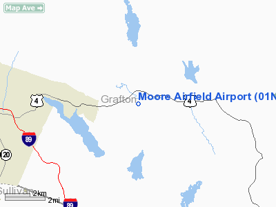
Location & QuickFacts
| FAA Information Effective: | 2008-09-25 |
| Airport Identifier: | 01NH |
| Airport Status: | Operational |
| Longitude/Latitude: | 072-05-13.3100W/43-38-40.2600N
-72.087031/43.644517 (Estimated) |
| Elevation: | 835 ft / 254.51 m (Estimated) |
| Land: | 0 acres |
| From nearest city: | 2 nautical miles NW of Enfield, NH |
| Location: | Belknap County, NH |
| Magnetic Variation: | 16W (1995) |
Owner & Manager
| Ownership: | Privately owned |
| Owner: | Moore Family Trust |
| Address: | 17-c South Road
West Canaan, NH 03741 |
| Phone number: | 603-632-4751 |
| Manager: | Walter J. Moore, Jr. |
| Address: | 179-c South Road
West Canaan, NH 03741 |
| Phone number: | 603-632-4751 |
Airport Operations and Facilities
| Airport Use: | Private |
| Segmented Circle: | No |
| Control Tower: | No |
| Sectional chart: | New York |
| Region: | ANE - New England |
| Boundary ARTCC: | ZBW - Boston |
| Tie-in FSS: | BTV - Burlington |
| FSS Toll Free: | 1-800-WX-BRIEF |
Runway Information
Runway 17/35
| Dimension: | 600 x 50 ft / 182.9 x 15.2 m |
| Surface: | TURF, |
| |
Runway 17 |
Runway 35 |
| Traffic Pattern: | Left | Right |
| Obstruction: | 100 ft trees, 125.0 ft from runway | 100 ft trees, 125.0 ft from runway |
|
Radio Navigation Aids
| ID |
Type |
Name |
Ch |
Freq |
Var |
Dist |
| LCI | FAN MARKER | Laconia | | | | 28.5 nm |
| R | FAN MARKER | Chitt | | | 14W | 38.6 nm |
| MPV | FAN MARKER | Brook | | | | 47.5 nm |
| HIE | FAN MARKER | Witey | | | 17W | 48.9 nm |
| LAH | NDB | Hanover | | 276.00 | 15W | 5.2 nm |
| IVV | NDB | White River | | 379.00 | 16W | 17.2 nm |
| CNH | NDB | Claremont | | 233.00 | 16W | 20.7 nm |
| LC | NDB | Blnap | | 328.00 | 16W | 24.8 nm |
| SXD | NDB | Springfield | | 265.00 | 15W | 31.3 nm |
| DYO | NDB | Smuto | | 221.00 | 15W | 38.0 nm |
| CO | NDB | Epsom | | 216.00 | 16W | 42.0 nm |
| GMA | NDB | Mahn | | 386.00 | 17W | 46.5 nm |
| LEB | VOR/DME | Lebanon | 084X | 113.70 | 15W | 6.0 nm |
| MPV | VOR/DME | Montpelier | 045X | 110.80 | 16W | 30.8 nm |
| RUT | VOR/DME | Rutland | 47X | 111.00 | 15W | 38.3 nm |
| CON | VORTAC | Concord | 076X | 112.90 | 15W | 33.9 nm |
Remarks
- NO OVERFLIGHT OVER HIGH SCHOOL 1/2 MI WNW OF ARPT.
- 100 FT TREES ALL QUADRANTS.
- PRVDD VFR, AVOID MASCOMA VALLEY HIGH SCHOOL 1/2 MILE NW OF ARPT; ALL USERS NOTIFIED OF TWO CONDITONS.
Images and information placed above are from
http://www.airport-data.com/airport/01NH/
We thank them for the data!
| General Info
|
| Country |
United States
|
| State |
NEW HAMPSHIRE
|
| FAA ID |
01NH
|
| Latitude |
43-38-40.260N
|
| Longitude |
072-05-13.310W
|
| Elevation |
835 feet
|
| Near City |
ENFIELD
|
We don't guarantee the information is fresh and accurate. The data may
be wrong or outdated.
For more up-to-date information please refer to other sources.
|
|


