 |
|
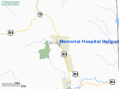
Memorial Hospital Heliport Heliport |
Location & QuickFacts
| FAA Information Effective: | 2008-09-25 |
| Airport Identifier: | 08NH |
| Airport Status: | Operational |
| Longitude/Latitude: | 071-08-08.8000W/44-03-40.6400N
-71.135778/44.061289 (Estimated) |
| Elevation: | 574 ft / 174.96 m (Estimated) |
| Land: | 0 acres |
| From nearest city: | 1 nautical miles SE of North Conway, NH |
| Location: | Carroll County, NH |
| Magnetic Variation: | 16W (2000) |
Owner & Manager
| Ownership: | Privately owned |
| Owner: | The Memorial Hospital |
| Address: | 3073 Main Street, P.o. Box 5001
North Conway, NH 03860 |
| Phone number: | 603-356-5461 |
| Manager: | Steve Fitzpatrick, Facilities Mgr. |
| Address: | 3073 Main Street, P.o. Box 5001
North Conway, NH 03860 |
| Phone number: | 603-356-5461 |
Airport Operations and Facilities
| Airport Use: | Private |
| Wind indicator: | Yes |
| Segmented Circle: | No |
| Control Tower: | No |
| Sectional chart: | Montreal |
| Region: | ANE - New England |
| Boundary ARTCC: | ZBW - Boston |
| Tie-in FSS: | BGR - Bangor |
| FSS Toll Free: | 1-800-WX-BRIEF |
Runway Information
Helipad H1
| Dimension: | 80 x 80 ft / 24.4 x 24.4 m |
| Surface: | CONC, |
| |
Runway H1 |
Runway |
| Traffic Pattern: | Left | Left |
|
Radio Navigation Aids
| ID |
Type |
Name |
Ch |
Freq |
Var |
Dist |
| SZO | FAN MARKER | Grinn | | | 17W | 12.6 nm |
| HIE | FAN MARKER | Witey | | | 17W | 26.0 nm |
| LCI | FAN MARKER | Laconia | | | | 32.5 nm |
| SZO | NDB | Sebago | | 227.00 | 17W | 18.0 nm |
| GMA | NDB | Mahn | | 386.00 | 17W | 29.8 nm |
| HXK | NDB | Hornebrook | | 281.00 | 17W | 31.1 nm |
| LC | NDB | Blnap | | 328.00 | 16W | 36.0 nm |
| LLX | NDB | Lyndonville | | 353.00 | 16W | 46.8 nm |
| BML | VOR/DME | Berlin | 041X | 110.40 | 17W | 34.5 nm |
| ENE | VORTAC | Kennebunk | 118X | 117.10 | 17W | 44.4 nm |
| PWM | VOT | Portland Intl Jetport | | 111.00 | | 43.6 nm |
Remarks
- MEDICAL USE.
- PRVDD INGRESS/EGRESS BETWEEN 240-090 DEGS, VFR ONLY.
Images and information placed above are from
http://www.airport-data.com/airport/08NH/
We thank them for the data!
| General Info
|
| Country |
United States
|
| State |
NEW HAMPSHIRE
|
| FAA ID |
08NH
|
| Latitude |
44-03-40.640N
|
| Longitude |
071-08-08.800W
|
| Elevation |
574 feet
|
| Near City |
NORTH CONWAY
|
We don't guarantee the information is fresh and accurate. The data may
be wrong or outdated.
For more up-to-date information please refer to other sources.
|
|


