 |
|
Location & QuickFacts
| FAA Information Effective: | 2008-09-25 |
| Airport Identifier: | 19NH |
| Airport Status: | Operational |
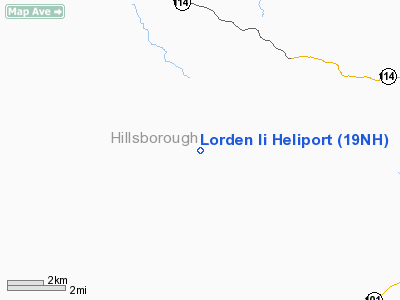
| Longitude/Latitude: | 071-41-37.7000W/42-58-41.5000N
-71.693806/42.978194 (Estimated) |
| Elevation: | 700 ft / 213.36 m (Estimated) |
| Land: | 14 acres |
| From nearest city: | 1 nautical miles E of New Boston, NH |
| Location: | Hillsborough County, NH |
| Magnetic Variation: | () |
Owner & Manager
| Ownership: | Privately owned |
| Owner: | Thomas Lorden |
| Address: | 60 Stable Rd
Milford, NH 03055 |
| Phone number: | 603-673-9724 |
| Manager: | Thomas Lorden |
| Address: | 60 Stable Rd
Milford, NH 03055 |
| Phone number: | 603-673-9724 |
Airport Operations and Facilities
| Airport Use: | Private |
| Segmented Circle: | No |
| Control Tower: | No |
| Sectional chart: | New York |
| Region: | ANE - New England |
| Boundary ARTCC: | ZBW - Boston |
| Tie-in FSS: | BGR - Bangor |
| FSS Toll Free: | 1-800-WX-BRIEF |
Runway Information
Helipad H1
| Dimension: | 20 x 20 ft / 6.1 x 6.1 m |
| Surface: | GRVL, |
| |
Runway H1 |
Runway |
| Traffic Pattern: | Left | Left |
|
Radio Navigation Aids
| ID |
Type |
Name |
Ch |
Freq |
Var |
Dist |
| LCI | FAN MARKER | Laconia | | | | 37.1 nm |
| BVY | FAN MARKER | Beverly | | | | 39.8 nm |
| AS | NDB | Chern | | 359.00 | 16W | 10.1 nm |
| CO | NDB | Epsom | | 216.00 | 16W | 13.6 nm |
| DRY | NDB | Derry | | 338.00 | 16W | 14.6 nm |
| FIT | NDB | Fitchburg | | 365.00 | 15W | 25.8 nm |
| LC | NDB | Blnap | | 328.00 | 16W | 34.3 nm |
| ORE | NDB | Orange | | 205.00 | 15W | 35.9 nm |
| CNH | NDB | Claremont | | 233.00 | 16W | 37.9 nm |
| SKR | NDB | Shaker Hill | | 251.00 | 16W | 38.8 nm |
| TOF | NDB | Topsfield | | 269.00 | 16W | 39.0 nm |
| ESG | NDB | Rollins | | 260.00 | 16W | 40.7 nm |
| SXD | NDB | Springfield | | 265.00 | 15W | 42.9 nm |
| LQ | NDB | Lyndy | | 382.00 | 16W | 45.2 nm |
| LAH | NDB | Hanover | | 276.00 | 15W | 48.4 nm |
| IVV | NDB | White River | | 379.00 | 16W | 48.6 nm |
| MHT | VOR/DME | Manchester | 091X | 114.40 | 15W | 15.7 nm |
| LWM | VOR/DME | Lawrence | 072X | 112.50 | 15W | 30.0 nm |
| PSM | VOR/DME | Pease | 112X | 116.50 | 16W | 38.4 nm |
| LEB | VOR/DME | Lebanon | 084X | 113.70 | 15W | 47.9 nm |
| CON | VORTAC | Concord | 076X | 112.90 | 15W | 15.4 nm |
| EEN | VORTAC | Keene | 031X | 109.40 | 14W | 28.6 nm |
| GDM | VORTAC | Gardner | 043X | 110.60 | 14W | 30.6 nm |
| BOS | VORTAC | Boston | 074X | 112.70 | 16W | 48.6 nm |
| BED | VOT | Laurence G Hanscom Fld | | 110.00 | | 35.5 nm |
| ORH | VOT | Worcester | | 108.20 | | 43.4 nm |
| BOS | VOT | Boston Logan Intl | | 111.00 | | 46.8 nm |
Remarks
- OWNER DOES NOT WANT ARPT TO BE CHARTED.
- PRVDD PRIMARY INGRESS/EGRESS FM 230-300 DEGS & FM 050-120 DEGS; SECONDARY INGRESS/EGRESS FM 180-200 DEGS & 020-360 DEGS; WIDEN THE PAD TO 20 X 20 FT; INSTALL WIND INDICATOR; VFR OPNS; & ALL USERS ARE NOTIFIED & COMPLY WITH THESE CONDITIONS.
Images and information placed above are from
http://www.airport-data.com/airport/19NH/
We thank them for the data!
|
|


