 |
|
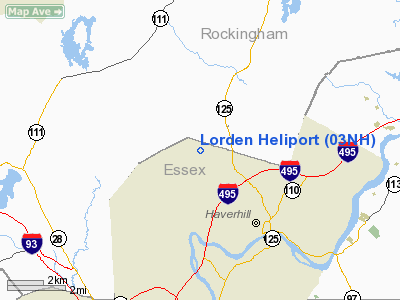
Location & QuickFacts
| FAA Information Effective: | 2008-09-25 |
| Airport Identifier: | 03NH |
| Airport Status: | Operational |
| Longitude/Latitude: | 071-07-27.8200W/42-48-55.6100N
-71.124394/42.815447 (Estimated) |
| Elevation: | 400 ft / 121.92 m (Estimated) |
| Land: | 0 acres |
| From nearest city: | 1 nautical miles NW of Milford, NH |
| Location: | Hillsborough County, NH |
| Magnetic Variation: | 16W (2000) |
Owner & Manager
| Ownership: | Privately owned |
| Owner: | Kenneth Lorden |
| Address: | 60 Stable Road
Mildford, NH 03055 |
| Phone number: | 603-673-9724 |
| Manager: | Kenneth Lorden |
| Address: | 60 Stable Road
Mildford, NH 03055 |
| Phone number: | 603-673-9724 |
Airport Operations and Facilities
| Airport Use: | Private |
| Segmented Circle: | No |
| Control Tower: | No |
| Sectional chart: | New York |
| Region: | ANE - New England |
| Boundary ARTCC: | ZBW - Boston |
| Tie-in FSS: | BGR - Bangor |
| FSS Toll Free: | 1-800-WX-BRIEF |
Runway Information
Helipad H1
| Dimension: | 12 x 80 ft / 3.7 x 24.4 m |
| Surface: | ASPH, |
| |
Runway H1 |
Runway |
| Traffic Pattern: | Left | Left |
|
Radio Navigation Aids
| ID |
Type |
Name |
Ch |
Freq |
Var |
Dist |
| BVY | FAN MARKER | Beverly | | | | 14.7 nm |
| ORW | FAN MARKER | Canton | | | 15W | 39.5 nm |
| LCI | FAN MARKER | Laconia | | | | 47.3 nm |
| DRY | NDB | Derry | | 338.00 | 16W | 12.5 nm |
| TOF | NDB | Topsfield | | 269.00 | 16W | 13.9 nm |
| AS | NDB | Chern | | 359.00 | 16W | 21.1 nm |
| SKR | NDB | Shaker Hill | | 251.00 | 16W | 21.8 nm |
| LQ | NDB | Lyndy | | 382.00 | 16W | 23.0 nm |
| CO | NDB | Epsom | | 216.00 | 16W | 23.3 nm |
| ESG | NDB | Rollins | | 260.00 | 16W | 27.6 nm |
| FIT | NDB | Fitchburg | | 365.00 | 15W | 32.2 nm |
| LC | NDB | Blnap | | 328.00 | 16W | 47.0 nm |
| IMR | NDB | Marshfield | | 368.00 | 16W | 47.5 nm |
| IHM | NDB | Mansfield | | 220.00 | 16W | 49.0 nm |
| NZW | TACAN | South Weymouth | 061X | | 15W | 40.9 nm |
| LWM | VOR/DME | Lawrence | 072X | 112.50 | 15W | 4.7 nm |
| MHT | VOR/DME | Manchester | 091X | 114.40 | 15W | 11.3 nm |
| PSM | VOR/DME | Pease | 112X | 116.50 | 16W | 20.7 nm |
| BOS | VORTAC | Boston | 074X | 112.70 | 16W | 28.2 nm |
| CON | VORTAC | Concord | 076X | 112.90 | 15W | 31.4 nm |
| ENE | VORTAC | Kennebunk | 118X | 117.10 | 17W | 43.0 nm |
| GDM | VORTAC | Gardner | 043X | 110.60 | 14W | 44.3 nm |
| BED | VOT | Laurence G Hanscom Fld | | 110.00 | | 22.1 nm |
| BOS | VOT | Boston Logan Intl | | 111.00 | | 26.8 nm |
| ORH | VOT | Worcester | | 108.20 | | 46.6 nm |
Remarks
- PRVDD VFR OPNS; LNDG SITE IS USED ONLY BE THE PROPONENT; INGRESS IS FROM THE SE THROUGH THE W; AND EGRESS IS FROM THE E THROUGH THE W.
Images and information placed above are from
http://www.airport-data.com/airport/03NH/
We thank them for the data!
| General Info
|
| Country |
United States
|
| State |
NEW HAMPSHIRE
|
| FAA ID |
03NH
|
| Latitude |
42-48-55.610N
|
| Longitude |
071-07-27.820W
|
| Elevation |
400 feet
|
| Near City |
MILFORD
|
We don't guarantee the information is fresh and accurate. The data may
be wrong or outdated.
For more up-to-date information please refer to other sources.
|
|


