 |
|
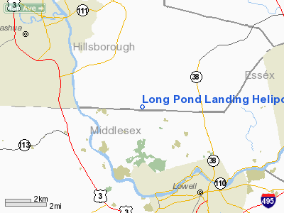
Long Pond Landing Heliport |
Location & QuickFacts
| FAA Information Effective: | 2008-09-25 |
| Airport Identifier: | 36NH |
| Airport Status: | Operational |
| Longitude/Latitude: | 071-22-16.0000W/42-42-03.0000N
-71.371111/42.700833 (Estimated) |
| Elevation: | 185 ft / 56.39 m (Estimated) |
| Land: | 0 acres |
| From nearest city: | 2 nautical miles SE of Pelham, NH |
| Location: | Belknap County, NH |
| Magnetic Variation: | () |
Owner & Manager
| Ownership: | Privately owned |
| Owner: | Richard & Brenda Lannan |
| Address: | 11 Mcgrath Rd
Pelham, NH 03076 |
| Phone number: | 603-635-0879 |
| Manager: | Steven R. Rancourt |
| Address: | 7 Mcgrath Road
Pelham, NH 03076 |
| Phone number: | 603-635-3269 |
Airport Operations and Facilities
| Airport Use: | Private |
| Control Tower: | No |
| Region: | ANE - New England |
| Boundary ARTCC: | ZBW - Boston |
| Tie-in FSS: | BTV - Burlington |
| FSS Toll Free: | 1-800-WX-BRIEF |
Runway Information
Helipad H1
| Dimension: | 87 x 40 ft / 26.5 x 12.2 m |
| Surface: | ASPH, |
| |
Runway H1 |
Runway |
| Traffic Pattern: | Left | Left |
|
Radio Navigation Aids
| ID |
Type |
Name |
Ch |
Freq |
Var |
Dist |
| BVY | FAN MARKER | Beverly | | | | 19.7 nm |
| ORW | FAN MARKER | Canton | | | 15W | 34.0 nm |
| DRY | NDB | Derry | | 338.00 | 16W | 10.2 nm |
| AS | NDB | Chern | | 359.00 | 16W | 12.6 nm |
| SKR | NDB | Shaker Hill | | 251.00 | 16W | 17.0 nm |
| TOF | NDB | Topsfield | | 269.00 | 16W | 19.0 nm |
| FIT | NDB | Fitchburg | | 365.00 | 15W | 19.3 nm |
| LQ | NDB | Lyndy | | 382.00 | 16W | 23.4 nm |
| CO | NDB | Epsom | | 216.00 | 16W | 25.4 nm |
| ESG | NDB | Rollins | | 260.00 | 16W | 39.3 nm |
| ORE | NDB | Orange | | 205.00 | 15W | 41.2 nm |
| IHM | NDB | Mansfield | | 220.00 | 16W | 42.7 nm |
| SFZ | NDB | Central | | 241.00 | 15W | 47.3 nm |
| IMR | NDB | Marshfield | | 368.00 | 16W | 47.6 nm |
| NZW | TACAN | South Weymouth | 061X | | 15W | 38.3 nm |
| MHT | VOR/DME | Manchester | 091X | 114.40 | 15W | 10.1 nm |
| LWM | VOR/DME | Lawrence | 072X | 112.50 | 15W | 12.4 nm |
| PSM | VOR/DME | Pease | 112X | 116.50 | 16W | 33.1 nm |
| PUT | VOR/DME | Putnam | 121X | 117.40 | 14W | 49.5 nm |
| BOS | VORTAC | Boston | 074X | 112.70 | 16W | 26.7 nm |
| GDM | VORTAC | Gardner | 043X | 110.60 | 14W | 31.8 nm |
| CON | VORTAC | Concord | 076X | 112.90 | 15W | 32.5 nm |
| EEN | VORTAC | Keene | 031X | 109.40 | 14W | 41.0 nm |
| BED | VOT | Laurence G Hanscom Fld | | 110.00 | | 14.5 nm |
| BOS | VOT | Boston Logan Intl | | 111.00 | | 24.9 nm |
| ORH | VOT | Worcester | | 108.20 | | 34.2 nm |
Remarks
- OWNER DOES NOT WANT HELIPORT CHARTED.
- 800 FT TOWERS WITH WIRES 2.1 NM NORTH OF PAD.
- PRVDD INGRESS AT 355 DEGS & EGRESS AT 175 DEGS; RESOLVE ANY TRAFFIC PATTERN CONFLICTS WITH MERRIMACK VALLEY SPB; INSTALL WIND INDICATOR; DAYLIGHT VFR OPNS ONLY; PRIVATE USE; AND ALL USERS ARE NOTIFIED OF THESE CONDITONS.
Images and information placed above are from
http://www.airport-data.com/airport/36NH/
We thank them for the data!
|
|


