 |
|
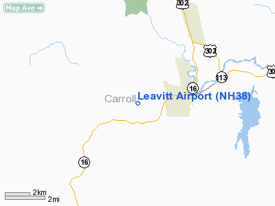
Location & QuickFacts
| FAA Information Effective: | 2008-09-25 |
| Airport Identifier: | NH38 |
| Airport Status: | Operational |
| Longitude/Latitude: | 071-10-11.2530W/43-58-21.2560N
-71.169792/43.972571 (Estimated) |
| Elevation: | 860 ft / 262.13 m (Estimated) |
| Land: | 0 acres |
| From nearest city: | 2 nautical miles W of Albany, NH |
| Location: | Carroll County, NH |
| Magnetic Variation: | 17W (1985) |
Owner & Manager
| Ownership: | Privately owned |
| Owner: | James L. Goldman |
| Address: | 3316 Chatham Place
Media, PA 19063 |
| Phone number: | 610-368-1570 |
| Manager: | James L. Goldman |
| Address: | 3316 Chatham Place
Media, PA 19063 |
| Phone number: | 610-368-1570 |
Airport Operations and Facilities
| Airport Use: | Private |
| Segmented Circle: | No |
| Control Tower: | No |
| Landing fee charge: | No |
| Sectional chart: | New York |
| Region: | ANE - New England |
| Boundary ARTCC: | ZBW - Boston |
| Tie-in FSS: | BGR - Bangor |
| FSS Toll Free: | 1-800-WX-BRIEF |
Runway Information
Runway 10/28
| Dimension: | 2000 x 40 ft / 609.6 x 12.2 m |
| Surface: | GRAVEL, |
| |
Runway 10 |
Runway 28 |
| Traffic Pattern: | Left | Left |
|
Radio Navigation Aids
| ID |
Type |
Name |
Ch |
Freq |
Var |
Dist |
| SZO | FAN MARKER | Grinn | | | 17W | 12.5 nm |
| LCI | FAN MARKER | Laconia | | | | 27.1 nm |
| HIE | FAN MARKER | Witey | | | 17W | 29.2 nm |
| SZO | NDB | Sebago | | 227.00 | 17W | 17.3 nm |
| LC | NDB | Blnap | | 328.00 | 16W | 30.7 nm |
| GMA | NDB | Mahn | | 386.00 | 17W | 32.3 nm |
| HXK | NDB | Hornebrook | | 281.00 | 17W | 36.3 nm |
| LAH | NDB | Hanover | | 276.00 | 15W | 46.6 nm |
| ESG | NDB | Rollins | | 260.00 | 16W | 47.6 nm |
| LLX | NDB | Lyndonville | | 353.00 | 16W | 48.9 nm |
| BML | VOR/DME | Berlin | 041X | 110.40 | 17W | 39.7 nm |
| LEB | VOR/DME | Lebanon | 084X | 113.70 | 15W | 48.7 nm |
| ENE | VORTAC | Kennebunk | 118X | 117.10 | 17W | 40.8 nm |
| CON | VORTAC | Concord | 076X | 112.90 | 15W | 48.6 nm |
| PWM | VOT | Portland Intl Jetport | | 111.00 | | 42.0 nm |
Remarks
Images and information placed above are from
http://www.airport-data.com/airport/NH38/
We thank them for the data!
| General Info
|
| Country |
United States
|
| State |
NEW HAMPSHIRE
|
| FAA ID |
NH38
|
| Latitude |
43-58-21.256N
|
| Longitude |
071-10-11.253W
|
| Elevation |
860 feet
|
| Near City |
ALBANY
|
We don't guarantee the information is fresh and accurate. The data may
be wrong or outdated.
For more up-to-date information please refer to other sources.
|
|


