 |
|
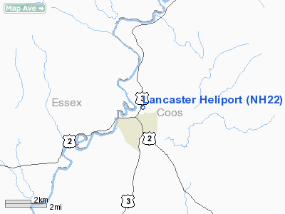
Location & QuickFacts
| FAA Information Effective: | 2008-09-25 |
| Airport Identifier: | NH22 |
| Airport Status: | Operational |
| Longitude/Latitude: | 071-34-09.3040W/44-30-13.2050N
-71.569251/44.503668 (Estimated) |
| Elevation: | 860 ft / 262.13 m (Surveyed) |
| Land: | 0 acres |
| From nearest city: | 1 nautical miles N of Lancaster, NH |
| Location: | Coos County, NH |
| Magnetic Variation: | 17W (1985) |
Owner & Manager
| Ownership: | Privately owned |
| Owner: | Public Service Co. Of N.h. |
| Address: | 1000 Elm St.
Manchester, NH 03105 |
| Phone number: | 603-669-4000 |
| Manager: | Paul B. Bohan |
| Address: | Po Box 330, 1000 Elm St
Manchester, NH 03105 |
| Phone number: | 603-669-4000 |
Airport Operations and Facilities
| Airport Use: | Private |
| Wind indicator: | Yes |
| Segmented Circle: | No |
| Control Tower: | No |
| Landing fee charge: | No |
| Sectional chart: | Montreal |
| Region: | ANE - New England |
| Boundary ARTCC: | ZBW - Boston |
| Tie-in FSS: | BGR - Bangor |
| FSS on Airport: | No |
| FSS Toll Free: | 1-800-WX-BRIEF |
Airport Services
| Airframe Repair: | NONE |
| Power Plant Repair: | NONE |
Runway Information
Helipad H1
| Dimension: | 100 x 100 ft / 30.5 x 30.5 m |
| Surface: | ASPH-TURF, |
| |
Runway H1 |
Runway |
| Traffic Pattern: | Left | Left |
|
Radio Navigation Aids
| ID |
Type |
Name |
Ch |
Freq |
Var |
Dist |
| HIE | FAN MARKER | Witey | | | 17W | 8.2 nm |
| SZO | FAN MARKER | Grinn | | | 17W | 44.2 nm |
| MPV | FAN MARKER | Brook | | | | 48.0 nm |
| GMA | NDB | Mahn | | 386.00 | 17W | 9.9 nm |
| HXK | NDB | Hornebrook | | 281.00 | 17W | 17.3 nm |
| LLX | NDB | Lyndonville | | 353.00 | 16W | 19.7 nm |
| EFK | NDB | Newport | | 242.00 | 17W | 37.5 nm |
| RQM | NDB | Rangeley | | 221.00 | 18W | 43.5 nm |
| JRV | NDB | Morrisville/stowe | | 375.00 | 16W | 43.8 nm |
| VKN | NDB | Mount Mansfield | | 268.00 | 16W | 48.8 nm |
| SZO | NDB | Sebago | | 227.00 | 17W | 49.5 nm |
| BML | VOR/DME | Berlin | 041X | 110.40 | 17W | 18.2 nm |
| MPV | VOR/DME | Montpelier | 045X | 110.80 | 16W | 45.4 nm |
| YSC | VORTAC | Sherbrooke | 079X | 113.20 | 17W | 49.7 nm |
Remarks
Images and information placed above are from
http://www.airport-data.com/airport/NH22/
We thank them for the data!
| General Info
|
| Country |
United States
|
| State |
NEW HAMPSHIRE
|
| FAA ID |
NH22
|
| Latitude |
44-30-13.205N
|
| Longitude |
071-34-09.304W
|
| Elevation |
860 feet
|
| Near City |
LANCASTER
|
We don't guarantee the information is fresh and accurate. The data may
be wrong or outdated.
For more up-to-date information please refer to other sources.
|
|


