 |
|
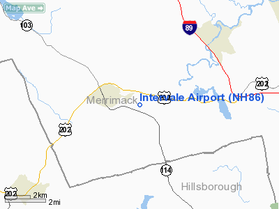
Location & QuickFacts
| FAA Information Effective: | 2008-09-25 |
| Airport Identifier: | NH86 |
| Airport Status: | Operational |
| Longitude/Latitude: | 071-47-14.2800W/43-10-30.2900N
-71.787300/43.175081 (Estimated) |
| Elevation: | 425 ft / 129.54 m (Estimated) |
| Land: | 0 acres |
| From nearest city: | 2 nautical miles E of Henniker, NH |
| Location: | Merrimack County, NH |
| Magnetic Variation: | 16W (1995) |
Owner & Manager
| Ownership: | Privately owned |
| Owner: | Robert Garrison |
| Address: | P.o. Box 394
Henniker, NH 03242 |
| Phone number: | 603-938-2529 |
| Manager: | Robert Garrison |
| Address: | P.o. Box 394
Henniker, NH 03242 |
| Phone number: | 603-938-2529 |
Airport Operations and Facilities
| Airport Use: | Private |
| Wind indicator: | Yes |
| Segmented Circle: | No |
| Control Tower: | No |
| Lighting Schedule: | PHONE REQ
FOR LIRL RY 14/32 CALL 603-938-2529; ACTVT ON FREQ 122.75. |
| Sectional chart: | New York |
| Region: | ANE - New England |
| Boundary ARTCC: | ZBW - Boston |
| Tie-in FSS: | BGR - Bangor |
| FSS Toll Free: | 1-800-WX-BRIEF |
Runway Information
Runway 14/32
| Dimension: | 2100 x 45 ft / 640.1 x 13.7 m |
| Surface: | ASPH, Good Condition |
| Edge Lights: | Low |
| |
Runway 14 |
Runway 32 |
| Traffic Pattern: | Left | Left |
|
Radio Navigation Aids
| ID |
Type |
Name |
Ch |
Freq |
Var |
Dist |
| LCI | FAN MARKER | Laconia | | | | 28.0 nm |
| CO | NDB | Epsom | | 216.00 | 16W | 15.1 nm |
| AS | NDB | Chern | | 359.00 | 16W | 22.7 nm |
| LC | NDB | Blnap | | 328.00 | 16W | 24.3 nm |
| DRY | NDB | Derry | | 338.00 | 16W | 25.1 nm |
| CNH | NDB | Claremont | | 233.00 | 16W | 28.1 nm |
| SXD | NDB | Springfield | | 265.00 | 15W | 35.5 nm |
| LAH | NDB | Hanover | | 276.00 | 15W | 36.0 nm |
| FIT | NDB | Fitchburg | | 365.00 | 15W | 37.5 nm |
| IVV | NDB | White River | | 379.00 | 16W | 37.6 nm |
| ESG | NDB | Rollins | | 260.00 | 16W | 42.1 nm |
| ORE | NDB | Orange | | 205.00 | 15W | 42.6 nm |
| TOF | NDB | Topsfield | | 269.00 | 16W | 49.5 nm |
| VWD | NDB | Mount Snow | | 224.00 | 15W | 49.6 nm |
| MHT | VOR/DME | Manchester | 091X | 114.40 | 15W | 26.0 nm |
| LEB | VOR/DME | Lebanon | 084X | 113.70 | 15W | 35.6 nm |
| LWM | VOR/DME | Lawrence | 072X | 112.50 | 15W | 40.1 nm |
| PSM | VOR/DME | Pease | 112X | 116.50 | 16W | 42.3 nm |
| CON | VORTAC | Concord | 076X | 112.90 | 15W | 9.7 nm |
| EEN | VORTAC | Keene | 031X | 109.40 | 14W | 31.9 nm |
| GDM | VORTAC | Gardner | 043X | 110.60 | 14W | 39.7 nm |
| BED | VOT | Laurence G Hanscom Fld | | 110.00 | | 47.8 nm |
Remarks
- LAND RY 32; DEPART RY 14.
- AVOID OVERFLYING THE SCHOOLS IN THE CTR OF TOWN, EAST OF ARPT.
- 900 FT HILL 1 MI SW OF RY; AND 1,000 FT TWR 1.6 MI SW OF RY.
- SEE AIRSPACE CASE 97-ANE-20-NRA.
Images and information placed above are from
http://www.airport-data.com/airport/NH86/
We thank them for the data!
| General Info
|
| Country |
United States
|
| State |
NEW HAMPSHIRE
|
| FAA ID |
NH86
|
| Latitude |
43-10-30.290N
|
| Longitude |
071-47-14.280W
|
| Elevation |
425 feet
|
| Near City |
HENNIKER
|
We don't guarantee the information is fresh and accurate. The data may
be wrong or outdated.
For more up-to-date information please refer to other sources.
|
|


