 |
|
Location & QuickFacts
| FAA Information Effective: | 2008-09-25 |
| Airport Identifier: | 15NH |
| Airport Status: | Operational |
| Longitude/Latitude: | 071-27-30.0000W/42-42-30.0000N
-71.458333/42.708333 (Estimated) |
| Elevation: | 235 ft / 71.63 m (Estimated) |
| Land: | 0 acres |
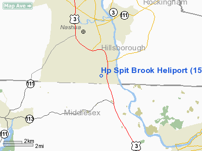
| From nearest city: | 3 nautical miles S of Nashua, NH |
| Location: | Hillsborough County, NH |
| Magnetic Variation: | () |
Owner & Manager
| Ownership: | Privately owned |
| Owner: | John J. Flatley Company |
| Address: | 35 Braintree Hill Office Park
Braintree, MA 02184 |
| Phone number: | 781-380-7731 |
| Address: |
|
Airport Operations and Facilities
| Airport Use: | Private |
| Control Tower: | No |
| Sectional chart: | New York |
| Region: | ANE - New England |
| Boundary ARTCC: | ZBW - Boston |
| Tie-in FSS: | BGR - Bangor |
| FSS Toll Free: | 1-800-WX-BRIEF |
Runway Information
Helipad H1
| Dimension: | 20 x 20 ft / 6.1 x 6.1 m |
| Surface: | CONC, |
| |
Runway H1 |
Runway |
| Traffic Pattern: | Left | Left |
|
Radio Navigation Aids
| ID |
Type |
Name |
Ch |
Freq |
Var |
Dist |
| BVY | FAN MARKER | Beverly | | | | 23.5 nm |
| ORW | FAN MARKER | Canton | | | 15W | 35.7 nm |
| AS | NDB | Chern | | 359.00 | 16W | 9.4 nm |
| DRY | NDB | Derry | | 338.00 | 16W | 10.1 nm |
| FIT | NDB | Fitchburg | | 365.00 | 15W | 16.3 nm |
| SKR | NDB | Shaker Hill | | 251.00 | 16W | 19.6 nm |
| TOF | NDB | Topsfield | | 269.00 | 16W | 22.8 nm |
| CO | NDB | Epsom | | 216.00 | 16W | 24.7 nm |
| LQ | NDB | Lyndy | | 382.00 | 16W | 26.8 nm |
| ORE | NDB | Orange | | 205.00 | 15W | 37.6 nm |
| ESG | NDB | Rollins | | 260.00 | 16W | 41.4 nm |
| IHM | NDB | Mansfield | | 220.00 | 16W | 44.0 nm |
| SFZ | NDB | Central | | 241.00 | 15W | 47.5 nm |
| LC | NDB | Blnap | | 328.00 | 16W | 49.9 nm |
| NZW | TACAN | South Weymouth | 061X | | 15W | 40.8 nm |
| MHT | VOR/DME | Manchester | 091X | 114.40 | 15W | 10.4 nm |
| LWM | VOR/DME | Lawrence | 072X | 112.50 | 15W | 16.2 nm |
| PSM | VOR/DME | Pease | 112X | 116.50 | 16W | 35.7 nm |
| PUT | VOR/DME | Putnam | 121X | 117.40 | 14W | 48.4 nm |
| GDM | VORTAC | Gardner | 043X | 110.60 | 14W | 28.3 nm |
| BOS | VORTAC | Boston | 074X | 112.70 | 16W | 29.6 nm |
| CON | VORTAC | Concord | 076X | 112.90 | 15W | 31.2 nm |
| EEN | VORTAC | Keene | 031X | 109.40 | 14W | 37.1 nm |
| BED | VOT | Laurence G Hanscom Fld | | 110.00 | | 16.3 nm |
| BOS | VOT | Boston Logan Intl | | 111.00 | | 27.8 nm |
| ORH | VOT | Worcester | | 108.20 | | 32.2 nm |
Remarks
- PRVDD EGRESS FM 150 DEGS TO 200 DEGS & 250 DEGS TO 300 DEGS; INGRESS FM 330 DEGS TO 020 DEGS & 150 DEGS TO 200 DEGS; RESOLVE ANY TRAFFIC PATTERN CONFLICTS WITH BOIRE BLD (ASH) & ALL PRIVATE USE ARPTS WITHIN 7 NM; VFR OPNS; PRIVATE USE; & ALL USERS ARE NOTIFIED & COMPLY WITH THESE RESTRICTIONS.
Images and information placed above are from
http://www.airport-data.com/airport/15NH/
We thank them for the data!
|
|


