 |
|
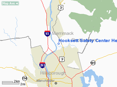
Hooksett Safety Center Heliport |
Location & QuickFacts
| FAA Information Effective: | 2008-09-25 |
| Airport Identifier: | 61NH |
| Airport Status: | Operational |
| Longitude/Latitude: | 071-26-48.3000W/43-03-21.5000N
-71.446750/43.055972 (Estimated) |
| Elevation: | 300 ft / 91.44 m (Estimated) |
| Land: | 0 acres |
| From nearest city: | 0 nautical miles S of Hooksett, NH |
| Location: | Merrimack County, NH |
| Magnetic Variation: | () |
Owner & Manager
| Ownership: | Privately owned |
| Owner: | Town Of Hooksett |
| Address: | 15 Legends Drive
Hooksett, NH 03106 |
| Phone number: | 603-623-7272 |
| Manager: | Michael J. Howard |
| Address: | 15 Legends Drive
Hooksett, NH 03106 |
| Phone number: | 603-623-7272 |
Airport Operations and Facilities
| Airport Use: | Private |
| Segmented Circle: | No |
| Control Tower: | No |
| Sectional chart: | New York |
| Region: | ANE - New England |
| Boundary ARTCC: | ZBW - Boston |
| Tie-in FSS: | BGR - Bangor |
| FSS Toll Free: | 1-800-WX-BRIEF |
Runway Information
Helipad H1
| Dimension: | 330 x 190 ft / 100.6 x 57.9 m |
| Surface: | TURF, |
| |
Runway H1 |
Runway |
| Traffic Pattern: | Left | Left |
|
Radio Navigation Aids
| ID |
Type |
Name |
Ch |
Freq |
Var |
Dist |
| LCI | FAN MARKER | Laconia | | | | 30.7 nm |
| BVY | FAN MARKER | Beverly | | | | 34.8 nm |
| CO | NDB | Epsom | | 216.00 | 16W | 3.8 nm |
| DRY | NDB | Derry | | 338.00 | 16W | 11.4 nm |
| AS | NDB | Chern | | 359.00 | 16W | 15.6 nm |
| ESG | NDB | Rollins | | 260.00 | 16W | 28.9 nm |
| LC | NDB | Blnap | | 328.00 | 16W | 29.2 nm |
| FIT | NDB | Fitchburg | | 365.00 | 15W | 33.3 nm |
| TOF | NDB | Topsfield | | 269.00 | 16W | 34.0 nm |
| SKR | NDB | Shaker Hill | | 251.00 | 16W | 38.0 nm |
| LQ | NDB | Lyndy | | 382.00 | 16W | 42.1 nm |
| CNH | NDB | Claremont | | 233.00 | 16W | 44.7 nm |
| ORE | NDB | Orange | | 205.00 | 15W | 47.2 nm |
| MHT | VOR/DME | Manchester | 091X | 114.40 | 15W | 11.8 nm |
| LWM | VOR/DME | Lawrence | 072X | 112.50 | 15W | 24.5 nm |
| PSM | VOR/DME | Pease | 112X | 116.50 | 16W | 27.0 nm |
| CON | VORTAC | Concord | 076X | 112.90 | 15W | 11.3 nm |
| EEN | VORTAC | Keene | 031X | 109.40 | 14W | 40.4 nm |
| GDM | VORTAC | Gardner | 043X | 110.60 | 14W | 40.8 nm |
| ENE | VORTAC | Kennebunk | 118X | 117.10 | 17W | 42.7 nm |
| BOS | VORTAC | Boston | 074X | 112.70 | 16W | 46.6 nm |
| BED | VOT | Laurence G Hanscom Fld | | 110.00 | | 36.0 nm |
| BOS | VOT | Boston Logan Intl | | 111.00 | | 44.9 nm |
Remarks
- 95 FT PLINE 191 FT S OF PAD.
- PRVDD INGRESS IS 060-090 & EGRESS IS 250-270 DEGS; INSTALL WIND INDICATOR; PLINES S & E OF PAD ARE MKD; VFR OPNS; ALL USERS ARE NOTIFIED & COMPLY WITH THESE RESTRICTIONS.
Images and information placed above are from
http://www.airport-data.com/airport/61NH/
We thank them for the data!
|
|


