 |
|
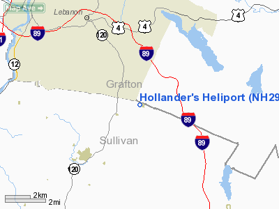
Location & QuickFacts
| FAA Information Effective: | 2008-09-25 |
| Airport Identifier: | NH29 |
| Airport Status: | Operational |
| Longitude/Latitude: | 072-12-11.3200W/43-34-55.2600N
-72.203144/43.582017 (Estimated) |
| Elevation: | 1300 ft / 396.24 m (Estimated) |
| Land: | 0 acres |
| From nearest city: | 13 nautical miles W of Plainfield, NH |
| Location: | Sullivan County, NH |
| Magnetic Variation: | 16W (1995) |
Owner & Manager
| Ownership: | Privately owned |
| Owner: | James Hollander |
| Address: | 166 Methodist Hill Road
Plainfield, NH 03781 |
| Phone number: | 603-448-0303 |
| Manager: | James Hollander |
| Address: | 166 Methodist Hill Road
Plainfield, NH 03781 |
| Phone number: | 603-448-0303 |
Airport Operations and Facilities
| Airport Use: | Private |
| Wind indicator: | Yes |
| Segmented Circle: | No |
| Control Tower: | No |
| Sectional chart: | New York |
| Region: | ANE - New England |
| Boundary ARTCC: | ZBW - Boston |
| Tie-in FSS: | BGR - Bangor |
| FSS on Airport: | No |
| FSS Toll Free: | 1-800-WX-BRIEF |
Runway Information
Helipad H1
| Dimension: | 120 x 120 ft / 36.6 x 36.6 m |
| Surface: | TURF, |
| |
Runway H1 |
Runway |
| Traffic Pattern: | Left | Left |
|
Radio Navigation Aids
| ID |
Type |
Name |
Ch |
Freq |
Var |
Dist |
| LCI | FAN MARKER | Laconia | | | | 33.2 nm |
| R | FAN MARKER | Chitt | | | 14W | 33.7 nm |
| MPV | FAN MARKER | Brook | | | | 48.5 nm |
| LAH | NDB | Hanover | | 276.00 | 15W | 7.3 nm |
| IVV | NDB | White River | | 379.00 | 16W | 11.5 nm |
| CNH | NDB | Claremont | | 233.00 | 16W | 14.7 nm |
| SXD | NDB | Springfield | | 265.00 | 15W | 25.1 nm |
| LC | NDB | Blnap | | 328.00 | 16W | 29.1 nm |
| DYO | NDB | Smuto | | 221.00 | 15W | 33.6 nm |
| CO | NDB | Epsom | | 216.00 | 16W | 43.0 nm |
| VWD | NDB | Mount Snow | | 224.00 | 15W | 48.8 nm |
| LEB | VOR/DME | Lebanon | 084X | 113.70 | 15W | 5.8 nm |
| MPV | VOR/DME | Montpelier | 045X | 110.80 | 16W | 32.1 nm |
| RUT | VOR/DME | Rutland | 47X | 111.00 | 15W | 32.7 nm |
| CON | VORTAC | Concord | 076X | 112.90 | 15W | 35.0 nm |
| EEN | VORTAC | Keene | 031X | 109.40 | 14W | 47.5 nm |
Remarks
- PRVDD DAY/VFR USE ONLY; INGRESS/EGRESS ROUTES DEVELOPED TO AVOID RISING TERRAIN/TREES TO E.
Images and information placed above are from
http://www.airport-data.com/airport/NH29/
We thank them for the data!
| General Info
|
| Country |
United States
|
| State |
NEW HAMPSHIRE
|
| FAA ID |
NH29
|
| Latitude |
43-34-55.260N
|
| Longitude |
072-12-11.320W
|
| Elevation |
1300 feet
|
| Near City |
PLAINFIELD
|
We don't guarantee the information is fresh and accurate. The data may
be wrong or outdated.
For more up-to-date information please refer to other sources.
|
|


