 |
|
Location & QuickFacts
| FAA Information Effective: | 2008-09-25 |
| Airport Identifier: | NH28 |
| Airport Status: | Operational |
| Longitude/Latitude: | 071-55-02.4000W/43-06-36.0000N
-71.917333/43.110000 (Estimated) |
| Elevation: | 551 ft / 167.94 m (Estimated) |
| Land: | 0 acres |
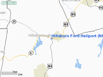
| From nearest city: | 0 nautical miles W of Hillsboro, NH |
| Location: | Hillsborough County, NH |
| Magnetic Variation: | () |
Owner & Manager
| Ownership: | Privately owned |
| Owner: | 16 Antrim Road Llc |
| Address: | P.o.box 2160
Hillsboro, NH 03224-2160 |
| Phone number: | 603-464-4000 |
| Manager: | Dennis Roberts |
| Address: | P.o. Box 2160
Hillsboro, NH 03224-2160 |
| Phone number: | 603-662-5600 |
Airport Operations and Facilities
| Airport Use: | Private |
| Wind indicator: | Yes |
| Control Tower: | No |
| Region: | ANE - New England |
| Boundary ARTCC: | ZBW - Boston |
| Tie-in FSS: | BGR - Bangor |
| FSS Toll Free: | 1-800-WX-BRIEF |
Runway Information
Helipad H1
| Dimension: | 20 x 20 ft / 6.1 x 6.1 m |
| Surface: | TURF, |
| |
Runway H1 |
Runway |
| Traffic Pattern: | Left | Left |
|
Radio Navigation Aids
| ID |
Type |
Name |
Ch |
Freq |
Var |
Dist |
| LCI | FAN MARKER | Laconia | | | | 34.5 nm |
| CO | NDB | Epsom | | 216.00 | 16W | 20.4 nm |
| AS | NDB | Chern | | 359.00 | 16W | 22.1 nm |
| CNH | NDB | Claremont | | 233.00 | 16W | 25.3 nm |
| DRY | NDB | Derry | | 338.00 | 16W | 27.0 nm |
| LC | NDB | Blnap | | 328.00 | 16W | 30.6 nm |
| SXD | NDB | Springfield | | 265.00 | 15W | 30.9 nm |
| FIT | NDB | Fitchburg | | 365.00 | 15W | 34.3 nm |
| IVV | NDB | White River | | 379.00 | 16W | 36.1 nm |
| ORE | NDB | Orange | | 205.00 | 15W | 36.4 nm |
| LAH | NDB | Hanover | | 276.00 | 15W | 37.4 nm |
| VWD | NDB | Mount Snow | | 224.00 | 15W | 43.0 nm |
| ESG | NDB | Rollins | | 260.00 | 16W | 48.2 nm |
| MHT | VOR/DME | Manchester | 091X | 114.40 | 15W | 28.1 nm |
| LEB | VOR/DME | Lebanon | 084X | 113.70 | 15W | 36.6 nm |
| LWM | VOR/DME | Lawrence | 072X | 112.50 | 15W | 42.5 nm |
| PSM | VOR/DME | Pease | 112X | 116.50 | 16W | 47.7 nm |
| CON | VORTAC | Concord | 076X | 112.90 | 15W | 16.4 nm |
| EEN | VORTAC | Keene | 031X | 109.40 | 14W | 25.1 nm |
| GDM | VORTAC | Gardner | 043X | 110.60 | 14W | 34.5 nm |
| BED | VOT | Laurence G Hanscom Fld | | 110.00 | | 47.5 nm |
Remarks
- ANNOUNCE INTENTIONS ON FREQ 123.025.
- PRVDD VFR OPNS, PR USE, WIND INDICATOR IS MAINTAINED, AND HELO USED BY SMALL ROTORCRAFT HELOS ONLY.
Images and information placed above are from
http://www.airport-data.com/airport/NH28/
We thank them for the data!
| General Info
|
| Country |
United States
|
| State |
NEW HAMPSHIRE
|
| FAA ID |
NH28
|
| Latitude |
43-00-30.321N
|
| Longitude |
070-47-58.191W
|
| Elevation |
100 feet
|
| Near City |
RYE
|
We don't guarantee the information is fresh and accurate. The data may
be wrong or outdated.
For more up-to-date information please refer to other sources.
|
|


