 |
|
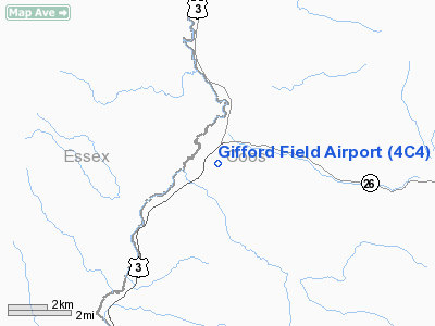
Location & QuickFacts
| FAA Information Effective: | 2008-09-25 |
| Airport Identifier: | 4C4 |
| Airport Status: | Operational |
| Longitude/Latitude: | 071-29-58.3030W/44-53-00.1700N
-71.499529/44.883381 (Estimated) |
| Elevation: | 1010 ft / 307.85 m (Estimated) |
| Land: | 5 acres |
| From nearest city: | 1 nautical miles SW of Colebrook, NH |
| Location: | Coos County, NH |
| Magnetic Variation: | 17W (1985) |
Owner & Manager
| Ownership: | Privately owned |
| Owner: | Ian & Christina Stevenson |
| Address: | 44 Crabapple Place
Stamford, CT 06903 |
| Phone number: | 203 569-9727 |
| Manager: | Douglas Brooks |
| Address: | 14 Depot Street
Odenton, MD 21113 |
| Phone number: | 603 237-4914 |
Airport Operations and Facilities
| Airport Use: | Open to public |
| Wind indicator: | Yes |
| Segmented Circle: | No |
| Control Tower: | No |
| Landing fee charge: | No |
| Sectional chart: | Montreal |
| Region: | ANE - New England |
| Boundary ARTCC: | ZBW - Boston |
| Tie-in FSS: | BGR - Bangor |
| FSS on Airport: | No |
| FSS Toll Free: | 1-800-WX-BRIEF |
| NOTAMs Facility: | BGR (NOTAM-d service avaliable) |
Airport Communications
| CTAF: | 122.800 |
| Unicom: | 122.800 |
Airport Services
| Airframe Repair: | NONE |
| Power Plant Repair: | NONE |
| Bottled Oxygen: | NONE |
| Bulk Oxygen: | NONE |
Runway Information
Runway 04/22
| Dimension: | 2450 x 75 ft / 746.8 x 22.9 m
ROAD TRAVERSES RY 425 FT. FR RY 04 THLD. |
| Surface: | TURF, Good Condition |
| |
Runway 04 |
Runway 22 |
| Traffic Pattern: | Left | Left |
| Obstruction: | 20 ft trees | 10 ft road, 0.0 ft from runway |
|
Radio Navigation Aids
| ID |
Type |
Name |
Ch |
Freq |
Var |
Dist |
| HIE | FAN MARKER | Witey | | | 17W | 31.2 nm |
| HXK | NDB | Hornebrook | | 281.00 | 17W | 22.9 nm |
| EFK | NDB | Newport | | 242.00 | 17W | 29.1 nm |
| RQM | NDB | Rangeley | | 221.00 | 18W | 32.0 nm |
| LLX | NDB | Lyndonville | | 353.00 | 16W | 32.1 nm |
| GMA | NDB | Mahn | | 386.00 | 17W | 32.3 nm |
| SC | NDB | Sherbrooke | | 362.00 | 17W | 37.6 nm |
| JRV | NDB | Morrisville/stowe | | 375.00 | 16W | 49.9 nm |
| BML | VOR/DME | Berlin | 041X | 110.40 | 17W | 20.1 nm |
| YSC | VORTAC | Sherbrooke | 079X | 113.20 | 17W | 28.8 nm |
Remarks
- RWY 04-22 STRIP SOFT IN SPRING.
- RY 22 +80 FT TREES 900 FT FROM THR.
- RY 04/22 CLSD NOV TO MAY EXCEPT SKI ACFT. CALL (603) 237-4914 FOR AIRFIELD CONDITIONS.
- ROAD TRAVERSES RY 425 FT FM RY 04 THLD.
- VFR OPNS ONLY
Images and information placed above are from
http://www.airport-data.com/airport/4C4/
We thank them for the data!
| General Info
|
| Country |
United States
|
| State |
NEW HAMPSHIRE
|
| FAA ID |
4C4
|
| Latitude |
44-53-00.170N
|
| Longitude |
071-29-58.303W
|
| Elevation |
1010 feet
|
| Near City |
COLEBROOK
|
We don't guarantee the information is fresh and accurate. The data may
be wrong or outdated.
For more up-to-date information please refer to other sources.
|
|


