 |
|
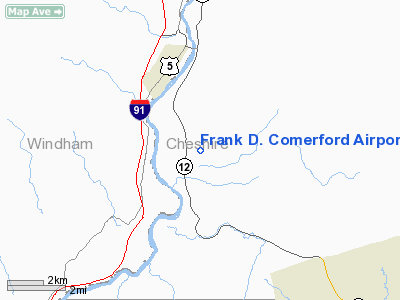
Frank D. Comerford Airport |
Location & QuickFacts
| FAA Information Effective: | 2008-09-25 |
| Airport Identifier: | NH39 |
| Airport Status: | Operational |
| Longitude/Latitude: | 072-25-47.3160W/43-02-00.2870N
-72.429810/43.033413 (Estimated) |
| Elevation: | 640 ft / 195.07 m (Estimated) |
| Land: | 20 acres |
| From nearest city: | 3 nautical miles W of Walpole, NH |
| Location: | Cheshire County, NH |
| Magnetic Variation: | 15W (1985) |
Owner & Manager
| Ownership: | Privately owned |
| Owner: | Alyson's Apple Orchard Inc |
| Address: | Po Box 534
Walpole, NH 03608 |
| Phone number: | 603-756-9009 |
| Manager: | Robert F. Jasse |
| Address: | Po Box 66
Walpole, NH 03608 |
| Phone number: | 603-756-3424 |
Airport Operations and Facilities
| Airport Use: | Private |
| Wind indicator: | Yes |
| Segmented Circle: | No |
| Control Tower: | No |
| Landing fee charge: | No |
| Sectional chart: | New York |
| Region: | ANE - New England |
| Boundary ARTCC: | ZBW - Boston |
| Tie-in FSS: | BGR - Bangor |
| FSS on Airport: | No |
| FSS Toll Free: | 1-800-WX-BRIEF |
Airport Services
Runway Information
Runway 02/20
| Dimension: | 1300 x 65 ft / 396.2 x 19.8 m |
| Surface: | TURF, Good Condition |
| |
Runway 02 |
Runway 20 |
| Traffic Pattern: | Left | Left |
| VASI: | nonstandard system | nonstandard system |
| Runway End Identifier: | Yes | Yes |
| Obstruction: | | 65 ft trees, 650.0 ft from runway |
|
Radio Navigation Aids
| ID |
Type |
Name |
Ch |
Freq |
Var |
Dist |
| R | FAN MARKER | Chitt | | | 14W | 43.4 nm |
| PSF | FAN MARKER | Abyss | | | 13W | 49.0 nm |
| SXD | NDB | Springfield | | 265.00 | 15W | 15.8 nm |
| VWD | NDB | Mount Snow | | 224.00 | 15W | 20.1 nm |
| CNH | NDB | Claremont | | 233.00 | 16W | 20.4 nm |
| ORE | NDB | Orange | | 205.00 | 15W | 28.6 nm |
| IVV | NDB | White River | | 379.00 | 16W | 31.7 nm |
| AS | NDB | Chern | | 359.00 | 16W | 38.6 nm |
| FIT | NDB | Fitchburg | | 365.00 | 15W | 41.5 nm |
| LAH | NDB | Hanover | | 276.00 | 15W | 41.7 nm |
| CO | NDB | Epsom | | 216.00 | 16W | 43.2 nm |
| DRY | NDB | Derry | | 338.00 | 16W | 46.5 nm |
| DYO | NDB | Smuto | | 221.00 | 15W | 46.6 nm |
| DXT | NDB | Dalton | | 370.00 | 15W | 47.0 nm |
| LC | NDB | Blnap | | 328.00 | 16W | 49.4 nm |
| RUT | VOR/DME | Rutland | 47X | 111.00 | 15W | 37.4 nm |
| LEB | VOR/DME | Lebanon | 084X | 113.70 | 15W | 39.9 nm |
| CAM | VOR/DME | Cambridge | 097X | 115.00 | 14W | 40.2 nm |
| MHT | VOR/DME | Manchester | 091X | 114.40 | 15W | 47.7 nm |
| EEN | VORTAC | Keene | 031X | 109.40 | 14W | 15.6 nm |
| GDM | VORTAC | Gardner | 043X | 110.60 | 14W | 33.6 nm |
| CON | VORTAC | Concord | 076X | 112.90 | 15W | 39.1 nm |
Remarks
Images and information placed above are from
http://www.airport-data.com/airport/NH39/
We thank them for the data!
| General Info
|
| Country |
United States
|
| State |
NEW HAMPSHIRE
|
| FAA ID |
NH39
|
| Latitude |
43-02-00.287N
|
| Longitude |
072-25-47.316W
|
| Elevation |
640 feet
|
| Near City |
WALPOLE
|
We don't guarantee the information is fresh and accurate. The data may
be wrong or outdated.
For more up-to-date information please refer to other sources.
|
|


