 |
|
Location & QuickFacts
| FAA Information Effective: | 2008-09-25 |
| Airport Identifier: | NH70 |
| Airport Status: | Operational |
| Longitude/Latitude: | 071-09-28.0000W/44-02-43.0000N
-71.157778/44.045278 (Estimated) |
| Elevation: | 500 ft / 152.40 m (Estimated) |
| Land: | 0 acres |
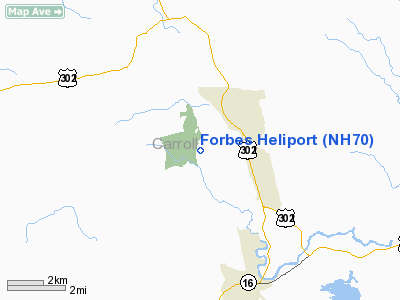
| From nearest city: | 2 nautical miles W of North Conway, NH |
| Location: | Carroll County, NH |
| Magnetic Variation: | 17W (1990) |
Owner & Manager
| Ownership: | Privately owned |
| Owner: | Cheney North Corp |
| Address: | 135 Beechnut Drive
North Conway, NH 03860 |
| Phone number: | 603-356-3652 |
| Manager: | Steven B Cheney |
| Address: | 5 Ledgeview Drive
North Conway, NH 03860 |
| Phone number: | 603-356-3652 |
Airport Operations and Facilities
| Airport Use: | Private
PERSONAL USE. |
| Wind indicator: | Yes |
| Segmented Circle: | No |
| Control Tower: | No |
| Sectional chart: | Montreal |
| Region: | ANE - New England |
| Boundary ARTCC: | ZBW - Boston |
| Tie-in FSS: | BGR - Bangor |
| FSS on Airport: | No |
| FSS Toll Free: | 1-800-WX-BRIEF |
Runway Information
Helipad H1
| Dimension: | 17 x 17 ft / 5.2 x 5.2 m |
| Surface: | CONC, |
| |
Runway H1 |
Runway |
| Traffic Pattern: | Left | Left |
|
Radio Navigation Aids
| ID |
Type |
Name |
Ch |
Freq |
Var |
Dist |
| SZO | FAN MARKER | Grinn | | | 17W | 13.1 nm |
| HIE | FAN MARKER | Witey | | | 17W | 26.1 nm |
| LCI | FAN MARKER | Laconia | | | | 31.3 nm |
| SZO | NDB | Sebago | | 227.00 | 17W | 18.3 nm |
| GMA | NDB | Mahn | | 386.00 | 17W | 29.7 nm |
| HXK | NDB | Hornebrook | | 281.00 | 17W | 32.0 nm |
| LC | NDB | Blnap | | 328.00 | 16W | 34.7 nm |
| LLX | NDB | Lyndonville | | 353.00 | 16W | 46.6 nm |
| LAH | NDB | Hanover | | 276.00 | 15W | 48.8 nm |
| BML | VOR/DME | Berlin | 041X | 110.40 | 17W | 35.4 nm |
| ENE | VORTAC | Kennebunk | 118X | 117.10 | 17W | 44.1 nm |
| PWM | VOT | Portland Intl Jetport | | 111.00 | | 43.8 nm |
Remarks
- PRVDD OPS ARE CONDUCTED DURING VFR WEATHER CONDITIONS.
Images and information placed above are from
http://www.airport-data.com/airport/NH70/
We thank them for the data!
| General Info
|
| Country |
United States
|
| State |
NEW HAMPSHIRE
|
| FAA ID |
NH70
|
| Latitude |
44-02-43.000N
|
| Longitude |
071-09-28.000W
|
| Elevation |
500 feet
|
| Near City |
NORTH CONWAY
|
We don't guarantee the information is fresh and accurate. The data may
be wrong or outdated.
For more up-to-date information please refer to other sources.
|
|


