 |
|
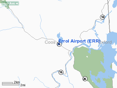
Location & QuickFacts
| FAA Information Effective: | 2008-09-25 |
| Airport Identifier: | ERR |
| Airport Status: | Operational |
| Longitude/Latitude: | 071-09-51.2820W/44-47-33.1790N
-71.164245/44.792550 (Estimated) |
| Elevation: | 1245 ft / 379.48 m (Estimated) |
| Land: | 30 acres |
| From nearest city: | 1 nautical miles NW of Errol, NH |
| Location: | Coos County, NH |
| Magnetic Variation: | 17W (1980) |
Owner & Manager
| Ownership: | Privately owned |
| Owner: | D.c. Heasley |
| Address: | P.o. Box 43
Errol, NH 03579 |
| Phone number: | 603-482-3320
ASK FOR EVERETT EAMES AUTHORIZED REPRESENTATIVE FOR AIRPORT |
| Manager: | D C Heasley |
| Address: | P.o. Box 43
Errol, NH 03579 |
| Phone number: | 603-482-3320
ASK FOR EVERETT EAMES AUTHORIZED REPRESENTATIVE FOR AIRPORT |
Airport Operations and Facilities
| Airport Use: | Open to public |
| Wind indicator: | Yes |
| Segmented Circle: | No |
| Control Tower: | No |
| Landing fee charge: | No |
| Sectional chart: | Montreal |
| Region: | ANE - New England |
| Traffic Pattern Alt: | 800 ft |
| Boundary ARTCC: | ZBW - Boston |
| Tie-in FSS: | BGR - Bangor |
| FSS on Airport: | No |
| FSS Toll Free: | 1-800-WX-BRIEF |
| NOTAMs Facility: | BGR (NOTAM-d service avaliable) |
Airport Communications
| CTAF: | 122.800 |
| Unicom: | 122.800 |
Airport Services
| Airframe Repair: | NONE |
| Power Plant Repair: | NONE |
| Bottled Oxygen: | NONE |
| Bulk Oxygen: | NONE |
Runway Information
Runway 15/33
| Dimension: | 3680 x 75 ft / 1121.7 x 22.9 m |
| Surface: | GRVL, Good Condition
LARGE PATCHES OF GRASS ON RY. |
| |
Runway 15 |
Runway 33 |
| Traffic Pattern: | Left | Left |
| Obstruction: | 50 ft tree, 234.0 ft from runway, 85 ft right of centerline, 5:1 slope to clear | 40 ft tree, 20.0 ft from runway, 70 ft right of centerline |
|
Radio Navigation Aids
| ID |
Type |
Name |
Ch |
Freq |
Var |
Dist |
| HIE | FAN MARKER | Witey | | | 17W | 30.8 nm |
| HXK | NDB | Hornebrook | | 281.00 | 17W | 13.0 nm |
| RQM | NDB | Rangeley | | 221.00 | 18W | 19.6 nm |
| GMA | NDB | Mahn | | 386.00 | 17W | 34.2 nm |
| LLX | NDB | Lyndonville | | 353.00 | 16W | 40.8 nm |
| EFK | NDB | Newport | | 242.00 | 17W | 44.2 nm |
| SC | NDB | Sherbrooke | | 362.00 | 17W | 48.8 nm |
| BML | VOR/DME | Berlin | 041X | 110.40 | 17W | 9.6 nm |
| YSC | VORTAC | Sherbrooke | 079X | 113.20 | 17W | 41.2 nm |
Remarks
- MOOSE & DEER ON & INVOF ARPT.
- BUILT BEFORE 1959
Images and information placed above are from
http://www.airport-data.com/airport/ERR/
We thank them for the data!
| General Info
|
| Country |
United States
|
| State |
NEW HAMPSHIRE
|
| FAA ID |
ERR
|
| Latitude |
44-47-33.179N
|
| Longitude |
071-09-51.282W
|
| Elevation |
1245 feet
|
| Near City |
ERROL
|
We don't guarantee the information is fresh and accurate. The data may
be wrong or outdated.
For more up-to-date information please refer to other sources.
|
|


