 |
|
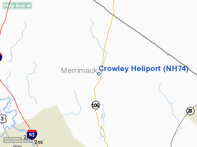
Location & QuickFacts
| FAA Information Effective: | 2008-09-25 |
| Airport Identifier: | NH74 |
| Airport Status: | Operational |
| Longitude/Latitude: | 071-28-15.2570W/43-20-27.2860N
-71.470905/43.340913 (Estimated) |
| Elevation: | 570 ft / 173.74 m (Estimated) |
| Land: | 0 acres |
| From nearest city: | 3 nautical miles N of Loudon, NH |
| Location: | Merrimack County, NH |
| Magnetic Variation: | 16W (1990) |
Owner & Manager
| Ownership: | Privately owned |
| Owner: | William Crowley |
| Address: | 23 Mudgett Hill Road
London, NH 03307 |
| Phone number: | 603-783-4734 |
| Manager: | William Crowley |
| Address: | 23 Mudgett Hill Road
London, NH 03307 |
| Phone number: | 603-783-4734 |
Airport Operations and Facilities
| Airport Use: | Private |
| Segmented Circle: | No |
| Control Tower: | No |
| Lighting Schedule: | PHONE REQ
FOR FLOODLIGHTS CALL 603-225-6873. |
| Sectional chart: | New York |
| Region: | ANE - New England |
| Boundary ARTCC: | ZBW - Boston |
| Tie-in FSS: | BGR - Bangor |
| FSS on Airport: | No |
| FSS Toll Free: | 1-800-WX-BRIEF |
Runway Information
Helipad H1
| Dimension: | 30 x 30 ft / 9.1 x 9.1 m |
| Surface: | ASPH-CONC, |
| |
Runway H1 |
Runway |
| Traffic Pattern: | Left | Left |
|
Radio Navigation Aids
| ID |
Type |
Name |
Ch |
Freq |
Var |
Dist |
| LCI | FAN MARKER | Laconia | | | | 13.6 nm |
| SZO | FAN MARKER | Grinn | | | 17W | 45.0 nm |
| BVY | FAN MARKER | Beverly | | | | 49.7 nm |
| LC | NDB | Blnap | | 328.00 | 16W | 12.1 nm |
| CO | NDB | Epsom | | 216.00 | 16W | 13.4 nm |
| DRY | NDB | Derry | | 338.00 | 16W | 28.5 nm |
| ESG | NDB | Rollins | | 260.00 | 16W | 29.0 nm |
| AS | NDB | Chern | | 359.00 | 16W | 31.6 nm |
| LAH | NDB | Hanover | | 276.00 | 15W | 37.7 nm |
| CNH | NDB | Claremont | | 233.00 | 16W | 39.4 nm |
| SZO | NDB | Sebago | | 227.00 | 17W | 45.2 nm |
| IVV | NDB | White River | | 379.00 | 16W | 45.4 nm |
| TOF | NDB | Topsfield | | 269.00 | 16W | 48.9 nm |
| SXD | NDB | Springfield | | 265.00 | 15W | 49.0 nm |
| FIT | NDB | Fitchburg | | 365.00 | 15W | 49.1 nm |
| MHT | VOR/DME | Manchester | 091X | 114.40 | 15W | 28.7 nm |
| PSM | VOR/DME | Pease | 112X | 116.50 | 16W | 32.0 nm |
| LEB | VOR/DME | Lebanon | 084X | 113.70 | 15W | 38.3 nm |
| LWM | VOR/DME | Lawrence | 072X | 112.50 | 15W | 39.7 nm |
| CON | VORTAC | Concord | 076X | 112.90 | 15W | 8.6 nm |
| ENE | VORTAC | Kennebunk | 118X | 117.10 | 17W | 37.8 nm |
| EEN | VORTAC | Keene | 031X | 109.40 | 14W | 48.8 nm |
Remarks
Images and information placed above are from
http://www.airport-data.com/airport/NH74/
We thank them for the data!
| General Info
|
| Country |
United States
|
| State |
NEW HAMPSHIRE
|
| FAA ID |
NH74
|
| Latitude |
43-20-27.286N
|
| Longitude |
071-28-15.257W
|
| Elevation |
570 feet
|
| Near City |
LOUDON
|
We don't guarantee the information is fresh and accurate. The data may
be wrong or outdated.
For more up-to-date information please refer to other sources.
|
|


