 |
|
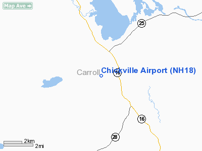
Location & QuickFacts
| FAA Information Effective: | 2008-09-25 |
| Airport Identifier: | NH18 |
| Airport Status: | Operational |
| Longitude/Latitude: | 071-09-04.2450W/43-44-00.2750N
-71.151179/43.733410 (Estimated) |
| Elevation: | 540 ft / 164.59 m (Estimated) |
| Land: | 90 acres |
| From nearest city: | 2 nautical miles S of Center Ossipee, NH |
| Location: | Carroll County, NH |
| Magnetic Variation: | 17W (1985) |
Owner & Manager
| Ownership: | Privately owned |
| Owner: | Jeremy Schulz |
| Address: | 25 Archers Pond Road
Ossipee, NH 03856 |
| Phone number: | 603-539-1583 |
| Manager: | Jeremy Schulz |
| Address: | 25 Archers Pond Road
Ossipee, NH 03856 |
| Phone number: | 603-539-1583 |
Airport Operations and Facilities
| Airport Use: | Private |
| Wind indicator: | Yes |
| Segmented Circle: | No |
| Control Tower: | No |
| Landing fee charge: | No |
| Sectional chart: | New York |
| Region: | ANE - New England |
| Boundary ARTCC: | ZBW - Boston |
| Tie-in FSS: | BGR - Bangor |
| FSS Toll Free: | 1-800-WX-BRIEF |
Runway Information
Runway 01/19
| Dimension: | 2000 x 100 ft / 609.6 x 30.5 m |
| Surface: | TURF, |
| |
Runway 01 |
Runway 19 |
| Traffic Pattern: | Right | Left |
| Displaced threshold: | 300.00 ft | 0.00 ft |
| Obstruction: | 40 ft trees, 300.0 ft from runway | 20 ft pline, 600.0 ft from runway |
|
Radio Navigation Aids
| ID |
Type |
Name |
Ch |
Freq |
Var |
Dist |
| LCI | FAN MARKER | Laconia | | | | 16.1 nm |
| SZO | FAN MARKER | Grinn | | | 17W | 17.8 nm |
| HIE | FAN MARKER | Witey | | | 17W | 42.0 nm |
| PH | MARINE NDB | Portland Lhb-p | | 301.00 | 17W | 47.7 nm |
| SZO | NDB | Sebago | | 227.00 | 17W | 19.0 nm |
| LC | NDB | Blnap | | 328.00 | 16W | 20.5 nm |
| ESG | NDB | Rollins | | 260.00 | 16W | 33.9 nm |
| CO | NDB | Epsom | | 216.00 | 16W | 39.2 nm |
| GMA | NDB | Mahn | | 386.00 | 17W | 44.3 nm |
| LAH | NDB | Hanover | | 276.00 | 15W | 44.6 nm |
| PSM | VOR/DME | Pease | 112X | 116.50 | 16W | 41.4 nm |
| LEB | VOR/DME | Lebanon | 084X | 113.70 | 15W | 46.4 nm |
| ENE | VORTAC | Kennebunk | 118X | 117.10 | 17W | 29.8 nm |
| CON | VORTAC | Concord | 076X | 112.90 | 15W | 36.0 nm |
| PWM | VOT | Portland Intl Jetport | | 111.00 | | 36.7 nm |
Remarks
- AIRPORT USED APRIL 1 TO NOVEMBER 1.
- OPEN DURG WINTER FOR EMERGENCY USE ONLY.
- VFR ONLY.
Images and information placed above are from
http://www.airport-data.com/airport/NH18/
We thank them for the data!
| General Info
|
| Country |
United States
|
| State |
NEW HAMPSHIRE
|
| FAA ID |
NH18
|
| Latitude |
43-44-00.275N
|
| Longitude |
071-09-04.245W
|
| Elevation |
540 feet
|
| Near City |
CENTER OSSIPEE
|
We don't guarantee the information is fresh and accurate. The data may
be wrong or outdated.
For more up-to-date information please refer to other sources.
|
|


