 |
|
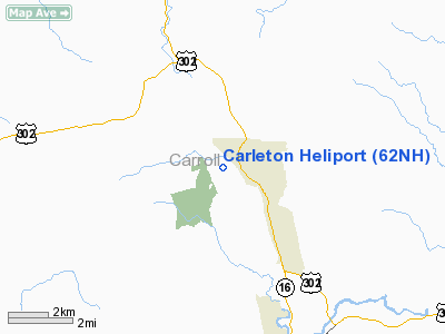
Location & QuickFacts
| FAA Information Effective: | 2008-09-25 |
| Airport Identifier: | 62NH |
| Airport Status: | Operational |
| Longitude/Latitude: | 071-09-10.0000W/44-03-49.0000N
-71.152778/44.063611 (Estimated) |
| Elevation: | 920 ft / 280.42 m (Estimated) |
| Land: | 0 acres |
| From nearest city: | 2 nautical miles SW of Hales Location, NH |
| Location: | Carroll County, NH |
| Magnetic Variation: | () |
Owner & Manager
| Ownership: | Privately owned |
| Owner: | Robert Carleton |
| Address: | 194 Boulder Ridge
Hales Location, NH 03860 |
| Phone number: | 603-387-4720 |
| Manager: | Robert Carleton |
| Address: | 194 Boulder Ridge
Hales Location, NH 03860 |
| Phone number: | 603-387-4720 |
Airport Operations and Facilities
| Airport Use: | Private |
| Control Tower: | No |
| Region: | ANE - New England |
| Boundary ARTCC: | ZBW - Boston |
| Tie-in FSS: | BGR - Bangor |
| FSS Toll Free: | 1-800-WX-BRIEF |
Runway Information
Helipad H1
| Dimension: | 35 x 33 ft / 10.7 x 10.1 m |
| Surface: | CONC, |
| |
Runway H1 |
Runway |
| Traffic Pattern: | Left | Left |
|
Radio Navigation Aids
| ID |
Type |
Name |
Ch |
Freq |
Var |
Dist |
| SZO | FAN MARKER | Grinn | | | 17W | 13.3 nm |
| HIE | FAN MARKER | Witey | | | 17W | 25.4 nm |
| LCI | FAN MARKER | Laconia | | | | 32.4 nm |
| SZO | NDB | Sebago | | 227.00 | 17W | 18.7 nm |
| GMA | NDB | Mahn | | 386.00 | 17W | 29.2 nm |
| HXK | NDB | Hornebrook | | 281.00 | 17W | 30.9 nm |
| LC | NDB | Blnap | | 328.00 | 16W | 35.8 nm |
| LLX | NDB | Lyndonville | | 353.00 | 16W | 46.1 nm |
| LAH | NDB | Hanover | | 276.00 | 15W | 49.4 nm |
| BML | VOR/DME | Berlin | 041X | 110.40 | 17W | 34.3 nm |
| ENE | VORTAC | Kennebunk | 118X | 117.10 | 17W | 44.9 nm |
| PWM | VOT | Portland Intl Jetport | | 111.00 | | 44.2 nm |
Remarks
- PRVDD INGRESS & EGRESS 120 DEG AND 320 DEG; MAINTAIN WIND INDICATOR; VFR OPNS; & ALL USERS COMPLY WITH THESE RESTRICTIONS.
Images and information placed above are from
http://www.airport-data.com/airport/62NH/
We thank them for the data!
|
|


