 |
|
Location & QuickFacts
| FAA Information Effective: | 2008-09-25 |
| Airport Identifier: | NH49 |
| Airport Status: | Operational |
| Longitude/Latitude: | 071-40-46.2870W/43-58-13.2450N
-71.679524/43.970346 (Estimated) |
| Elevation: | 650 ft / 198.12 m (Estimated) |
| Land: | 70 acres |
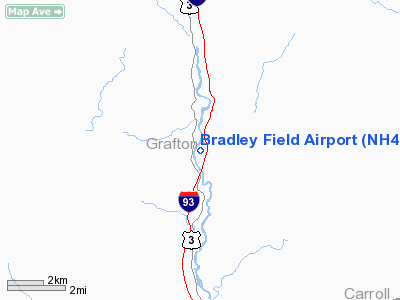
| From nearest city: | 0 nautical miles N of Woodstock, NH |
| Location: | Grafton County, NH |
| Magnetic Variation: | 16W (1980) |
Owner & Manager
| Ownership: | Privately owned |
| Owner: | Ralph Bradley |
| Address: | Box 22 Thronton Gore Road
Woodstock, NH 03293 |
| Phone number: | 603-745-3188 |
| Manager: | Ralph Bradley |
| Address: | Box 22 Thronton Gore Road
Woodstock, NH 03293 |
| Phone number: | 603-745-2586 |
Airport Operations and Facilities
| Airport Use: | Private |
| Segmented Circle: | No |
| Control Tower: | No |
| Sectional chart: | New York |
| Region: | ANE - New England |
| Boundary ARTCC: | ZBW - Boston |
| Tie-in FSS: | BGR - Bangor |
| FSS on Airport: | No |
| FSS Toll Free: | 1-800-WX-BRIEF |
Runway Information
Runway 02/20
| Dimension: | 1700 x 30 ft / 518.2 x 9.1 m |
| Surface: | TURF, |
| |
Runway 02 |
Runway 20 |
| Traffic Pattern: | Left | Left |
|
Radio Navigation Aids
| ID |
Type |
Name |
Ch |
Freq |
Var |
Dist |
| HIE | FAN MARKER | Witey | | | 17W | 24.3 nm |
| LCI | FAN MARKER | Laconia | | | | 26.4 nm |
| SZO | FAN MARKER | Grinn | | | 17W | 34.5 nm |
| MPV | FAN MARKER | Brook | | | | 47.1 nm |
| GMA | NDB | Mahn | | 386.00 | 17W | 23.6 nm |
| LC | NDB | Blnap | | 328.00 | 16W | 26.8 nm |
| LAH | NDB | Hanover | | 276.00 | 15W | 26.9 nm |
| LLX | NDB | Lyndonville | | 353.00 | 16W | 35.4 nm |
| SZO | NDB | Sebago | | 227.00 | 17W | 39.0 nm |
| IVV | NDB | White River | | 379.00 | 16W | 42.1 nm |
| HXK | NDB | Hornebrook | | 281.00 | 17W | 42.3 nm |
| CNH | NDB | Claremont | | 233.00 | 16W | 47.0 nm |
| LEB | VOR/DME | Lebanon | 084X | 113.70 | 15W | 29.1 nm |
| MPV | VOR/DME | Montpelier | 045X | 110.80 | 16W | 34.0 nm |
| BML | VOR/DME | Berlin | 041X | 110.40 | 17W | 45.2 nm |
| CON | VORTAC | Concord | 076X | 112.90 | 15W | 45.3 nm |
Remarks
Images and information placed above are from
http://www.airport-data.com/airport/NH49/
We thank them for the data!
| General Info
|
| Country |
United States
|
| State |
NEW HAMPSHIRE
|
| FAA ID |
NH49
|
| Latitude |
43-58-13.245N
|
| Longitude |
071-40-46.287W
|
| Elevation |
650 feet
|
| Near City |
WOODSTOCK
|
We don't guarantee the information is fresh and accurate. The data may
be wrong or outdated.
For more up-to-date information please refer to other sources.
|
|


