 |
|
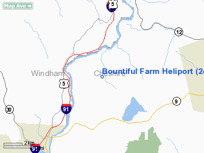
Location & QuickFacts
| FAA Information Effective: | 2008-09-25 |
| Airport Identifier: | 24NH |
| Airport Status: | Operational |
| Longitude/Latitude: | 072-29-04.0000W/42-56-37.0000N
-72.484444/42.943611 (Estimated) |
| Elevation: | 800 ft / 243.84 m (Estimated) |
| Land: | 0 acres |
| From nearest city: | 4 nautical miles SW of Westmoreland, NH |
| Location: | Cheshire County, NH |
| Magnetic Variation: | () |
Owner & Manager
| Ownership: | Privately owned |
| Owner: | Thomas & Rita Mc Connon |
| Address: | 90 Overman Rd
Westmoreland, NH 03467 |
| Phone number: | 978-263-1025 |
| Manager: | Thomas & Rita Mc Connon |
| Address: | 90 Overman Rd
Westmoreland, NH 03467 |
| Phone number: | 978-263-1025 |
Airport Operations and Facilities
| Airport Use: | Private |
| Control Tower: | No |
| Sectional chart: | New York |
| Region: | ANE - New England |
| Boundary ARTCC: | ZBW - Boston |
| Tie-in FSS: | BGR - Bangor |
| FSS Toll Free: | 1-800-WX-BRIEF |
Runway Information
Helipad H1
| Dimension: | 20 x 20 ft / 6.1 x 6.1 m |
| Surface: | TURF, |
| |
Runway H1 |
Runway |
| Traffic Pattern: | Left | Left |
|
Radio Navigation Aids
| ID |
Type |
Name |
Ch |
Freq |
Var |
Dist |
| PSF | FAN MARKER | Abyss | | | 13W | 43.6 nm |
| R | FAN MARKER | Chitt | | | 14W | 46.9 nm |
| VWD | NDB | Mount Snow | | 224.00 | 15W | 16.7 nm |
| SXD | NDB | Springfield | | 265.00 | 15W | 20.1 nm |
| ORE | NDB | Orange | | 205.00 | 15W | 24.2 nm |
| CNH | NDB | Claremont | | 233.00 | 16W | 26.1 nm |
| IVV | NDB | White River | | 379.00 | 16W | 37.1 nm |
| AS | NDB | Chern | | 359.00 | 16W | 39.5 nm |
| FIT | NDB | Fitchburg | | 365.00 | 15W | 39.8 nm |
| DXT | NDB | Dalton | | 370.00 | 15W | 41.5 nm |
| CO | NDB | Epsom | | 216.00 | 16W | 46.6 nm |
| LAH | NDB | Hanover | | 276.00 | 15W | 47.5 nm |
| DRY | NDB | Derry | | 338.00 | 16W | 48.1 nm |
| CAM | VOR/DME | Cambridge | 097X | 115.00 | 14W | 37.9 nm |
| RUT | VOR/DME | Rutland | 47X | 111.00 | 15W | 40.6 nm |
| CTR | VOR/DME | Chester | 098X | 115.10 | 13W | 44.3 nm |
| LEB | VOR/DME | Lebanon | 084X | 113.70 | 15W | 45.7 nm |
| MHT | VOR/DME | Manchester | 091X | 114.40 | 15W | 49.3 nm |
| EEN | VORTAC | Keene | 031X | 109.40 | 14W | 12.4 nm |
| GDM | VORTAC | Gardner | 043X | 110.60 | 14W | 30.4 nm |
| CON | VORTAC | Concord | 076X | 112.90 | 15W | 43.2 nm |
| CEF | VORTAC | Westover | 87X | 114.00 | 14W | 44.9 nm |
| BAF | VORTAC | Barnes | 077X | 113.00 | 14W | 48.1 nm |
| ORH | VOT | Worcester | | 108.20 | | 49.0 nm |
Remarks
- PRVDD VFR OPNS, PVT USE, AREA IS MARKED AND WIND INDICATOR IS MAINTAINED.
Images and information placed above are from
http://www.airport-data.com/airport/24NH/
We thank them for the data!
|
|


