 |
|
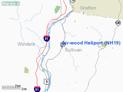
Location & QuickFacts
| FAA Information Effective: | 2008-09-25 |
| Airport Identifier: | NH19 |
| Airport Status: | Operational |
| Longitude/Latitude: | 072-21-08.3280W/43-32-35.2560N
-72.352313/43.543127 (Estimated) |
| Elevation: | 540 ft / 164.59 m (Estimated) |
| Land: | 0 acres |
| From nearest city: | 0 nautical miles N of Plainfield, NH |
| Location: | Sullivan County, NH |
| Magnetic Variation: | 15W (1985) |
Owner & Manager
| Ownership: | Privately owned |
| Owner: | Donald H Wood Jr |
| Address: | Rr 1 Box 269
Alstead, NH 03602 |
| Phone number: | 603-835-6606
ALSO 603-675-9266. |
| Manager: | Donald H Wood Jr |
| Address: | Rr 1 Box 269
Alstead, NH 03602 |
| Phone number: | 603-835-6606 |
Airport Operations and Facilities
| Airport Use: | Private |
| Wind indicator: | Yes |
| Segmented Circle: | No |
| Control Tower: | No |
| Lighting Schedule: | PHONE REQ
FOR PERIMETER LGTS & STROBE CALL 603-835-6606 OR 603-675-9266. |
| Beacon Color: | Clear-Green (lighted land airport) |
| Sectional chart: | New York |
| Region: | ANE - New England |
| Boundary ARTCC: | ZBW - Boston |
| Tie-in FSS: | BGR - Bangor |
| FSS Toll Free: | 1-800-WX-BRIEF |
Runway Information
Helipad H1
| Dimension: | 40 x 50 ft / 12.2 x 15.2 m |
| Surface: | CONC-TURF, |
| |
Runway H1 |
Runway |
| Traffic Pattern: | Left | Left |
|
Radio Navigation Aids
| ID |
Type |
Name |
Ch |
Freq |
Var |
Dist |
| R | FAN MARKER | Chitt | | | 14W | 27.7 nm |
| LCI | FAN MARKER | Laconia | | | | 39.7 nm |
| MPV | FAN MARKER | Brook | | | | 48.5 nm |
| IVV | NDB | White River | | 379.00 | 16W | 5.0 nm |
| CNH | NDB | Claremont | | 233.00 | 16W | 10.5 nm |
| LAH | NDB | Hanover | | 276.00 | 15W | 12.2 nm |
| SXD | NDB | Springfield | | 265.00 | 15W | 19.3 nm |
| DYO | NDB | Smuto | | 221.00 | 15W | 28.1 nm |
| LC | NDB | Blnap | | 328.00 | 16W | 35.5 nm |
| VWD | NDB | Mount Snow | | 224.00 | 15W | 43.3 nm |
| CO | NDB | Epsom | | 216.00 | 16W | 46.9 nm |
| LEB | VOR/DME | Lebanon | 084X | 113.70 | 15W | 10.1 nm |
| RUT | VOR/DME | Rutland | 47X | 111.00 | 15W | 26.1 nm |
| MPV | VOR/DME | Montpelier | 045X | 110.80 | 16W | 32.9 nm |
| CON | VORTAC | Concord | 076X | 112.90 | 15W | 39.1 nm |
| EEN | VORTAC | Keene | 031X | 109.40 | 14W | 45.1 nm |
Remarks
Images and information placed above are from
http://www.airport-data.com/airport/NH19/
We thank them for the data!
| General Info
|
| Country |
United States
|
| State |
NEW HAMPSHIRE
|
| FAA ID |
NH19
|
| Latitude |
43-32-35.256N
|
| Longitude |
072-21-08.328W
|
| Elevation |
540 feet
|
| Near City |
PLAINFIELD
|
We don't guarantee the information is fresh and accurate. The data may
be wrong or outdated.
For more up-to-date information please refer to other sources.
|
|


