 |
|
| Yucca Airstrip |
| IATA: KUCC – ICAO: UCC – FAA LID: NV11 |
| Summary |
| Operator |
Department of Energy |
| Location |
Nevada Test Site |
| Elevation AMSL |
3,919 ft / 1,195 m |
| Coordinates |
36°56′45″N 116°02′16″W / 36.94583°N 116.03778°W / 36.94583; -116.03778Coordinates: 36°56′45″N 116°02′16″W / 36.94583°N 116.03778°W / 36.94583; -116.03778 |
| Runways |
| Direction |
Length |
Surface |
| ft |
m |
| 14/32 |
9,000 |
2,743 |
Salt |
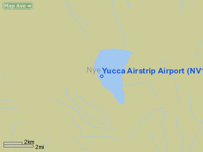
Yucca Airstrip (IATA: UCC, ICAO: KUCC, FAA LID: NV11) is a private-use airport located 17 miles (27 km) north of the central business district of Mercury, in Nye County, Nevada, United States. The airport is located on the Nevada Test Site and is owned by the United States Department of Energy. History
The airport was the staging area for SHOT BADGER, a test of the UPSHOT-KNOTHOLE Series on April 18, 1953.
Facilities
Yucca Airstrip Airport covers an area of 41 acres (17 ha) and has one runway:
- Runway 14/32: 9,000 x 200 ft (2,743 x 61 m), Surface: Salt
The above content comes from Wikipedia and is published under free licenses – click here to read more.
Location & QuickFacts
| FAA Information Effective: | 2008-09-25 |
| Airport Identifier: | NV11 |
| Airport Status: | Operational |
| Longitude/Latitude: | 116-02-16.1220W/36-56-44.8300N
-116.037812/36.945786 (Estimated) |
| Elevation: | 3919 ft / 1194.51 m (Surveyed) |
| Land: | 41 acres |
| From nearest city: | 17 nautical miles N of Mercury, NV |
| Location: | Nye County, NV |
| Magnetic Variation: | 14E (1985) |
Owner & Manager
| Ownership: | Publicly owned |
| Owner: | Nevada Dept Of Energy |
| Address: | Box 98518
Las Vegas, NV 89193-8518 |
| Phone number: | 702-295-4015 |
| Manager: | Michael Childers
OTHER CONTCACT: JOSEPH M. GINANNI 702-295-0209 |
| Address: | Nevada Dept Of Energy, Box 98518
Las Vegas, NV 89193-8518 |
| Phone number: | 702-295-4015 |
Airport Operations and Facilities
| Airport Use: | Private |
| Wind indicator: | Yes |
| Segmented Circle: | No |
| Control Tower: | No |
| Landing fee charge: | No |
| Sectional chart: | Las Vegas |
| Region: | AWP - Western-Pacific |
| Boundary ARTCC: | ZLA - Los Angeles |
| Tie-in FSS: | RNO - Reno |
| FSS on Airport: | No |
| FSS Toll Free: | 1-800-WX-BRIEF |
Airport Services
| Airframe Repair: | NONE |
| Power Plant Repair: | NONE |
Runway Information
Runway 14/32
| Dimension: | 9000 x 200 ft / 2743.2 x 61.0 m |
| Surface: | DIRT, |
| |
Runway 14 |
Runway 32 |
| Traffic Pattern: | Right | Right |
|
Radio Navigation Aids
| ID |
Type |
Name |
Ch |
Freq |
Var |
Dist |
| MCY | NDB | Mercury | | 326.00 | 16E | 19.1 nm |
| INS | TACAN | Indian Springs | 067X | | 15E | 28.0 nm |
| BTY | VORTAC | Beatty | 094X | 114.70 | 16E | 35.2 nm |
Remarks
- AIRSTRIP WITHIN R-4808.
- OFFICIAL BUSINESS ONLY. PPR RQRD FROM DEPT OF ENERGY FOR ALL FLIGHTS.
- OWNER DESIRES AIRPORT NOT BE CHARTED.
- FORMAL EVALUATION NOT RQRD, DATE ESTABD NOT KNOWN.
Images and information placed above are from
http://www.airport-data.com/airport/NV11/
We thank them for the data!
| General Info
|
| Country |
United States
|
| State |
NEVADA
|
| FAA ID |
NV11
|
| Latitude |
36-56-44.830N
|
| Longitude |
116-02-16.122W
|
| Elevation |
3919 feet
|
| Near City |
MERCURY
|
We don't guarantee the information is fresh and accurate. The data may
be wrong or outdated.
For more up-to-date information please refer to other sources.
|
|


