 |
|
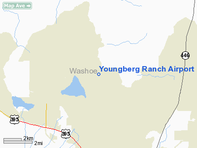
Location & QuickFacts
| FAA Information Effective: | 2008-09-25 |
| Airport Identifier: | NV17 |
| Airport Status: | Operational |
| Longitude/Latitude: | 119-48-46.6890W/39-40-23.6730N
-119.812969/39.673243 (Estimated) |
| Elevation: | 4960 ft / 1511.81 m (Estimated) |
| Land: | 0 acres |
| From nearest city: | 0 nautical miles NE of Lemmon Valley, NV |
| Location: | Washoe County, NV |
| Magnetic Variation: | 16E (1985) |
Owner & Manager
| Ownership: | Privately owned |
| Owner: | L. M. Youngberg |
| Address: | 1015 Chickadee Drive
Lemmon Valley, NV 89506 |
| Phone number: | 702-972-1286 |
| Address: |
|
Airport Operations and Facilities
| Airport Use: | Private |
| Wind indicator: | Yes |
| Segmented Circle: | No |
| Control Tower: | No |
| Landing fee charge: | No |
| Sectional chart: | San Francisco |
| Region: | AWP - Western-Pacific |
| Boundary ARTCC: | ZOA - Oakland |
| Tie-in FSS: | RNO - Reno |
| FSS on Airport: | No |
| FSS Toll Free: | 1-800-WX-BRIEF |
Airport Services
| Airframe Repair: | NONE |
| Power Plant Repair: | NONE |
Runway Information
Runway 11/29
| Dimension: | 1580 x 40 ft / 481.6 x 12.2 m |
| Surface: | DIRT, |
| |
Runway 11 |
Runway 29 |
| Traffic Pattern: | Left | Right |
| Obstruction: | | 4 ft fence |
|
Radio Navigation Aids
| ID |
Type |
Name |
Ch |
Freq |
Var |
Dist |
| SWR | VOR/DME | Squaw Valley | 079X | 113.20 | 16E | 36.4 nm |
| AHC | VOR/DME | Amedee | 027X | 109.00 | 17E | 39.0 nm |
| FMG | VORTAC | Mustang | 126X | 117.90 | 16E | 11.2 nm |
| HZN | VORTAC | Hazen | 088X | 114.10 | 17E | 38.9 nm |
Images and information placed above are from
http://www.airport-data.com/airport/NV17/
We thank them for the data!
| General Info
|
| Country |
United States
|
| State |
NEVADA
|
| FAA ID |
NV17
|
| Latitude |
39-40-23.673N
|
| Longitude |
119-48-46.689W
|
| Elevation |
4960 feet
|
| Near City |
LEMMON VALLEY
|
We don't guarantee the information is fresh and accurate. The data may
be wrong or outdated.
For more up-to-date information please refer to other sources.
|
|


