 |
|
Location & QuickFacts
| FAA Information Effective: | 2008-09-25 |
| Airport Identifier: | NV56 |
| Airport Status: | Operational |
| Longitude/Latitude: | 117-10-30.3150W/38-47-57.7510N
-117.175088/38.799375 (Estimated) |
| Elevation: | 5568 ft / 1697.13 m (Estimated) |
| Land: | 0 acres |
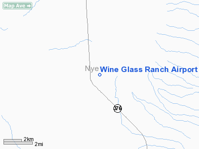
| From nearest city: | 7 nautical miles NW of Round Mountain, NV |
| Location: | Nye County, NV |
| Magnetic Variation: | 15E (1985) |
Owner & Manager
| Ownership: | Privately owned |
| Owner: | Truckee River Ranch, Llc |
| Address: | P O Box 5010
Fallon, NV 89407 |
| Phone number: | 775-867-4136 |
| Manager: | Truckee River Ranch |
| Address: | P O Box 5010
Fallon, NV 89407 |
| Phone number: | 775-867-4136 |
Airport Operations and Facilities
| Airport Use: | Private |
| Wind indicator: | Yes |
| Segmented Circle: | No |
| Control Tower: | No |
| Landing fee charge: | No |
| Sectional chart: | Las Vegas |
| Region: | AWP - Western-Pacific |
| Boundary ARTCC: | ZLC - Salt Lake City |
| Tie-in FSS: | RNO - Reno |
| FSS on Airport: | No |
| FSS Toll Free: | 1-800-WX-BRIEF |
Runway Information
Runway 16/34
| Dimension: | 3300 x 35 ft / 1005.8 x 10.7 m |
| Surface: | GRVL-TURF, |
| |
Runway 16 |
Runway 34 |
| Traffic Pattern: | Left | Left |
|
Radio Navigation Aids
| ID |
Type |
Name |
Ch |
Freq |
Var |
Dist |
| MVA | VORTAC | Mina | 098X | 115.10 | 17E | 42.6 nm |
| TPH | VORTAC | Tonopah | 119X | 117.20 | 17E | 46.7 nm |
Remarks
Images and information placed above are from
http://www.airport-data.com/airport/NV56/
We thank them for the data!
| General Info
|
| Country |
United States
|
| State |
NEVADA
|
| FAA ID |
NV56
|
| Latitude |
38-47-57.751N
|
| Longitude |
117-10-30.315W
|
| Elevation |
5568 feet
|
| Near City |
ROUND MOUNTAIN
|
We don't guarantee the information is fresh and accurate. The data may
be wrong or outdated.
For more up-to-date information please refer to other sources.
|
|


