 |
|
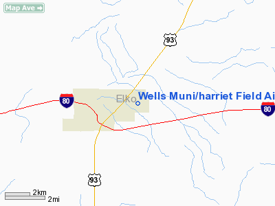
Wells Muni/harriet Field Airport |
Wells Municipal Airport
Harriet Field |
| IATA: LWL – ICAO: KLWL – FAA LID: LWL |
| Summary |
| Airport type |
Public |
| Operator |
City of Wells |
| Location |
Wells, Nevada |
| Elevation AMSL |
5,772 ft / 1,759.3 m |
| Coordinates |
41°07′02″N 114°55′20″W / 41.11722°N 114.92222°W / 41.11722; -114.92222Coordinates: 41°07′02″N 114°55′20″W / 41.11722°N 114.92222°W / 41.11722; -114.92222 |
| Runways |
| Direction |
Length |
Surface |
| ft |
m |
| 8/26 |
5,498 |
1,676 |
Asphalt |
| 1/19 |
2,681 |
817 |
Gravel/Soil |
Wells Municipal Airport (IATA: LWL, ICAO: KLWL, FAA LID: LWL), also known as Harriet Field, is a public airport located two miles (3 km) northeast of the central business district of Wells, a city in Elko County, Nevada, United States.
Facilities
Wells Municipal Airport covers 708 acres (287 ha) and has two runways:
- Runway 1/19: 2,681 x 150 ft. (817 x 46 m), Surface: Gravel/Dirt
- Runway 8/26: 5,498 x 150 ft. (1,676 x 46 m), Surface: Asphalt
The above content comes from Wikipedia and is published under free licenses – click here to read more.
Location & QuickFacts
| FAA Information Effective: | 2008-09-25 |
| Airport Identifier: | LWL |
| Airport Status: | Operational |
| Longitude/Latitude: | 114-55-19.6000W/41-07-01.7000N
-114.922111/41.117139 (Estimated) |
| Elevation: | 5772 ft / 1759.31 m (Estimated) |
| Land: | 708 acres |
| From nearest city: | 2 nautical miles NE of Wells, NV |
| Location: | Elko County, NV |
| Magnetic Variation: | 17W (1975) |
Owner & Manager
| Ownership: | Publicly owned |
| Owner: | City Of Wells |
| Address: | Box 366
Wells, NV 89835 |
| Phone number: | 775-752-3355 |
| Manager: | Jolene Supp
CITY MGR. |
| Address: | Po Box 366
Wells, NV 89835 |
| Phone number: | 775-752-3355 |
Airport Operations and Facilities
| Airport Use: | Open to public |
| Wind indicator: | Yes |
| Segmented Circle: | Yes |
| Control Tower: | No |
| Lighting Schedule: | DUSK-DAWN
ACTVT MIRL RWY 08/26 - CTAF. |
| Beacon Color: | Clear-Green (lighted land airport) |
| Landing fee charge: | No |
| Sectional chart: | Salt Lake City |
| Region: | AWP - Western-Pacific |
| Boundary ARTCC: | ZLC - Salt Lake City |
| Tie-in FSS: | RNO - Reno |
| FSS on Airport: | No |
| FSS Toll Free: | 1-800-WX-BRIEF |
| NOTAMs Facility: | RNO (NOTAM-d service avaliable) |
| Federal Agreements: | NGY2 |
Airport Communications
| CTAF: | 122.800 |
| Unicom: | 122.800 |
Airport Services
| Fuel available: | 100LL |
| Bottled Oxygen: | NONE |
| Bulk Oxygen: | NONE |
Runway Information
Runway 01/19
| Dimension: | 2681 x 150 ft / 817.2 x 45.7 m |
| Surface: | GRVL-DIRT, Fair Condition
VEGETATION +1' FULL LENGTH. |
| |
Runway 01 |
Runway 19 |
| Longitude: | 114-55-25.6104W | 114-55-09.7771W |
| Latitude: | 41-06-59.0206N | 41-07-22.6355N |
| Elevation: | 5734.00 ft | 5711.00 ft |
| Alignment: | 27 | 127 |
| Traffic Pattern: | Right | Left |
| Runway End Identifier: | No | No |
| Centerline Lights: | No | No |
| Touchdown Lights: | No | No |
| Obstruction: | 30 ft bldg, 600.0 ft from runway, 300 ft left of centerline, 20:1 slope to clear | 11 ft hill, 300.0 ft from runway, 27:1 slope to clear |
|
Runway 08/26
| Dimension: | 5498 x 150 ft / 1675.8 x 45.7 m |
| Surface: | ASPH, Good Condition
VEGETATION +1' FULL LENGTH. |
| Weight Limit: | Single wheel: 25000 lbs.
CENTER 75 FT STRESSED FOR 25000 LBS SNGL WHEEL; REMAINDER OF 150 FT WIDTH IS 11500 LBS SNGL WHEEL. |
| Edge Lights: | Medium |
| |
Runway 08 |
Runway 26 |
| Longitude: | 114-55-55.7427W | 114-54-45.2097W |
| Latitude: | 41-07-02.2833N | 41-06-52.0958N |
| Elevation: | 5708.00 ft | 5769.00 ft |
| Alignment: | 101 | 127 |
| Traffic Pattern: | Right | Left |
| Markings: | Basic, Good Condition | Basic, Good Condition |
| Runway End Identifier: | No | No |
| Centerline Lights: | No | No |
| Touchdown Lights: | No | No |
|
Radio Navigation Aids
| ID |
Type |
Name |
Ch |
Freq |
Var |
Dist |
| LWL | VOR | Wells | | 114.20 | 17E | 3.0 nm |
| BQU | VOR/DME | Bullion | 092X | 114.50 | 17E | 43.7 nm |
Remarks
- TELEPHONE AVBL LCTD AT HANGAR.
- RWY 01/19 NO LINE OF SIGHT BETWEEN RWY ENDS.
- MOUNTAINS N & S QUADRANTS.
- SNOW REMOVAL SVCS DURG DALGT ONLY EXCP BY PRIOR ARRANGEMENT CALL 775-777-7300.
- ULTRALIGHT ACTVTY ON & INVOF ARPT.
Images and information placed above are from
http://www.airport-data.com/airport/LWL/
We thank them for the data!
| General Info
|
| Country |
United States
|
| State |
NEVADA
|
| FAA ID |
LWL
|
| Latitude |
41-07-01.700N
|
| Longitude |
114-55-19.600W
|
| Elevation |
5772 feet
|
| Near City |
WELLS
|
We don't guarantee the information is fresh and accurate. The data may
be wrong or outdated.
For more up-to-date information please refer to other sources.
|
|


