 |
|
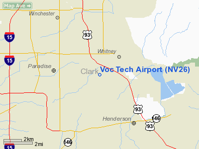
Location & QuickFacts
| FAA Information Effective: | 2008-09-25 |
| Airport Identifier: | NV26 |
| Airport Status: | Operational |
| Longitude/Latitude: | 115-04-07.9860W/36-04-44.9060N
-115.068885/36.079141 (Estimated) |
| Elevation: | 1913 ft / 583.08 m (Estimated) |
| Land: | 0 acres |
| From nearest city: | 3 nautical miles NW of Henderson, NV |
| Location: | Clark County, NV |
| Magnetic Variation: | 14E (1985) |
Owner & Manager
| Ownership: | Publicly owned |
| Owner: | Acft Maintenance Trng Dept |
| Address: | 5710 Mtn Vista Drive
Las Vegas, NV 89120 |
| Phone number: | 702-799-7534 |
| Manager: | Matthew J. Pandolfo |
| Address: | 5710 Mtn Vista Drive
Las Vegas, NV 89120 |
| Phone number: | 702-779-7534 |
Airport Operations and Facilities
| Airport Use: | Private |
| Wind indicator: | Yes |
| Segmented Circle: | No |
| Control Tower: | No |
| Landing fee charge: | No |
| Sectional chart: | Las Vegas |
| Region: | AWP - Western-Pacific |
| Boundary ARTCC: | ZLA - Los Angeles |
| Tie-in FSS: | RNO - Reno |
| FSS on Airport: | No |
| FSS Toll Free: | 1-800-WX-BRIEF |
Airport Services
| Airframe Repair: | NONE |
| Power Plant Repair: | NONE |
Runway Information
Runway E/W
| Dimension: | 2100 x 100 ft / 640.1 x 30.5 m |
| Surface: | GRAVEL, |
| |
Runway E |
Runway W |
| Traffic Pattern: | Right | Left |
| Obstruction: | | 200 ft hill |
|
Radio Navigation Aids
| ID |
Type |
Name |
Ch |
Freq |
Var |
Dist |
| LSV | TACAN | Nellis | 012X | | 15E | 10.2 nm |
| INS | TACAN | Indian Springs | 067X | | 15E | 42.1 nm |
| LAS | VORTAC | Las Vegas | 116X | 116.90 | 15E | 4.4 nm |
| BLD | VORTAC | Boulder City | 114X | 116.70 | 15E | 11.2 nm |
| VGT | VOT | North Las Vegas | | 108.20 | | 10.3 nm |
Remarks
- RWY USED TO BRING ACFT TO OUR A & P PROGRAM AT SNVTC. OTHER USE RSTRD TO EMERG LNDG ONLY.
Images and information placed above are from
http://www.airport-data.com/airport/NV26/
We thank them for the data!
| General Info
|
| Country |
United States
|
| State |
NEVADA
|
| FAA ID |
NV26
|
| Latitude |
36-04-44.906N
|
| Longitude |
115-04-07.986W
|
| Elevation |
1913 feet
|
| Near City |
HENDERSON
|
We don't guarantee the information is fresh and accurate. The data may
be wrong or outdated.
For more up-to-date information please refer to other sources.
|
|


