 |
|
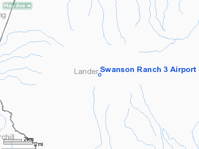
Location & QuickFacts
| FAA Information Effective: | 2008-09-25 |
| Airport Identifier: | NV64 |
| Airport Status: | Operational |
| Longitude/Latitude: | 117-23-31.3830W/40-00-29.7000N
-117.392051/40.008250 (Estimated) |
| Elevation: | 4940 ft / 1505.71 m (Estimated) |
| Land: | 6 acres |
| From nearest city: | 44 nautical miles SW of Battle Mountain, NV |
| Location: | Lander County, NV |
| Magnetic Variation: | 16E (1985) |
Owner & Manager
| Ownership: | Privately owned |
| Owner: | Ray Swanson |
| Address: | 10368 Fareway Ave
Hanford, CA 9323O |
| Phone number: | 209-584-3217 |
| Manager: | Ray Swanson |
| Address: | P.o. Box 1146
Hanford, CA 93232 |
| Phone number: | 209-584-3217 |
Airport Operations and Facilities
| Airport Use: | Private |
| Wind indicator: | Yes |
| Segmented Circle: | No |
| Control Tower: | No |
| Landing fee charge: | No |
| Sectional chart: | Klamath Falls |
| Region: | AWP - Western-Pacific |
| Boundary ARTCC: | ZLC - Salt Lake City |
| Tie-in FSS: | RNO - Reno |
| FSS on Airport: | No |
| FSS Toll Free: | 1-800-WX-BRIEF |
Runway Information
Runway 16/34
| Dimension: | 2500 x 50 ft / 762.0 x 15.2 m |
| Surface: | GRVL, |
| |
Runway 16 |
Runway 34 |
| Traffic Pattern: | Left | Left |
|
Radio Navigation Aids
| ID |
Type |
Name |
Ch |
Freq |
Var |
Dist |
| BAM | VORTAC | Battle Mountain | 059X | 112.20 | 18E | 40.0 nm |
Remarks
- VFR; PRIVATE USE ONLY; LNDGS FROM THE EAST AND TAKEOFFS TO THE EAST ONLY.
Images and information placed above are from
http://www.airport-data.com/airport/NV64/
We thank them for the data!
| General Info
|
| Country |
United States
|
| State |
NEVADA
|
| FAA ID |
NV64
|
| Latitude |
40-00-29.700N
|
| Longitude |
117-23-31.383W
|
| Elevation |
4940 feet
|
| Near City |
BATTLE MOUNTAIN
|
We don't guarantee the information is fresh and accurate. The data may
be wrong or outdated.
For more up-to-date information please refer to other sources.
|
|


