 |
|
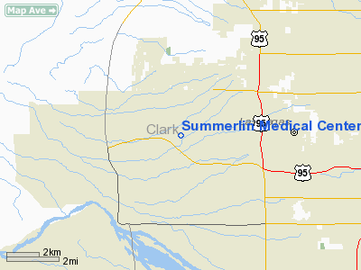
Summerlin Medical Center Heliport |
Location & QuickFacts
| FAA Information Effective: | 2008-09-25 |
| Airport Identifier: | 0NV1 |
| Airport Status: | Operational |
| Longitude/Latitude: | 115-18-03.0000W/36-11-37.0000N
-115.300833/36.193611 (Estimated) |
| Elevation: | 2745 ft / 836.68 m (Estimated) |
| Land: | 24 acres |
| From nearest city: | 5 nautical miles E of Las Vegas, NV |
| Location: | Clark County, NV |
| Magnetic Variation: | 14E (1995) |
Owner & Manager
| Ownership: | Privately owned |
| Owner: | Universal Health Service Inc |
| Address: | 367 S Gulph Rd
King Of Prussia, PA 19406 |
| Phone number: | 610-768-3300 |
| Manager: | Justin Fleming |
| Address: | 620 Shadow Lane
Las Vegas, NV 89106 |
| Phone number: | 702-388-4598 |
Airport Operations and Facilities
| Airport Use: | Private
MEDICAL USE. |
| Wind indicator: | Yes |
| Segmented Circle: | No |
| Control Tower: | No |
| Lighting Schedule: | PHONE REQ
FOR PERIMETER & DIRECTIONAL LGTS CALL 610-768-3300. |
| Sectional chart: | Las Vegas |
| Region: | AWP - Western-Pacific |
| Boundary ARTCC: | ZLA - Los Angeles |
| Tie-in FSS: | RNO - Reno |
| FSS Toll Free: | 1-800-WX-BRIEF |
Runway Information
Helipad H1
| Dimension: | 40 x 40 ft / 12.2 x 12.2 m |
| Surface: | CONC, |
| |
Runway H1 |
Runway |
| Traffic Pattern: | Left | Left |
|
Radio Navigation Aids
| ID |
Type |
Name |
Ch |
Freq |
Var |
Dist |
| MCY | NDB | Mercury | | 326.00 | 16E | 43.8 nm |
| LSV | TACAN | Nellis | 012X | | 15E | 13.7 nm |
| INS | TACAN | Indian Springs | 067X | | 15E | 29.5 nm |
| LAS | VORTAC | Las Vegas | 116X | 116.90 | 15E | 9.7 nm |
| BLD | VORTAC | Boulder City | 114X | 116.70 | 15E | 24.3 nm |
| VGT | VOT | North Las Vegas | | 108.20 | | 4.9 nm |
Remarks
- PRVDD VFR USE PRIVATE USE SPONSON ENSURE OBSTR FREE INGRESS/EGRESS.
Images and information placed above are from
http://www.airport-data.com/airport/0NV1/
We thank them for the data!
| General Info
|
| Country |
United States
|
| State |
NEVADA
|
| FAA ID |
0NV1
|
| Latitude |
36-11-37.000N
|
| Longitude |
115-18-03.000W
|
| Elevation |
2745 feet
|
| Near City |
LAS VEGAS
|
We don't guarantee the information is fresh and accurate. The data may
be wrong or outdated.
For more up-to-date information please refer to other sources.
|
|


