 |
|
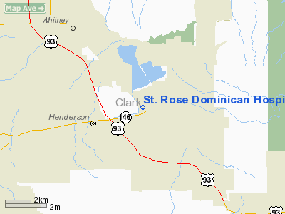
St. Rose Dominican Hospital Heliport |
Location & QuickFacts
| FAA Information Effective: | 2008-09-25 |
| Airport Identifier: | NV25 |
| Airport Status: | Operational |
| Longitude/Latitude: | 114-59-02.9710W/36-02-29.9150N
-114.984159/36.041643 (Estimated) |
| Elevation: | 1890 ft / 576.07 m (Estimated) |
| Land: | 0 acres |
| From nearest city: | 1 nautical miles W of Henderson, NV |
| Location: | Clark County, NV |
| Magnetic Variation: | 14E (1985) |
Owner & Manager
| Ownership: | Privately owned |
| Owner: | St. Rose Dominican Hospital |
| Address: | 102 Lake Mead Drive
Henderson, NV 89015 |
| Phone number: | 702-564-2622 |
| Manager: | Ken Mcglothlin
OTHER CONTACT: GARY SPURLIN 3001 ST. ROSE PKWY HENDERSON, NV 89052 702-616-5207 |
| Address: | 102 Lake Mead Drive
Henderson, NV 89015 |
| Phone number: | 702-616-4667 |
Airport Operations and Facilities
| Airport Use: | Private |
| Wind indicator: | Yes |
| Segmented Circle: | Yes |
| Control Tower: | No |
| Landing fee charge: | No |
| Sectional chart: | Las Vegas |
| Region: | AWP - Western-Pacific |
| Boundary ARTCC: | ZLA - Los Angeles |
| Tie-in FSS: | RNO - Reno |
| FSS on Airport: | No |
| FSS Toll Free: | 1-800-WX-BRIEF |
Airport Services
| Airframe Repair: | NONE |
| Power Plant Repair: | NONE |
Runway Information
Helipad H1
| Dimension: | 70 x 70 ft / 21.3 x 21.3 m |
| Surface: | ASPH, Good Condition
70' CIRCLE. |
| |
Runway H1 |
Runway |
| Traffic Pattern: | Left | Left |
|
Radio Navigation Aids
| ID |
Type |
Name |
Ch |
Freq |
Var |
Dist |
| LSV | TACAN | Nellis | 012X | | 15E | 12.4 nm |
| INS | TACAN | Indian Springs | 067X | | 15E | 46.6 nm |
| BLD | VORTAC | Boulder City | 114X | 116.70 | 15E | 6.5 nm |
| LAS | VORTAC | Las Vegas | 116X | 116.90 | 15E | 8.8 nm |
| VGT | VOT | North Las Vegas | | 108.20 | | 14.7 nm |
Remarks
- LCTD ADJ TO 2 HOSPITALS & 2 MEDICAL OFFICE BLDGS.
- PROVIDED PRIVATE USE VFR ONLY; P-LINES PENETRATING 8:1 APCH SLOPE BE MARKED & LGTD.
Images and information placed above are from
http://www.airport-data.com/airport/NV25/
We thank them for the data!
| General Info
|
| Country |
United States
|
| State |
NEVADA
|
| FAA ID |
NV25
|
| Latitude |
36-02-29.915N
|
| Longitude |
114-59-02.971W
|
| Elevation |
1890 feet
|
| Near City |
HENDERSON
|
We don't guarantee the information is fresh and accurate. The data may
be wrong or outdated.
For more up-to-date information please refer to other sources.
|
|


