 |
|
| Sky Ranch Airport |
| IATA: none – ICAO: none – FAA LID: 3L2 |
| Summary |
| Airport type |
Public |
| Operator |
Sky Ranch Home Owners Association |
| Location |
Sandy Valley, Nevada |
| Elevation AMSL |
2,599 ft / 792.2 m |
| Coordinates |
35°47′43″N 115°37′38″W / 35.79528°N 115.62722°W / 35.79528; -115.62722Coordinates: 35°47′43″N 115°37′38″W / 35.79528°N 115.62722°W / 35.79528; -115.62722 |
| Runways |
| Direction |
Length |
Surface |
| ft |
m |
| 3/21 |
3,340 |
1,018 |
Asphalt |
| 12/30 |
3,300 |
1,006 |
Soil |
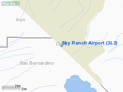
Sky Ranch Airport (FAA LID: 3L2), also known as Sky Ranch Estates, is a privately-owed, public-use airport located two miles (3 km) southwest of the central business district of Sandy Valley, a town in Clark County, Nevada, United States.
Facilities
Sky Ranch Airport covers 140 acres (57 ha) and has two runways:
- Runway 3/21: 3,340 x 45 ft. (1,018 x 14 m), Surface: Asphalt
- Runway 12/30: 3,300 x 105 ft. (1,006 x 32 m), Surface: Dirt
The above content comes from Wikipedia and is published under free licenses – click here to read more.
Location & QuickFacts
| FAA Information Effective: | 2008-09-25 |
| Airport Identifier: | 3L2 |
| Airport Status: | Operational |
| Longitude/Latitude: | 115-37-38.0200W/35-47-42.9110N
-115.627228/35.795253 (Estimated) |
| Elevation: | 2599 ft / 792.18 m (Surveyed) |
| Land: | 140 acres |
| From nearest city: | 2 nautical miles SW of Sandy Valley, NV |
| Location: | Clark County, NV |
| Magnetic Variation: | 14E (1985) |
Owner & Manager
| Ownership: | Privately owned |
| Owner: | Sky Ranch Home Owners Assn |
| Address: | Hcr 37 Box 455
Sandy Valley, NV 89019-8623 |
| Phone number: | 702-723-5197 |
| Manager: | Roger Keeney |
| Address: | Hcr 37 Box 450
Sandy Valley, NV 89019-8623 |
| Phone number: | 702-723-5193 |
Airport Operations and Facilities
| Airport Use: | Open to public |
| Wind indicator: | Yes |
| Segmented Circle: | Yes |
| Control Tower: | No |
| Lighting Schedule: | DUSK-DAWN |
| Landing fee charge: | No |
| Sectional chart: | Las Vegas |
| Region: | AWP - Western-Pacific |
| Boundary ARTCC: | ZLA - Los Angeles |
| Tie-in FSS: | RNO - Reno |
| FSS on Airport: | No |
| FSS Toll Free: | 1-800-WX-BRIEF |
| NOTAMs Facility: | RNO (NOTAM-d service avaliable) |
Airport Communications
| CTAF: | 123.000 |
| Unicom: | 123.000 |
Airport Services
Runway Information
Runway 03/21
| Dimension: | 3340 x 45 ft / 1018.0 x 13.7 m |
| Surface: | ASPH, Good Condition |
| Edge Lights: | Non-standard lighting system
RY 03/21 THLD LGTS ONLY. RY EDGES MARKED WITH REFLECTORS. |
| |
Runway 03 |
Runway 21 |
| Traffic Pattern: | Right | Left |
| Markings: | Basic, Good Condition | Basic, Good Condition |
| Displaced threshold: | 0.00 ft | 180.00 ft
DSPLCD THLD MARKED WITH 8 FT WHITE LINE. |
| Obstruction: | , 50:1 slope to clear | 15 ft road, 20.0 ft from runway
APCH SLOPE 25:1 AT DSPLCD THLD.
4 FT FENCE - 80 FT FM RY. |
|
Runway 12/30
| Dimension: | 3300 x 105 ft / 1005.8 x 32.0 m |
| Surface: | DIRT, Fair Condition |
| |
Runway 12 |
Runway 30 |
| Traffic Pattern: | Right | Left |
| Markings: | None, | None, |
|
Radio Navigation Aids
| ID |
Type |
Name |
Ch |
Freq |
Var |
Dist |
| LSV | TACAN | Nellis | 012X | | 15E | 39.8 nm |
| INS | TACAN | Indian Springs | 067X | | 15E | 47.5 nm |
| LAS | VORTAC | Las Vegas | 116X | 116.90 | 15E | 28.5 nm |
| BLD | VORTAC | Boulder City | 114X | 116.70 | 15E | 39.1 nm |
| GFS | VORTAC | Goffs | 091X | 114.40 | 15E | 45.6 nm |
| VGT | VOT | North Las Vegas | | 108.20 | | 32.4 nm |
Remarks
- AVOID NOISE SENSITIVE RESIDENTIAL AREA 1.5 MILES NW OF ARPT.
- LOW FLYING MILITARY AIRCRAFT IN AREA.
- POWER POLES/LINES NW/SE OF RY 03/21.
- ARPT IS A RESIDENTIAL AIRPARK; AUTO TRAFFIC IS ON & ACROSS RYS.
- OCNL LIVESTOCK ON AND INVOF ACFT MOVEMENT AREAS.
- RY 03/21 OBSTACLE FREE AREA LIMITED TO 96 FT EITHER SIDE OF RY CNTRLN.
- NO LINE OF SIGHT BTWN RY ENDS.
- ULTRALIGHT ACTIVITY ON AND IN VICINTY OF AIRPORT.
Images and information placed above are from
http://www.airport-data.com/airport/3L2/
We thank them for the data!
| General Info
|
| Country |
United States
|
| State |
NEVADA
|
| FAA ID |
3L2
|
| Latitude |
35-47-42.911N
|
| Longitude |
115-37-38.020W
|
| Elevation |
2599 feet
|
| Near City |
SANDY VALLEY
|
We don't guarantee the information is fresh and accurate. The data may
be wrong or outdated.
For more up-to-date information please refer to other sources.
|
|


