 |
|
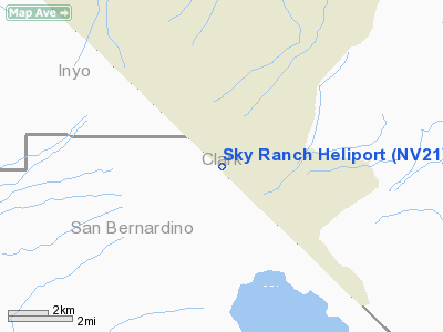
Location & QuickFacts
| FAA Information Effective: | 2008-09-25 |
| Airport Identifier: | NV21 |
| Airport Status: | Operational |
| Longitude/Latitude: | 115-37-38.0200W/35-47-42.9110N
-115.627228/35.795253 (Estimated) |
| Elevation: | 2600 ft / 792.48 m (Estimated) |
| Land: | 0 acres |
| From nearest city: | 30 nautical miles SW of Sandy Valley, NV |
| Location: | Clark County, NV |
| Magnetic Variation: | 14E (1985) |
Owner & Manager
| Ownership: | Privately owned |
| Owner: | M.s. Moore |
| Address: | 620 Geronimo Trail
Sandy Valley, NV 89019 |
| Phone number: | 702-723-5044 |
| Address: | Box 454 Hcr 31
Sandy Valley, NV 89019 |
| Phone number: | 702-723-5044 |
Airport Operations and Facilities
| Airport Use: | Private |
| Segmented Circle: | No |
| Control Tower: | No |
| Sectional chart: | Phoenix |
| Region: | AWP - Western-Pacific |
| Boundary ARTCC: | ZLA - Los Angeles |
| Tie-in FSS: | RNO - Reno |
| FSS Toll Free: | 1-800-WX-BRIEF |
Runway Information
Helipad H1
| Dimension: | 54 x 54 ft / 16.5 x 16.5 m |
| Surface: | CONC, |
| |
Runway H1 |
Runway |
| Traffic Pattern: | Left | Left |
|
Radio Navigation Aids
| ID |
Type |
Name |
Ch |
Freq |
Var |
Dist |
| LSV | TACAN | Nellis | 012X | | 15E | 39.8 nm |
| INS | TACAN | Indian Springs | 067X | | 15E | 47.5 nm |
| LAS | VORTAC | Las Vegas | 116X | 116.90 | 15E | 28.5 nm |
| BLD | VORTAC | Boulder City | 114X | 116.70 | 15E | 39.1 nm |
| GFS | VORTAC | Goffs | 091X | 114.40 | 15E | 45.6 nm |
| VGT | VOT | North Las Vegas | | 108.20 | | 32.4 nm |
Remarks
- PROVIDED PRIVATE USE ONLY; OPERATIONS CONDUCTED DURG VFR CONDITIONS; ENTER A LETTER OF AGREEMENT WITH SKY RANCH ESTATES AIRPORT.
Images and information placed above are from
http://www.airport-data.com/airport/NV21/
We thank them for the data!
| General Info
|
| Country |
United States
|
| State |
NEVADA
|
| FAA ID |
NV21
|
| Latitude |
35-47-42.911N
|
| Longitude |
115-37-38.020W
|
| Elevation |
2600 feet
|
| Near City |
SANDY VALLEY
|
We don't guarantee the information is fresh and accurate. The data may
be wrong or outdated.
For more up-to-date information please refer to other sources.
|
|


