 |
|
| Silver Springs Airport |
| IATA: none – ICAO: KSPZ – FAA LID: SPZ |
| Summary |
| Airport type |
Public |
| Owner |
Lyon County |
| Operator |
Silver Springs Airport, LLC |
| Serves |
Silver Springs, Nevada |
| Elevation AMSL |
4,269 ft / 1,301 m |
| Coordinates |
39°24′11″N 119°15′04″W / 39.40306°N 119.25111°W / 39.40306; -119.25111 |
| Runways |
| Direction |
Length |
Surface |
| ft |
m |
| 5/23 |
5,998 |
1,828 |
Asphalt |
| Statistics (2007) |
| Aircraft operations |
4,000 |
| Based aircraft |
14 |
| Source: Federal Aviation Administration |
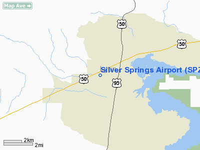
Silver Springs Airport (ICAO: KSPZ, FAA LID: SPZ, formerly B08) is a public use airport located 2 nmi (3.7 km; 2.3 mi) southwest of the central business district of Silver Springs, in Lyon County, Nevada, United States. It is owned by Lyon County and leased to Silver Springs Airport, LLC.
Although most U.S. airports use the same three-letter location identifier for the FAA and IATA, this airport is assigned SPZ by the FAA but has no designation from the IATA (which assigned SPZ to Springdale Municipal Airport in Springdale, Arkansas). Facilities and aircraft
Silver Springs Airport covers an area of 400 acres (160 ha) at an elevation of 4,269 ft (1,301 m) above mean sea level. It has one runway designated 5/23 with an asphalt surface measuring 5,998 by 75 ft (1,828 by 23 m).
For the 12-month period ending May 30, 2007, the airport had 4,000 general aviation aircraft operations, an average of 333 per month. At that time there were 14 aircraft based at this airport, 50% single-engine and 50% ultralight.
History
The airport was built by the United States Army Air Force about 1942, and was known as Churchill Flight Strip. It was an emergency landing airfield for military aircraft on training flights. It was closed after World War II, and was turned over for local government use by the War Assets Administration (WAA).
The above content comes from Wikipedia and is published under free licenses – click here to read more.
Location & QuickFacts
| FAA Information Effective: | 2008-09-25 |
| Airport Identifier: | SPZ |
| Airport Status: | Operational |
| Longitude/Latitude: | 119-15-04.3000W/39-24-10.9000N
-119.251194/39.403028 (Estimated) |
| Elevation: | 4269 ft / 1301.19 m (Surveyed) |
| Land: | 400 acres |
| From nearest city: | 2 nautical miles SW of Silver Springs, NV |
| Location: | Lyon County, NV |
| Magnetic Variation: | 16E (1985) |
Owner & Manager
| Ownership: | Publicly owned |
| Owner: | Lyon County
COMMISSIONERS OFFICE - MAUREEN WILLISS |
| Address: | 27 South Main St
Yerington, NV 89447 |
| Phone number: | 775-577-5037 |
| Manager: | Hale B. Bennett |
| Address: | P.o. Box 311
Silver Springs, NV 89429 |
| Phone number: | 775-577-2111 |
Airport Operations and Facilities
| Airport Use: | Open to public |
| Wind indicator: | Yes |
| Segmented Circle: | Yes |
| Control Tower: | No |
| Lighting Schedule: | RDO-CTL
ACTVT MIRL RY 05/23 ON CTAF. |
| Landing fee charge: | No |
| Sectional chart: | San Francisco |
| Region: | AWP - Western-Pacific |
| Boundary ARTCC: | ZOA - Oakland |
| Tie-in FSS: | RNO - Reno |
| FSS on Airport: | No |
| FSS Toll Free: | 1-800-WX-BRIEF |
| NOTAMs Facility: | RNO (NOTAM-d service avaliable) |
| Federal Agreements: | N |
Airport Communications
Airport Services
| Airframe Repair: | NONE |
| Power Plant Repair: | NONE |
| Bottled Oxygen: | NONE |
| Bulk Oxygen: | NONE |
Runway Information
Runway 05/23
| Dimension: | 5998 x 75 ft / 1828.2 x 22.9 m |
| Surface: | ASPH, Good Condition |
| Surface Treatment: | Saw-cut or plastic Grooved |
| Weight Limit: | Single wheel: 30000 lbs. |
| Edge Lights: | Medium |
| |
Runway 05 |
Runway 23 |
| Longitude: | 119-15-40.0177W | 119-14-28.6522W |
| Latitude: | 39-24-00.3622N | 39-24-21.5167N |
| Elevation: | 4265.00 ft | 4214.00 ft |
| Traffic Pattern: | Left | Right |
| Markings: | Basic, Good Condition | Basic, Good Condition |
| Runway End Identifier: | No | No |
| Centerline Lights: | No | No |
| Touchdown Lights: | No | No |
|
Radio Navigation Aids
| ID |
Type |
Name |
Ch |
Freq |
Var |
Dist |
| NFL | TACAN | Fallon | 082X | | 16E | 25.4 nm |
| SWR | VOR/DME | Squaw Valley | 079X | 113.20 | 16E | 49.2 nm |
| HZN | VORTAC | Hazen | 088X | 114.10 | 17E | 13.6 nm |
| FMG | VORTAC | Mustang | 126X | 117.90 | 16E | 20.3 nm |
Remarks
- 150 BY 150 FT BLAST PADS EACH END.
- ULTRA-LIGHT ACTIVITY ON & INVOF ARPT.
- NO OBJECTION
Images and information placed above are from
http://www.airport-data.com/airport/SPZ/
We thank them for the data!
|
|


