 |
|
Rosaschi Air Park Airport |
| Rosaschi Air Park |
| IATA: none – ICAO: none – FAA LID: N59 |
| Summary |
| Airport type |
Public |
| Operator |
U.S. Bureau of Land Management |
| Location |
Smith, Nevada |
| Elevation AMSL |
4,809 ft / 1,465.8 m |
| Coordinates |
38°50′22″N 119°20′18″W / 38.83944°N 119.33833°W / 38.83944; -119.33833Coordinates: 38°50′22″N 119°20′18″W / 38.83944°N 119.33833°W / 38.83944; -119.33833 |
| Runways |
| Direction |
Length |
Surface |
| ft |
m |
| 7/25 |
4,800 |
1,463 |
Asphalt |
| 17/35 |
3,700 |
1,128 |
Soil |
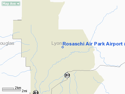
Rosaschi Air Park (FAA LID: N59) is a public airport located two miles (3 km) north of the central business district of Smith, a town in Lyon County, Nevada, USA.
Facilities
Rosaschi Air Park covers 482 acres (195 ha) and has two runways:
- Runway 7/25: 4,800 x 32 ft. (1,463 x 10 m), Surface: Asphalt
- Runway 17/35: 3,700 x 64 ft. (1,128 x 20 m), Surface: Dirt
The above content comes from Wikipedia and is published under free licenses – click here to read more.
Location & QuickFacts
| FAA Information Effective: | 2008-09-25 |
| Airport Identifier: | N59 |
| Airport Status: | Operational |
| Longitude/Latitude: | 119-20-17.5720W/38-50-21.6850N
-119.338214/38.839357 (Estimated) |
| Elevation: | 4809 ft / 1465.78 m (Surveyed) |
| Land: | 482 acres |
| From nearest city: | 2 nautical miles N of Smith, NV |
| Location: | Lyon County, NV |
| Magnetic Variation: | 16E (1985) |
Owner & Manager
| Ownership: | Publicly owned |
| Owner: | Bureau Of Land Management |
| Address: | P.o. Box 12000
Reno, NV 89502 |
| Phone number: | 775-861-6400 |
| Manager: | Michael G. Rosaschi |
| Address: | P.o. Box 208
Wellington, NV 89444 |
| Phone number: | 775-465-2417 |
Airport Operations and Facilities
| Airport Use: | Open to public |
| Wind indicator: | Yes |
| Segmented Circle: | No |
| Control Tower: | No |
| Sectional chart: | San Francisco |
| Region: | AWP - Western-Pacific |
| Boundary ARTCC: | ZOA - Oakland |
| Tie-in FSS: | RNO - Reno |
| FSS on Airport: | No |
| FSS Toll Free: | 1-800-WX-BRIEF |
| NOTAMs Facility: | RNO (NOTAM-d service avaliable) |
Airport Communications
Airport Services
| Fuel available: | 100LL
FOR FUEL 24 HOUR PRIOR NOTICE REQUIRED CALL (775) 465-2417. |
Runway Information
Runway 07/25
| Dimension: | 4800 x 32 ft / 1463.0 x 9.8 m |
| Surface: | ASPH, Poor Condition
NUMEROUS SEVERE CRACKS ENTIRE LENGTH OF RUNWAY. |
| |
Runway 07 |
Runway 25 |
| Traffic Pattern: | Left | Left |
|
Runway 17/35
| Dimension: | 3700 x 64 ft / 1127.8 x 19.5 m |
| Surface: | DIRT, Good Condition
NUMEROUS SEVERE CRACKS ENTIRE LENGTH OF RUNWAY. |
| |
Runway 17 |
Runway 35 |
| Traffic Pattern: | Left | Left |
| Obstruction: | , 50:1 slope to clear | 30 ft bldg, 300.0 ft from runway, 32 ft right of centerline, 10:1 slope to clear |
|
Radio Navigation Aids
| ID |
Type |
Name |
Ch |
Freq |
Var |
Dist |
| NFL | TACAN | Fallon | 082X | | 16E | 45.6 nm |
| SWR | VOR/DME | Squaw Valley | 079X | 113.20 | 16E | 48.1 nm |
| HZN | VORTAC | Hazen | 088X | 114.10 | 17E | 43.7 nm |
| FMG | VORTAC | Mustang | 126X | 117.90 | 16E | 44.1 nm |
Remarks
Images and information placed above are from
http://www.airport-data.com/airport/N59/
We thank them for the data!
| General Info
|
| Country |
United States
|
| State |
NEVADA
|
| FAA ID |
N59
|
| Latitude |
38-50-21.685N
|
| Longitude |
119-20-17.572W
|
| Elevation |
4809 feet
|
| Near City |
SMITH
|
We don't guarantee the information is fresh and accurate. The data may
be wrong or outdated.
For more up-to-date information please refer to other sources.
|
|


