|
|
| Reno-Tahoe International Airport |
 |
| FAA airport diagram |
| IATA: RNO – ICAO: KRNO – FAA LID: RNO
Location of the Reno-Tahoe International Airport
|
| Summary |
| Airport type |
Public |
| Owner/Operator |
Reno-Tahoe Airport Authority |
| Serves |
Reno, Nevada |
| Location |
Reno, Nevada |
| Elevation AMSL |
4,415 ft / 1,346 m |
| Coordinates |
39°29′57″N 119°46′05″W / 39.49917°N 119.76806°W / 39.49917; -119.76806Coordinates: 39°29′57″N 119°46′05″W / 39.49917°N 119.76806°W / 39.49917; -119.76806 |
| Website |
www.RenoAirport.com |
| Runways |
| Direction |
Length |
Surface |
| ft |
m |
| 16R/34L |
11,002 |
3,353 |
Concrete |
| 16L/34R |
9,000 |
2,743 |
Concrete |
| 7/25 |
6,102 |
1,860 |
Concrete |
| Statistics (2007) |
| Aircraft operations |
145,515 |
| Based aircraft |
182 |
| Sources: FAA and airport web site |
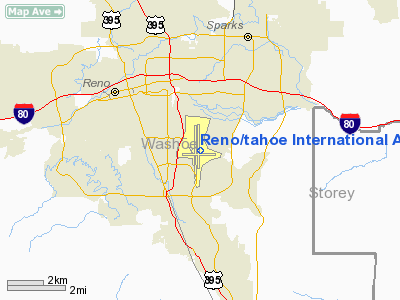
Reno-Tahoe International Airport (IATA: RNO, ICAO: KRNO, FAA LID: RNO) is a joint civil-military public airport located three nautical miles (6 km) southeast of the central business district of Reno, a city in Washoe County, Nevada, United States. It serves the Reno metropolitan area, western Nevada, and parts of eastern California and is the closest commercial airport to the vacation and ski resort destination of Lake Tahoe.
It is the second busiest commercial airport in the state of Nevada after McCarran International Airport in Las Vegas.
The Nevada Air National Guard maintains the 152nd Airlift Wing to the southwest of the airport's main terminal.
Reno-Tahoe International used to be the hub of Reno Air, a now-defunct medium sized airline that had offered non-stop MD-80 and MD-90 service to many cities, until Reno Air was bought and taken over by American Airlines and eventually completely disposed of in 2001. Reno Air's first flight was on July 1, 1992, and its last flight was on August 30, 1999.
The passenger terminal is named after the late US Senator Howard Cannon. The main lobby of the terminal contains an exhibit featuring the bust of Nevada State Senator (and Nevada State Senate Minority Leader) William J. "Bill" Raggio. Raggio is described in the exhibit as being "The Father of the Airport Authority."
Public transportation to and from the airport is provided by RTC Ride bus #19.
Reno-Tahoe International Airport is ranked at the 61th busiest commercial airport in the nation and in the fall of 2010 will open a new 200ft ATCT replacing the old one of more than 50 years.
Reno-Tahoe Airport Authority officials are currently exploring the possibilities of expanding the terminal and adding a 3rd concourse in the future, potentially starting in 2012. The airport is also exploring the possibility of a consolodated rental car facility and international flights to Mexico and Canada as well as more domestic flights. American Airlines has established a very strong relationship with the airport. History
The airport was built in 1929 by Boeing Transport Inc. and named Hubbard Field after Boeing Air Transport VP and air transport pioneer Eddie Hubbard [1] [2]. It was acquired by United Airlines in 1936 and purchased by the City of Reno in 1953. The first terminal building was completed in time for the 1960 Winter Olympics held in Squaw Valley, California. The airport received its current name in 1994, when the terminal was named in honor of retired Air Force Reserve Major General and former U.S. Senator Howard Cannon. Prior to that airport itself was named Cannon International Airport.
Management
- Krys T. Bart, CEO
- Marily M. Mora, Executive Vice President
- Richard Gorman
, Chief Financial Officer
- Tina Iftiger, Director of Airport Economic Development
- Brian Kulpin, Communications Director
Board of Directors
- Joseph W. Mayer, Chairman
- Mary Simmons, Vice Chair/Treasurer
- Randi Thompson, Secretary
- Lynn S. Atcheson
- William "Bill" Eck
- Jerry Hall
- Brooks Mancini
- Rick Murdock
- John S. Wagnon
Accidents and incidents
In the early morning hours of January 21, 1985, Galaxy Airlines Flight 203 took off from the airport for Minneapolis, Minnesota and crashed 1.5 miles (2.4 km) southwest of the airport while the pilots were attempting an emergency landing after experiencing an unexpected vibration from under the wing. An investigation attributed the crash to pilot error for failing to maintain proper control over the aircraft while investigating the cause of the vibration. The vibration was later found to be caused by an open air start service door which the ground crew failed to secure before departure. All but 1 of the 71 passengers and crew onboard were killed.
Facilities and aircraft
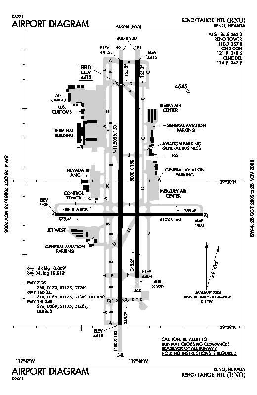
Reno-Tahoe International Airport covers an area of 1,450 acres (587 ha) at an elevation of 4,415 feet (1,346 m) above mean sea level. It has three concrete paved runways: 16R/34L measuring 11,002 by 150 feet (3,353 x 46 m), 16L/34R measuring 9,000 by 150 feet (2,743 x 46 m), and 7/25 measuring 6,102 by 150 feet (1,860 x 46 m).
For the 12-month period ending July 31, 2007, the airport had 145,515 aircraft operations, an average of 398 per day: 44% general aviation, 37% scheduled commercial, 15% air taxi and 4% military. At that time there were 182 aircraft based at this airport: 68% single-engine, 13% multi-engine, 12% jet, 2% helicopter and 4% military.
Military facilities and aircraftThe airport is also host to Reno Air National Guard Base, an approximately 60 acre complex which was established on the west side of the airport in 1954 when Air National Guard units relocated from the former Stead AFB in Reno. The base is home to the 152d Airlift Wing (152 AW), a Nevada Air National Guard unit operationally gained by the Air Mobility Command (AMC) and equipped with C-130H Hercules aircraft. A tactical fighter and fighter-reconnaissance unit for most of its history, the 152 AW transitioned to a tactical airlift mission in 1995. The wing is the host unit for the base, which has over 1,100 Air National Guard personnel, both full-time Active Guard and Reserve (AGR) and Air Reserve Technicians (ART), as well as part-time traditional air national guardsmen.
Airlines and destinations
| Airlines |
Destinations |
Concourse |
| American Airlines |
Chicago-O'Hare, Dallas/Fort Worth |
C |
| American Eagle |
Los Angeles |
C |
| Delta Air Lines |
Atlanta[seasonal], Minneapolis-St. Paul[seasonal], Salt Lake City |
B |
Delta Connection operated by
SkyWest Airlines |
Salt Lake City |
B |
| Horizon Air |
Los Angeles, Seattle/Tacoma |
C |
| Southwest Airlines |
Boise, Chicago-Midway, Denver, Las Vegas, Los Angeles, Oakland, Phoenix, Portland (OR), Salt Lake City, San Diego, San Jose (CA), Seattle/Tacoma |
B |
| United Airlines |
Denver, San Francisco |
C |
United Express operated by
SkyWest Airlines |
Denver, Los Angeles, San Francisco |
C |
| US Airways |
Phoenix |
C |
US Airways Express operated by
Mesa Airlines |
Phoenix |
C |
Sound levels
Sound levels have been analyzed for over two decades at this airport, with one of the first studies being a comprehensive production of aircraft sound level contour maps. Later analysis was conducted to analyze sound levels at Kate Smith School and provide retrofitting to reduce sound levels through a Federal Aviation Administration grant.
The above content comes from Wikipedia and is published under free licenses – click here to read more.
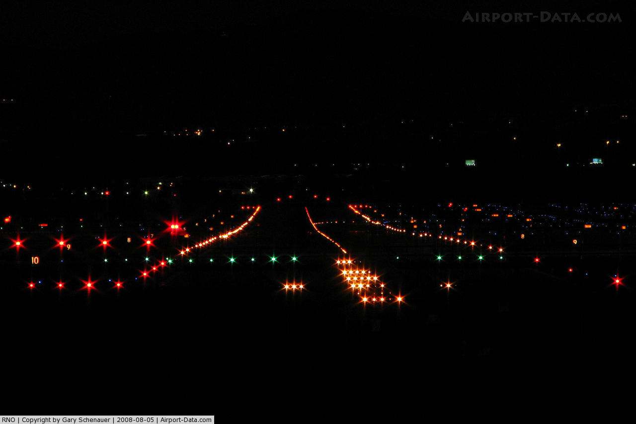
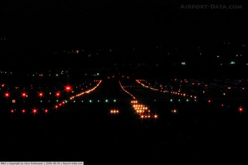 |
(Click on the photo to enlarge) |
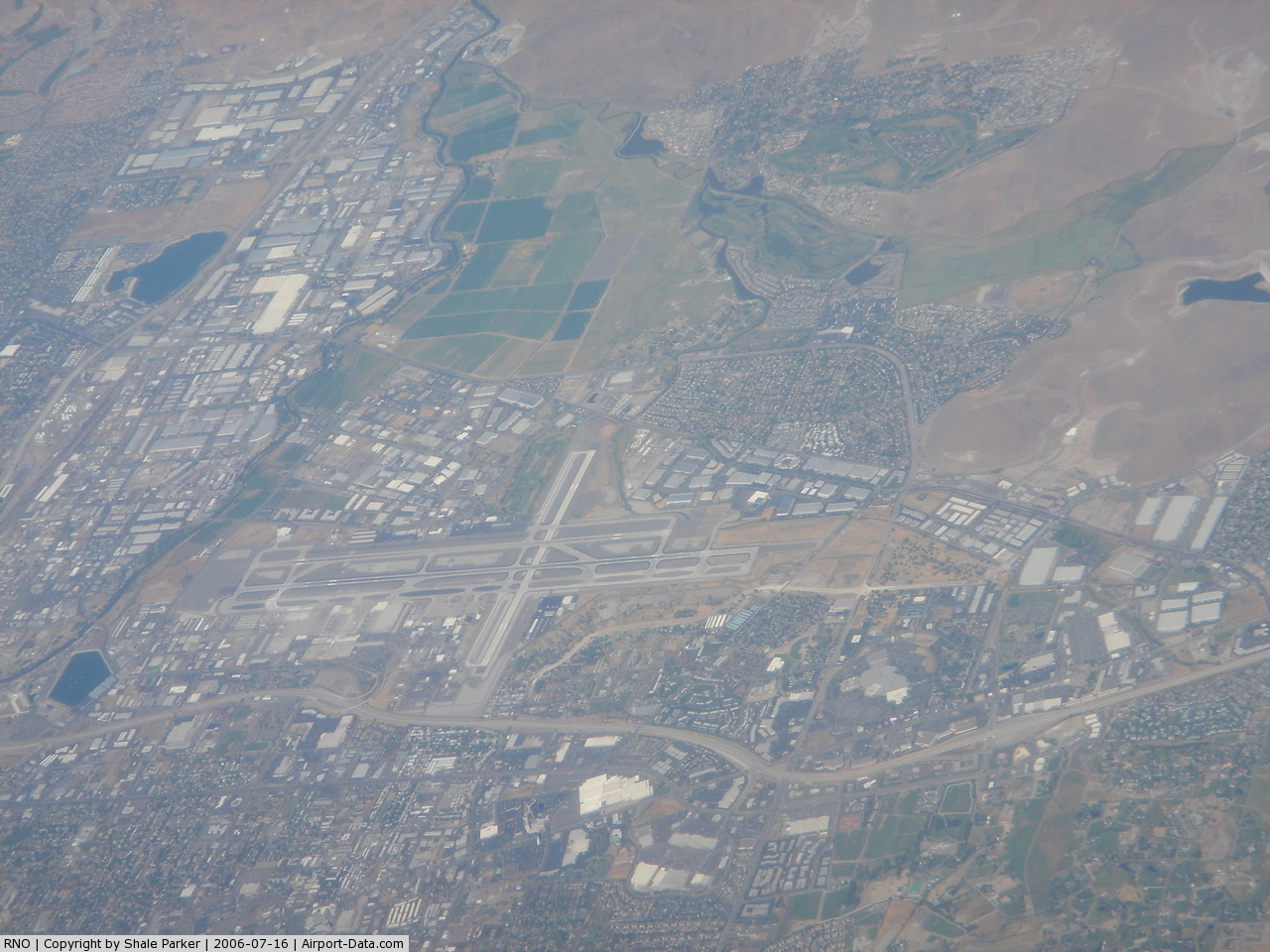
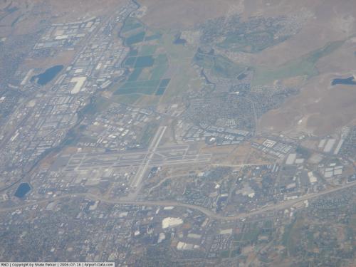 |
(Click on the photo to enlarge) |
Location & QuickFacts
| FAA Information Effective: | 2008-09-25 |
| Airport Identifier: | RNO |
| Airport Status: | Operational |
| Longitude/Latitude: | 119-46-05.2000W/39-29-56.8000N
-119.768111/39.499111 (Estimated) |
| Elevation: | 4415 ft / 1345.69 m (Surveyed) |
| Land: | 1450 acres |
| From nearest city: | 3 nautical miles SE of Reno, NV |
| Location: | Washoe County, NV |
| Magnetic Variation: | 16E (1985) |
Owner & Manager
| Ownership: | Publicly owned |
| Owner: | Reno-tahoe Airport Authority |
| Address: | P O Box 12490
Reno, NV 89510 |
| Phone number: | 775-328-6400 |
| Manager: | Krys T. Bart
PRESIDENT/CEO OF RENO-TAHOE AIRPORT AUTHORITY - MARILY MORA - DEPUTY EXECUTIVE DIRECTOR. |
| Address: | P O Box 12490
Reno, NV 89510 |
| Phone number: | 775-328-6400 |
Airport Operations and Facilities
| Airport Use: | Open to public |
| Wind indicator: | Yes |
| Segmented Circle: | Yes |
| Control Tower: | Yes |
| Lighting Schedule: | ATC-CTL
FOR MIRL RY 07/25 2200-0530; HIRL RY 16L/34R & CNTRLN LGTS 0000-0530 CTC ATCT. |
| Beacon Color: | Clear-Green (lighted land airport) |
| Landing fee charge: | No |
| Sectional chart: | San Francisco |
| Region: | AWP - Western-Pacific |
| Traffic Pattern Alt: | 800 ft |
| Boundary ARTCC: | ZOA - Oakland |
| Tie-in FSS: | RNO - Reno |
| FSS on Airport: | No |
| FSS Toll Free: | 1-800-WX-BRIEF |
| NOTAMs Facility: | RNO (NOTAM-d service avaliable) |
| Certification type/date: | I C S 05/1973 |
| Federal Agreements: | NGY |
Airport Communications
Airport Services
| Fuel available: | 100LLA1+ |
| Airframe Repair: | MAJOR |
| Power Plant Repair: | MAJOR |
| Bottled Oxygen: | HIGH/LOW |
| Bulk Oxygen: | HIGH/LOW |
Runway Information
Runway 07/25
| Dimension: | 6102 x 150 ft / 1859.9 x 45.7 m |
| Surface: | CONC, Good Condition |
| Surface Treatment: | Saw-cut or plastic Grooved |
| Weight Limit: | Single wheel: 60000 lbs.
Dual wheel: 170000 lbs.
Dual tandem wheel: 260000 lbs. |
| Edge Lights: | Medium |
| |
Runway 07 |
Runway 25 |
| Longitude: | 119-46-43.8188W | 119-45-25.9923W |
| Latitude: | 39-29-46.6262N | 39-29-46.3700N |
| Elevation: | 4409.00 ft | 4400.00 ft |
| Alignment: | 90 | 127 |
| Traffic Pattern: | Left | Left |
| Markings: | Non-precision instrument, Good Condition | Non-precision instrument, Good Condition |
| Crossing Height: | 48.00 ft | 45.00 ft |
| VASI: | 4-light PAPI on left side | 4-light PAPI on left side
PAPI NOT TO BE USED BEYOND 2 NM DUE TO RAPIDLY RISING MOUNTAINOUS TERRAIN |
| Visual Glide Angle: | 3.20° | 3.00° |
| Runway End Identifier: | Yes | Yes |
| Centerline Lights: | No | No |
| Touchdown Lights: | No | No |
| Obstruction: | 118 ft pole, 2625.0 ft from runway, 500 ft left of centerline, 20:1 slope to clear | 44 ft tree, 1150.0 ft from runway, 275 ft left of centerline, 21:1 slope to clear |
|
Runway 16L/34R
| Dimension: | 9000 x 150 ft / 2743.2 x 45.7 m |
| Surface: | CONC, |
| Surface Treatment: | Saw-cut or plastic Grooved |
| Weight Limit: | Single wheel: 75000 lbs.
Dual wheel: 209000 lbs.
Dual tandem wheel: 407000 lbs.
Dual dual tandem wheel: 850000 lbs. |
| Edge Lights: | High |
| |
Runway 16L |
Runway 34R |
| Longitude: | 119-46-00.2623W | 119-46-00.4934W |
| Latitude: | 39-30-49.8240N | 39-29-20.8922N |
| Elevation: | 4415.00 ft | 4408.00 ft |
| Alignment: | 127 | 0 |
| Traffic Pattern: | Left | Left |
| Markings: | Basic, Good Condition | Basic, Good Condition |
| Crossing Height: | 75.00 ft | 75.00 ft |
| VASI: | 4-light PAPI on left side | 4-light PAPI on left side
PAPI NOT TO BE USED BYD 6 NM DUE TO HIGH TERRAIN. |
| Visual Glide Angle: | 3.00° | 3.00° |
| Runway End Identifier: | Yes | Yes |
| Centerline Lights: | Yes | Yes |
|
Runway 16R/34L
| Dimension: | 11002 x 150 ft / 3353.4 x 45.7 m |
| Surface: | CONC, Good Condition |
| Surface Treatment: | Saw-cut or plastic Grooved |
| Weight Limit: | Single wheel: 75000 lbs.
Dual wheel: 185000 lbs.
Dual tandem wheel: 350000 lbs.
Dual dual tandem wheel: 850000 lbs. |
| Edge Lights: | High |
| |
Runway 16R |
Runway 34L |
| Longitude: | 119-46-09.1898W | 119-46-09.4770W |
| Latitude: | 39-30-49.8359N | 39-29-01.1279N |
| Elevation: | 4415.00 ft | 4415.00 ft |
| Alignment: | 127 | 0 |
| ILS Type: | ILS/DME
| ILS/DME |
| Traffic Pattern: | Left | Left |
| Markings: | Precision instrument, Good Condition | Precision instrument, Good Condition |
| Crossing Height: | 105.00 ft | 75.00 ft |
| Displaced threshold: | 999.00 ft | 990.00 ft |
| VASI: | 4-light PAPI on left side | 4-light PAPI on left side
PAPI NOT TO BE USED BYD 6 NM DUE TO HIGH TERRAIN. |
| Visual Glide Angle: | 3.10° | 3.00° |
| RVR Equipment: | touchdown | |
| Approach lights: | MALSR | |
| Runway End Identifier: | No | No |
| Centerline Lights: | Yes | Yes |
| Touchdown Lights: | No | No |
| Obstruction: | , 50:1 slope to clear | 243 ft ground, 8050.0 ft from runway, 1500 ft right of centerline, 32:1 slope to clear
APCH RATIO 37:1 TO DSPLCD THR. |
|
Radio Navigation Aids
| ID |
Type |
Name |
Ch |
Freq |
Var |
Dist |
| NFL | TACAN | Fallon | 082X | | 16E | 49.6 nm |
| SWR | VOR/DME | Squaw Valley | 079X | 113.20 | 16E | 30.2 nm |
| AHC | VOR/DME | Amedee | 027X | 109.00 | 17E | 49.5 nm |
| FMG | VORTAC | Mustang | 126X | 117.90 | 16E | 5.5 nm |
| HZN | VORTAC | Hazen | 088X | 114.10 | 17E | 35.7 nm |
Remarks
- WATERFOWL ALL QUADRANTS ALL SEASONS. CONCENTRATED NW OF RWY 16R AND E OF RWY 16L.
- GLIDER/SOARING OPER 30-50 MILES SOUTH OF ARPT DURING VFR WEATHER & MOUNTAIN WAVE WIND CONDITIONS 1100 TO SS.
- PURE JET TOUCH & GO LOW APPROACH & PRACTICE INSTRUMENT APPROACHES ARE PROHIBITED; ACFT OVER 12500 LBS REQUIRE PRIOR WRITTEN APPROVAL FOR TRAINING FLIGHTS; FOR FURTHER INFORMATION CTC AIRPORT OPNS 1-877-736-6359.
- TWY C BETWEEN TWY L AND TWY D CLSD TO AIR CARRIER ACFT.
- TWY A BETWEEN NORTH TWY B AND TWY D CLSD TO ACFT WITH WINGSPAN GREATER THAN 149 FT.
- ALL COMMERCIAL AIRCRAFT CONTACT GROUND CONTROL FOR ADVISORIES PRIOR TO PUSH BACK ON THE TERMINAL RAMP.
- 24 HRS PPR FOR TSNT ACFT PARKING WITH WINGSPANS GREATER THAN 75'.
- TWY C BTN TWY L & TWY D RESTRICTED TO ACFT 60000 LBS OR LESS.
- NOISE SENSITIVE AREA ALL QUADS. PILOTS OF TBJT ACFT USE RCMDD NOISE ABATEMENT PROCS; AVBL ON REQ.
- NOISE NOTE CONT: PILOTS OF NON-TBJT ACFT USE BEST ABATEMENT PROCS AND SETTINGS. AVOID AS MUCH AS FEASIBLE FLYING OVER POPULATED AREAS.
- MIL ACFT: TSNT ACFT EXECUTE STRAIGHT-IN FULL STOP APCH. OVERHEAD PAT NOT AUTH FOR TSNT ACFT.
- MIL ACFT: NOISE ABTMT CRITICAL TERMINATE AFTERBURNER ASAP THEN CLIMB TO 6500 FT MSL ASAP.
Images and information placed above are from
http://www.airport-data.com/airport/RNO/
We thank them for the data!
| General Info
|
| Country |
United States
|
| State |
NEVADA
|
| FAA ID |
RNO
|
| Latitude |
39-29-54.874N
|
| Longitude |
119-46-05.033W
|
| Elevation |
4412 feet
|
| Near City |
RENO
|
We don't guarantee the information is fresh and accurate. The data may
be wrong or outdated.
For more up-to-date information please refer to other sources.
|
|