 |
|
Location & QuickFacts
| FAA Information Effective: | 2008-09-25 |
| Airport Identifier: | NV55 |
| Airport Status: | Operational |
| Longitude/Latitude: | 119-38-57.9000W/38-53-55.9200N
-119.649417/38.898867 (Estimated) |
| Elevation: | 5260 ft / 1603.25 m (Estimated) |
| Land: | 0 acres |
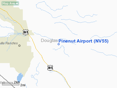
| From nearest city: | 5 nautical miles SE of Gardnerville, NV |
| Location: | Douglas County, NV |
| Magnetic Variation: | 16E (1985) |
Owner & Manager
| Ownership: | Privately owned |
| Owner: | Don Bartholomew |
| Address: | 885 Taildragger Rd
Gardnerville, NV 89410 |
| Phone number: | 775-782-2992 |
| Manager: | Don Bartholomew |
| Address: | 885 Taildragger Rd
Gardnerville, NV 89410 |
| Phone number: | 775-782-2992 |
Airport Operations and Facilities
| Airport Use: | Private |
| Wind indicator: | Yes |
| Segmented Circle: | No |
| Control Tower: | No |
| Sectional chart: | San Francisco |
| Region: | AWP - Western-Pacific |
| Boundary ARTCC: | ZOA - Oakland |
| Tie-in FSS: | RNO - Reno |
| FSS on Airport: | No |
| FSS Toll Free: | 1-800-WX-BRIEF |
Runway Information
Runway 16/34
| Dimension: | 2000 x 45 ft / 609.6 x 13.7 m |
| Surface: | DIRT, |
| |
Runway 16 |
Runway 34 |
| Traffic Pattern: | Left | Left |
| Obstruction: | 18 ft pline, 660.0 ft from runway | |
|
Radio Navigation Aids
| ID |
Type |
Name |
Ch |
Freq |
Var |
Dist |
| SWR | VOR/DME | Squaw Valley | 079X | 113.20 | 16E | 33.5 nm |
| FMG | VORTAC | Mustang | 126X | 117.90 | 16E | 38.0 nm |
| HZN | VORTAC | Hazen | 088X | 114.10 | 17E | 48.0 nm |
Images and information placed above are from
http://www.airport-data.com/airport/NV55/
We thank them for the data!
| General Info
|
| Country |
United States
|
| State |
NEVADA
|
| FAA ID |
NV55
|
| Latitude |
38-56-14.672N
|
| Longitude |
119-37-14.614W
|
| Elevation |
5260 feet
|
| Near City |
GARDNERVILLE
|
We don't guarantee the information is fresh and accurate. The data may
be wrong or outdated.
For more up-to-date information please refer to other sources.
|
|


