 |
|
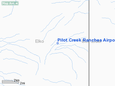
Pilot Creek Ranches Airport |
Location & QuickFacts
| FAA Information Effective: | 2008-09-25 |
| Airport Identifier: | NV67 |
| Airport Status: | Operational |
| Longitude/Latitude: | 114-06-49.0480W/41-06-56.7300N
-114.113624/41.115758 (Estimated) |
| Elevation: | 4980 ft / 1517.90 m (Estimated) |
| Land: | 0 acres |
| From nearest city: | 10 nautical miles SE of Montello, NV |
| Location: | Elko County, NV |
| Magnetic Variation: | 15E (1980) |
Owner & Manager
| Ownership: | Privately owned |
| Owner: | Pilot Creek Ranches, Inc. |
| Address: | Po Box 5
Montello, NV 89830 |
| Manager: | Joseph R. Payne, Pres. |
| Address: | Po Box 5
Montello, NV 89830 |
Airport Operations and Facilities
| Airport Use: | Private |
| Wind indicator: | Yes |
| Segmented Circle: | No |
| Control Tower: | No |
| Sectional chart: | Salt Lake City |
| Region: | AWP - Western-Pacific |
| Boundary ARTCC: | ZLC - Salt Lake City |
| Tie-in FSS: | RNO - Reno |
| FSS Toll Free: | 1-800-WX-BRIEF |
Runway Information
Runway 07/25
| Dimension: | 2000 x 25 ft / 609.6 x 7.6 m |
| Surface: | DIRT, |
| |
Runway 07 |
Runway 25 |
| Traffic Pattern: | Left | Right |
| Obstruction: | 30 ft pline, 3600.0 ft from runway | |
|
Radio Navigation Aids
| ID |
Type |
Name |
Ch |
Freq |
Var |
Dist |
| LWL | VOR | Wells | | 114.20 | 17E | 39.2 nm |
| LCU | VORTAC | Lucin | 083X | 113.60 | 17E | 19.3 nm |
| BVL | VORTAC | Bonneville | 070X | 112.30 | 17E | 28.5 nm |
Remarks
- RWY SFC ROUGH; NO SNOW REMOVAL.
- VFR, PRIVATE USE ONLY; LTR OF AGREEMENT WITH USAF FOR ROUTES WITHIN R-6504C.
Images and information placed above are from
http://www.airport-data.com/airport/NV67/
We thank them for the data!
| General Info
|
| Country |
United States
|
| State |
NEVADA
|
| FAA ID |
NV67
|
| Latitude |
41-06-56.730N
|
| Longitude |
114-06-49.048W
|
| Elevation |
4980 feet
|
| Near City |
MONTELLO
|
We don't guarantee the information is fresh and accurate. The data may
be wrong or outdated.
For more up-to-date information please refer to other sources.
|
|


