 |
|
Parker Carson Stolport Airport |
| Parker Carson STOLport |
| IATA: none – ICAO: none – FAA LID: 2Q5 |
| Summary |
| Airport type |
Public |
| Owner |
James Parker |
| Serves |
Carson City, Nevada |
| Elevation AMSL |
4,939 ft / 1,505 m |
| Coordinates |
39°12′06″N 119°41′00″W / 39.20167°N 119.6833333°W / 39.20167; -119.6833333 |
| Runways |
| Direction |
Length |
Surface |
| ft |
m |
| 6/24 |
1,700 |
518 |
Gravel |
| Statistics (2000) |
| Aircraft operations |
1,500 |
| Source: Federal Aviation Administration |
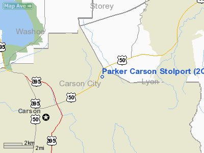
Parker Carson STOLport (FAA LID: 2Q5) is a privately-owned, public-use airport located five miles (8 km) east of the central business district of Carson City, Nevada, United States. It has a short runway designed for use by STOL (short take-off and landing) aircraft.
Facilities and aircraft
Parker Carson STOLport covers an area of 14 acres (6 ha) at an altitude of 4,939 feet (1,505 m) above mean sea level. It has one runway designated 6/24 with a 1,700 x 40 ft (518 x 12 m) gravel surface. For the 12-month period ending June 12, 2000, the airport had 1,500 general aviation aircraft operations, an average of 125 per month.
The above content comes from Wikipedia and is published under free licenses – click here to read more.
Location & QuickFacts
| FAA Information Effective: | 2008-09-25 |
| Airport Identifier: | 2Q5 |
| Airport Status: | Operational |
| Longitude/Latitude: | 119-41-00.4000W/39-12-05.7000N
-119.683444/39.201583 (Estimated) |
| Elevation: | 4939 ft / 1505.41 m (Surveyed) |
| Land: | 14 acres |
| From nearest city: | 5 nautical miles E of Carson City, NV |
| Location: | Carson City County, NV |
| Magnetic Variation: | 16E (1995) |
Owner & Manager
| Ownership: | Privately owned |
| Owner: | James Parker |
| Address: | Box 22030
Carson City, NV 89721 |
| Phone number: | 775-882-1532 |
| Manager: | James Parker |
| Address: | Box 22030
Carson City, NV 89721 |
| Phone number: | 775-882-2133 |
Airport Operations and Facilities
| Airport Use: | Open to public |
| Wind indicator: | Yes |
| Segmented Circle: | Yes |
| Control Tower: | No |
| Sectional chart: | San Francisco |
| Region: | AWP - Western-Pacific |
| Boundary ARTCC: | ZOA - Oakland |
| Tie-in FSS: | RNO - Reno |
| FSS on Airport: | No |
| FSS Toll Free: | 1-800-WX-BRIEF |
| NOTAMs Facility: | RNO (NOTAM-d service avaliable) |
Airport Communications
Airport Services
Runway Information
Runway 06/24
| Dimension: | 1700 x 40 ft / 518.2 x 12.2 m |
| Surface: | GRAVEL, Good Condition
+2 FT SAGE BRUSH ON RY EDGES FULL LENGTH. |
| |
Runway 06 |
Runway 24 |
| Longitude: | 119-41-09.7408W | 119-40-50.9780W |
| Latitude: | 39-12-01.5361N | 39-12-09.8525N |
| Elevation: | 4939.00 ft | 4937.00 ft |
| Alignment: | 60 | 127 |
| Traffic Pattern: | Left | Left |
| Obstruction: | 12 ft road, 100.0 ft from runway, 8:1 slope to clear | 400 ft hills, 2500.0 ft from runway, 6:1 slope to clear |
|
Radio Navigation Aids
| ID |
Type |
Name |
Ch |
Freq |
Var |
Dist |
| NFL | TACAN | Fallon | 082X | | 16E | 47.3 nm |
| SWR | VOR/DME | Squaw Valley | 079X | 113.20 | 16E | 27.3 nm |
| FMG | VORTAC | Mustang | 126X | 117.90 | 16E | 19.9 nm |
| HZN | VORTAC | Hazen | 088X | 114.10 | 17E | 37.1 nm |
Remarks
- POWER LINES NORTH; SOUTH & WEST OF ARPT.
- RY 24 GROUND RISES IMMEDIATELY UP TO 15%.
Images and information placed above are from
http://www.airport-data.com/airport/2Q5/
We thank them for the data!
| General Info
|
| Country |
United States
|
| State |
NEVADA
|
| FAA ID |
2Q5
|
| Latitude |
39-12-05.700N
|
| Longitude |
119-41-00.400W
|
| Elevation |
4939 feet
|
| Near City |
CARSON CITY
|
We don't guarantee the information is fresh and accurate. The data may
be wrong or outdated.
For more up-to-date information please refer to other sources.
|
|


