 |
|
| Owyhee Airport |
| IATA: none – ICAO: none – FAA LID: 10U |
| Summary |
| Airport type |
Public |
| Owner |
Shoshone-Paiute Tribes |
| Serves |
Owyhee, Nevada |
| Elevation AMSL |
5,374 ft / 1,638 m |
| Coordinates |
41°57′12″N 116°11′15″W / 41.95333°N 116.1875°W / 41.95333; -116.1875 |
| Runways |
| Direction |
Length |
Surface |
| ft |
m |
| 2/20 |
6,700 |
2,042 |
Asphalt/Gravel |
| Statistics (2009) |
| Aircraft operations |
50 |
| Source: Federal Aviation Administration |
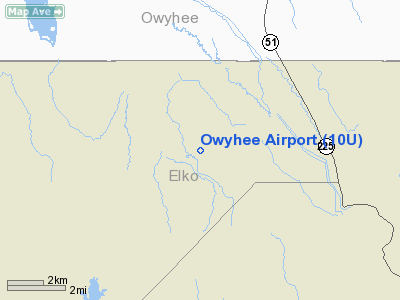
Owyhee Airport (FAA LID: 10U) is a public use airport located four nautical miles (7 km) west of the central business district of Owyhee, in Elko County, Nevada, United States. It is owned by the Shoshone-Paiute Tribes and is located within the Duck Valley Indian Reservation. History
The airport was built by the United States Army Air Force about 1942, and was known as Owyhee Flight Strip. It was an emergency landing airfield for military aircraft on training flights. It was closed after World War II, and was turned over for local government use by the War Assets Administration (WAA).
Facilities and aircraft
Owyhee Airport covers an area of 167 acres (68 ha) at an elevation of 5,374 feet (1,638 m) above mean sea level. It has one runway designated 2/20 with an asphalt and gravel surface measuring 6,700 by 60 feet (2,042 x 18 m). For the 12-month period ending June 30, 2009, the airport had 50 general aviation aircraft operations, an average of 4 per month.
The above content comes from Wikipedia and is published under free licenses – click here to read more.
Location & QuickFacts
| FAA Information Effective: | 2008-09-25 |
| Airport Identifier: | 10U |
| Airport Status: | Operational |
| Longitude/Latitude: | 116-11-15.3650W/41-57-11.6390N
-116.187601/41.953233 (Estimated) |
| Elevation: | 5374 ft / 1638.00 m (Surveyed) |
| Land: | 167 acres |
| From nearest city: | 4 nautical miles W of Owyhee, NV |
| Location: | Elko County, NV |
| Magnetic Variation: | 16E (1985) |
Owner & Manager
| Ownership: | Publicly owned |
| Owner: | Shoshone Paiute Tribes |
| Address: | Duck Valley Indian Res
Owyhee, NV 89832 |
| Phone number: | 775-757-3100 |
| Manager: | Herman Atkins |
| Address: | P.o. Box 219
Owyhee, NV 89832 |
| Phone number: | 775-757-3100 |
Airport Operations and Facilities
| Airport Use: | Open to public |
| Wind indicator: | Yes |
| Segmented Circle: | No |
| Control Tower: | No |
| Landing fee charge: | No |
| Sectional chart: | Salt Lake City |
| Region: | AWP - Western-Pacific |
| Boundary ARTCC: | ZLC - Salt Lake City |
| Tie-in FSS: | RNO - Reno |
| FSS on Airport: | No |
| FSS Toll Free: | 1-800-WX-BRIEF |
| NOTAMs Facility: | RNO (NOTAM-d service avaliable) |
| Federal Agreements: | N |
Airport Communications
Airport Services
| Airframe Repair: | NONE |
| Power Plant Repair: | NONE |
| Bottled Oxygen: | NONE |
| Bulk Oxygen: | NONE |
Runway Information
Runway 02/20
| Dimension: | 6700 x 60 ft / 2042.2 x 18.3 m |
| Surface: | ASPH-GRVL, Fair Condition |
| |
Runway 02 |
Runway 20 |
| Traffic Pattern: | Left | Left |
| Markings: | None, | None, |
|
Radio Navigation Aids
| ID |
Type |
Name |
Ch |
Freq |
Var |
Dist |
Remarks
- LIVESTOCK ON AND INVOF ARPT.
- RY 02/20 UNRESTRICTED MOTOR VEHICLE ACCESS ON RY.
- RY 02/20 SNOW & ICE ON RY DURG WINTER MONTHS.
- BE ALERT TO ACFT PARKED ON THLD OF RY 02/20.
- RY 02/20 WEEDS TO +5 FT BOTH SIDES OF RY.
- ESTABD PRIOR TO MAY 1959.
Images and information placed above are from
http://www.airport-data.com/airport/10U/
We thank them for the data!
| General Info
|
| Country |
United States
|
| State |
NEVADA
|
| FAA ID |
10U
|
| Latitude |
41-57-11.639N
|
| Longitude |
116-11-15.365W
|
| Elevation |
5374 feet
|
| Near City |
OWYHEE
|
We don't guarantee the information is fresh and accurate. The data may
be wrong or outdated.
For more up-to-date information please refer to other sources.
|
|


