 |
|
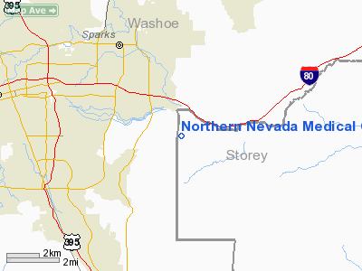
Northern Nevada Medical Center Heliport |
Location & QuickFacts
| FAA Information Effective: | 2008-09-25 |
| Airport Identifier: | NV69 |
| Airport Status: | Operational |
| Longitude/Latitude: | 119-41-33.6700W/39-30-19.6820N
-119.692686/39.505467 (Estimated) |
| Elevation: | 4460 ft / 1359.41 m (Estimated) |
| Land: | 0 acres |
| From nearest city: | 2 nautical miles W of Sparks, NV |
| Location: | Washoe County, NV |
| Magnetic Variation: | 16E (1980) |
Owner & Manager
| Ownership: | Privately owned |
| Owner: | Northern Nv Medical Center |
| Address: | 2375 East Prater Way
Sparks, NV 89434 |
| Phone number: | 775-331-4001 |
| Manager: | Mark Crawford |
| Address: | 2375 East Prater Way
Sparks, NV 89434 |
| Phone number: | 775-356-4001 |
Airport Operations and Facilities
| Airport Use: | Private
MEDICAL. |
| Segmented Circle: | No |
| Control Tower: | No |
| Sectional chart: | San Francisco |
| Region: | AWP - Western-Pacific |
| Boundary ARTCC: | ZOA - Oakland |
| Tie-in FSS: | RNO - Reno |
| FSS Toll Free: | 1-800-WX-BRIEF |
Runway Information
Helipad H1
| Dimension: | 40 x 40 ft / 12.2 x 12.2 m |
| Surface: | CONC, |
| |
Runway H1 |
Runway |
| Traffic Pattern: | Left | Left |
|
Radio Navigation Aids
| ID |
Type |
Name |
Ch |
Freq |
Var |
Dist |
| NFL | TACAN | Fallon | 082X | | 16E | 46.1 nm |
| SWR | VOR/DME | Squaw Valley | 079X | 113.20 | 16E | 33.2 nm |
| FMG | VORTAC | Mustang | 126X | 117.90 | 16E | 2.3 nm |
| HZN | VORTAC | Hazen | 088X | 114.10 | 17E | 32.2 nm |
Remarks
Images and information placed above are from
http://www.airport-data.com/airport/NV69/
We thank them for the data!
| General Info
|
| Country |
United States
|
| State |
NEVADA
|
| FAA ID |
NV69
|
| Latitude |
39-30-19.682N
|
| Longitude |
119-41-33.670W
|
| Elevation |
4460 feet
|
| Near City |
SPARKS
|
We don't guarantee the information is fresh and accurate. The data may
be wrong or outdated.
For more up-to-date information please refer to other sources.
|
|


