 |
|
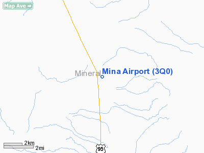
| Mina Airport |
| IATA: none – ICAO: none – FAA LID: 3Q0 |
| Summary |
| Airport type |
Public |
| Operator |
Bureau of Land Management |
| Location |
Mina, Nevada |
| Elevation AMSL |
4552 ft / 1387 m |
| Coordinates |
38°22′59″N 118°06′03″W / 38.38306°N 118.10083°W / 38.38306; -118.10083Coordinates: 38°22′59″N 118°06′03″W / 38.38306°N 118.10083°W / 38.38306; -118.10083 |
| Runways |
| Direction |
Length |
Surface |
| ft |
m |
| 13/31 |
4600 |
1402 |
Soil |
Mina Airport (FAA LID: 3Q0) is a public airport located southeast of Mina, in Mineral County, Nevada, USA.
Facilities
Mina Airport covers 29 acres (120,000 m) and has one runway:
- Runway 13/31: 4600 x 165 ft (1402 x 50 m), Surface: Dirt
The above content comes from Wikipedia and is published under free licenses – click here to read more.
Location & QuickFacts
| FAA Information Effective: | 2008-09-25 |
| Airport Identifier: | 3Q0 |
| Airport Status: | Operational |
| Longitude/Latitude: | 118-06-03.4250W/38-22-59.7300N
-118.100951/38.383258 (Estimated) |
| Elevation: | 4552 ft / 1387.45 m (Estimated) |
| Land: | 29 acres |
| From nearest city: | 0 nautical miles SE of Mina, NV |
| Location: | Mineral County, NV |
| Magnetic Variation: | 15E (1985) |
Owner & Manager
| Ownership: | Publicly owned |
| Owner: | U S Blm |
| Address: | P.o. Box 12000
Reno, NV 89520-0006 |
| Phone number: | 775-861-6400 |
| Manager: | Charles Frost |
| Address: | Box 407
Mina, NV 89422 |
| Phone number: | 775-573-2214 |
Airport Operations and Facilities
| Airport Use: | Open to public |
| Wind indicator: | Yes |
| Segmented Circle: | No |
| Control Tower: | No |
| Landing fee charge: | No |
| Sectional chart: | San Francisco |
| Region: | AWP - Western-Pacific |
| Boundary ARTCC: | ZOA - Oakland |
| Tie-in FSS: | RNO - Reno |
| FSS on Airport: | No |
| FSS Toll Free: | 1-800-WX-BRIEF |
| NOTAMs Facility: | RNO (NOTAM-d service avaliable) |
Airport Communications
Airport Services
| Airframe Repair: | NONE |
| Power Plant Repair: | NONE |
| Bottled Oxygen: | NONE |
| Bulk Oxygen: | NONE |
Runway Information
Runway 13/31
| Dimension: | 4600 x 165 ft / 1402.1 x 50.3 m |
| Surface: | DIRT, Good Condition |
| |
Runway 13 |
Runway 31 |
| Traffic Pattern: | Left | Left |
| Runway End Identifier: | No | No |
| Centerline Lights: | No | No |
| Touchdown Lights: | No | No |
|
Radio Navigation Aids
| ID |
Type |
Name |
Ch |
Freq |
Var |
Dist |
| MVA | VORTAC | Mina | 098X | 115.10 | 17E | 11.4 nm |
| OAL | VORTAC | Coaldale | 124X | 117.70 | 17E | 27.7 nm |
Remarks
- RY 13/31 HAS 2 FT BERMS ON BOTH SIDES FULL LENGTH OF RY.
- RY 13/31 HAS UNCONTROLLED VEHICLE ACCESS.
- ULTRALIGHTS ON & INVOF ARPT.
- REMOTE CONTROLLED AIRCRAFT INVOF ARPT.
- ESTABD PRIOR TO 5/15/59.
Images and information placed above are from
http://www.airport-data.com/airport/3Q0/
We thank them for the data!
| General Info
|
| Country |
United States
|
| State |
NEVADA
|
| FAA ID |
3Q0
|
| Latitude |
38-22-59.730N
|
| Longitude |
118-06-03.425W
|
| Elevation |
4552 feet
|
| Near City |
MINA
|
We don't guarantee the information is fresh and accurate. The data may
be wrong or outdated.
For more up-to-date information please refer to other sources.
|
|


