 |
|
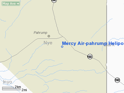
Mercy Air-pahrump Heliport |
Location & QuickFacts
| FAA Information Effective: | 2008-09-25 |
| Airport Identifier: | 2NV8 |
| Airport Status: | Operational |
| Longitude/Latitude: | 115-59-09.0000W/36-11-31.0000N
-115.985833/36.191944 (Estimated) |
| Elevation: | 2650 ft / 807.72 m (Estimated) |
| Land: | 0 acres |
| From nearest city: | 2 nautical miles SW of Pahrump, NV |
| Location: | Nye County, NV |
| Magnetic Variation: | () |
Owner & Manager
| Ownership: | Privately owned |
| Owner: | County Of Nye-city Clerk |
| Address: | 1520 East Basin Ave Suite 108
Pahrump, NV 89048 |
| Manager: | Mercy Air |
| Address: | 13000 South Las Vegas Blvd
Las Vegas, NV 89124 |
| Phone number: | 702-492-3489 |
Airport Operations and Facilities
| Airport Use: | Private |
| Wind indicator: | Yes |
| Control Tower: | No |
| Lighting Schedule: | DUSK-DAWN |
| Sectional chart: | Las Vegas |
| Region: | AWP - Western-Pacific |
| Boundary ARTCC: | ZLA - Los Angeles |
| Tie-in FSS: | RNO - Reno |
| FSS Toll Free: | 1-800-WX-BRIEF |
Runway Information
Helipad H1
| Dimension: | 46 x 46 ft / 14.0 x 14.0 m |
| Surface: | CONC, |
| |
Runway H1 |
Runway |
| Traffic Pattern: | Left | Left |
|
Radio Navigation Aids
| ID |
Type |
Name |
Ch |
Freq |
Var |
Dist |
| MCY | NDB | Mercury | | 326.00 | 16E | 26.3 nm |
| INS | TACAN | Indian Springs | 067X | | 15E | 28.1 nm |
| LSV | TACAN | Nellis | 012X | | 15E | 46.7 nm |
| LAS | VORTAC | Las Vegas | 116X | 116.90 | 15E | 40.7 nm |
| VGT | VOT | North Las Vegas | | 108.20 | | 38.0 nm |
Remarks
- SEE AIRSPACE CASE 2003-AWP-520-NRA.
Images and information placed above are from
http://www.airport-data.com/airport/2NV8/
We thank them for the data!
|
|


