|
|
| McCarran International Airport |
 |
 |
| IATA: LAS – ICAO: KLAS – FAA LID: LAS
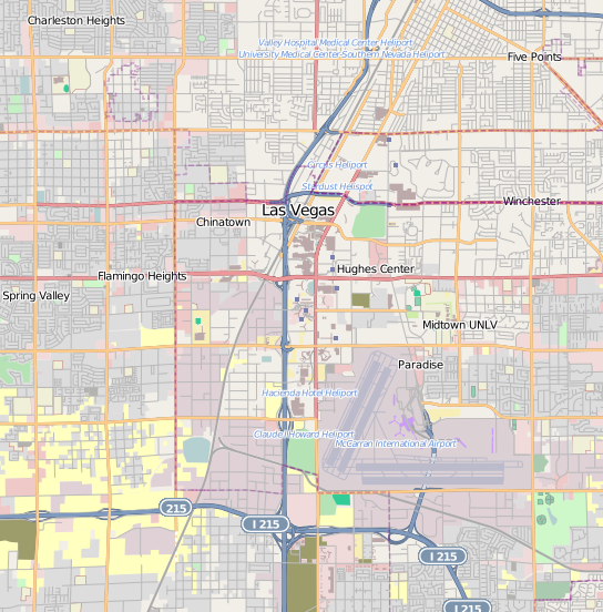
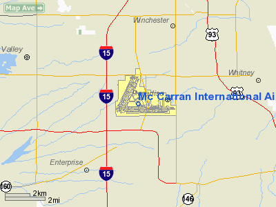
Location of the McCarran International Airport
|
| Summary |
| Airport type |
Public |
| Owner |
Clark County |
| Serves |
Las Vegas |
| Location |
Paradise, Nevada |
| Elevation AMSL |
2,181 ft / 665 m |
| Coordinates |
36°04′48″N 115°09′08″W / 36.08°N 115.15222°W / 36.08; -115.15222 |
| Website |
www.McCarran.com |
| Runways |
| Direction |
Length |
Surface |
| ft |
m |
| 1L/19R |
8,985 |
2,739 |
Concrete |
| 1R/19L |
9,775 |
2,979 |
Concrete |
| 7L/25R |
14,510 |
4,423 |
Asphalt |
| 7R/25L |
10,526 |
3,208 |
Concrete |
| Statistics (2008) |
| Aircraft operations |
578,949 |
| Passengers |
44,074,707 |
| Based aircraft |
129 |
| Sources: ACI and FAA |
McCarran International Airport (IATA: LAS, ICAO: KLAS, FAA LID: LAS) is the principal commercial airport serving Las Vegas and Clark County, Nevada, United States. The airport is located five miles (8 km) south of the central business district of Las Vegas, in the unincorporated area of Paradise in Clark County. It covers an area of 2,800 acres (1,100 ha) and has four runways. McCarran is owned by Clark County and operated by the Clark County Department of Aviation (DOA). It serves as a focus city for Allegiant Air and Southwest Airlines ; McCarran is also the largest operation base for both Allegiant and Southwest. It is named after the former Nevada Senator Pat McCarran.
In 2008, McCarran ranked 15th in the world for passenger traffic, with 44,074,707 passengers passing through the terminal. The airport ranked 6th in the world for aircraft movements with 578,949 takeoffs and landings. McCarran and the DOA are completely self-sufficient enterprises, requiring no money from the County's general fund.
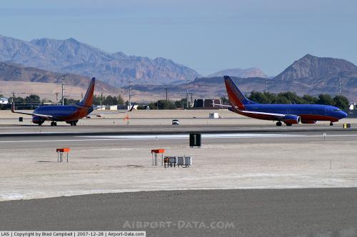
As of November 2009, Southwest Airlines operated more flights out of McCarran than at any other airport. Southwest also carries the most passengers in and out of McCarran. Southwest currently operates out of 21 gates, primarily in Concourse C. Since 2008, Canadian airline WestJet has become the largest international carrier at McCarran.
The top five largest scheduled airlines at McCarran in number of passengers carried in the first 11 months of 2009 are Southwest Airlines (38.3%), US Airways/US Airways Express (11.8%), United Airlines/United Express (6.9%), Delta Air Lines/Delta Connection (5.6%), and American Airlines (5.5%).
McCarran Airport has more than 1,234 slot machines throughout the airport terminals. The slots are owned and operated by Michael Gaughan Airport Slots. Reno/Tahoe International Airport also has 251 gambling machines both airside and landside.
Maximum capacity for the airport is estimated at 53 million passengers and 625,000 aircraft movements. As McCarran is predicted to reach this capacity around 2017, Ivanpah Airport is planned as a relief airport. History
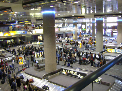 | |
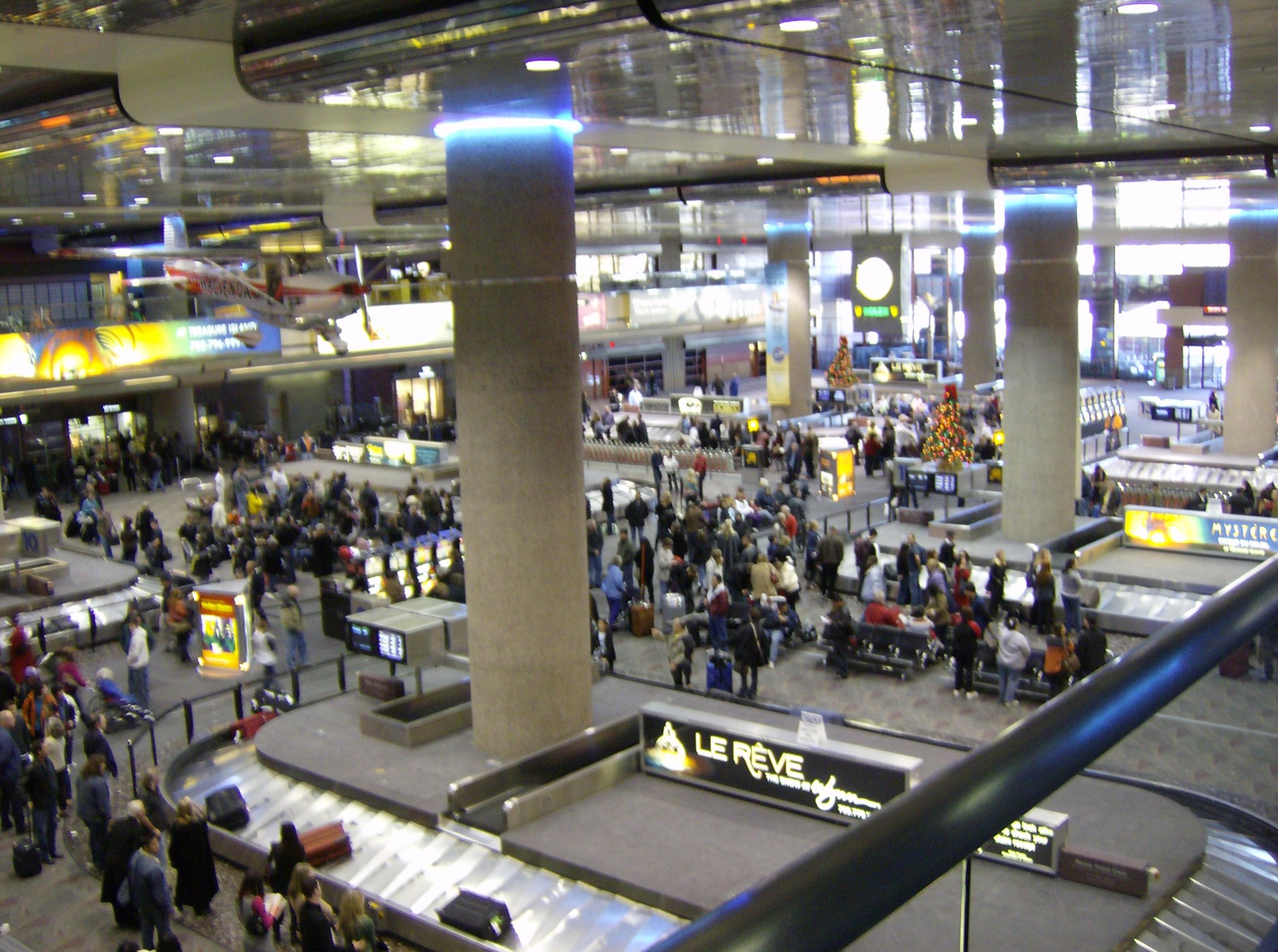
McCarran passengers wait for baggage, with aviation historical artifacts hanging above. |
American aviator George Crockett, a descendant of frontiersman Davy Crockett, established Alamo Airport in 1942 on the site currently occupied by McCarran International. In 1948, Clark County purchased the airfield from Crockett to establish the Clark County Public Airport, and all commercial operations moved to the site of this airport. On December 20, 1948 the airport was renamed McCarran Field for U.S. Senator Pat McCarran, a longtime Nevada politician who authored the Civil Aeronautics Act and played a major role in developing aviation nationwide.
By this time, the airport was serving 1.5 million passengers a year, the location for the present terminals was moved from Las Vegas Boulevard South to Paradise Road, opening in March 1963. The terminal, designed by Welton Becket and Associates and John Replogle, was inspired by the TWA terminal at JFK. It ultimately became the basis for the United Airlines terminal at O'Hare International Airport seven years later.
In 1978, Senator Howard Cannon pushed the Airline Deregulation Act through Congress. Airlines no longer had to get the federal government's permission to fly to a city, but instead dealt directly with airports to establish additional routes. Just after deregulation, the number of airlines serving McCarran doubled from seven to 14.
An expansion plan called McCarran 2000 was adopted in 1978 and funded by a $300 million bond issue in 1982. The three-phase plan included a new central terminal; a nine-level parking facility; runway additions and expansions; additional gates; upgraded passenger assistance facilities; and a new tunnel and revamped roadways into the airport. The first phase of McCarran 2000 opened in 1985 and was completed by 1987.
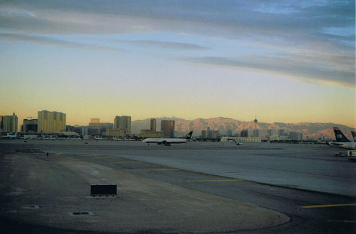 | |
McCarran International Airport's main taxiway. |
Between 1986 and 1997, Terminal 2 was built where two separate terminals had been in the 1970s and 1980s; one for American Airlines and the other for Pacific Southwest Airlines.
In the 1990s all gates and check in counters were upgraded to use a common set of computer hardware. CUTE, Common Use Terminal Equipment. This eliminates the need for each airline to have their own equipment and allows the airport to reassign gates and counters without having to address individual airlines' computer systems. While portions of Los Angeles International Airport and San Francisco International Airport deployed CUTE prior to McCarran, as of 2008 it remains the only major airport in the USA that is 100 percent common use. (White Plains, N.Y., is also a 100 percent common use airport, though it has only eight gates.) McCarran's CUTE system also supports several airlines' use of the Cockpit Access Security System, or CASS. In Europe, and to some extent the Asia-Pacific rim, CUTE has been widely prevalent for much longer.
In 1998, the D Gates SE and SW wings opened adding 28 gates. The D Gates project is a modification to the original McCarran 2000 plan.
On October 16, 2003, the airport installed SpeedCheck kiosks which allow customers to obtain a boarding pass without having to go to a specific airline kiosk or counter. McCarran was the first airport in the US to provide this service and the first in the world to provide the service to all airlines from a single kiosk. At the same time, 6 kiosks were activated at the Las Vegas Convention Center allowing convention attendees to get boarding passes on their way to the airport. This system was enhanced to add printing of baggage tags in 2005.
 | |
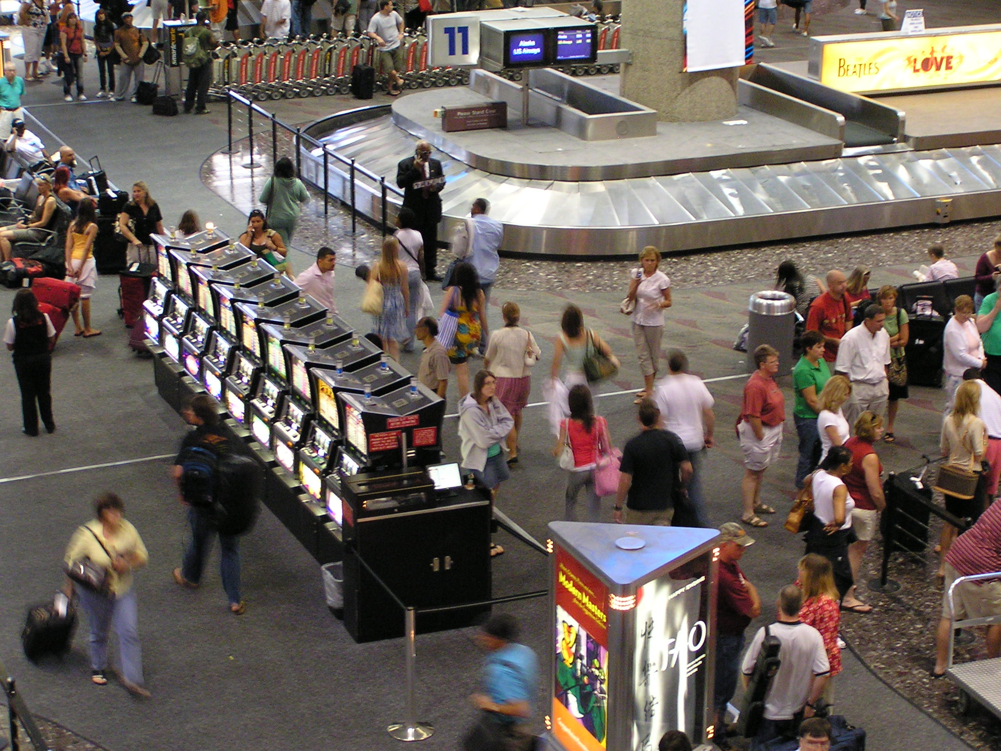
Slot machines at the baggage claim |
In 2003 the airport announced it was implementing a baggage-tracking system that will use Radio-frequency identification (RFID) bag tags from Matrics Inc. to improve air safety. The decision to implement the tracking system makes McCarran one of the first airports to use the RFID technology airportwide.
On January 4, 2005, the airport started offering wireless internet service at no charge. The signal is available in the boarding areas and most other public areas. The airport was the first to provide this as a free service for the entire facility. At the time, this was the largest (2 million square feet (180,000 m²)) free wireless Internet installation in the world.
In 2005, the D Gates NE wing opened adding 10 gates.
On April 4, 2007, the Consolidated Rent-a-Car facility opened, located 3 miles (5 km) from the terminals (see Transportation section). The distance from the airport (including a segment of US Interstate 215) requires the facility be permanently linked via bus to the airport.
In 2008, the D Gates NW wing opened with additional 9 gates.
Due to Continental Airlines moving into the Star Alliance, along with cost-cutting moves at US Airways because of the 2008 night-flight hub closure, the US Airways Club was closed on September 13, 2009. All passengers flying on US Airways or United Airlines can access the Presidents Club in Concourse D starting on October 25. Delta Airlines' Crown Room lounge had previously closed in 2001.
The US Airways night-flight hub operation, established in 1986 by predecessor America West Airlines, made the carrier McCarran's second busiest airline. Due to the 2008 energy crisis the night hub was closed in September 2008. US Airways closed its crew base on January 31, 2010.
Terminals, airlines and destinations
 | |
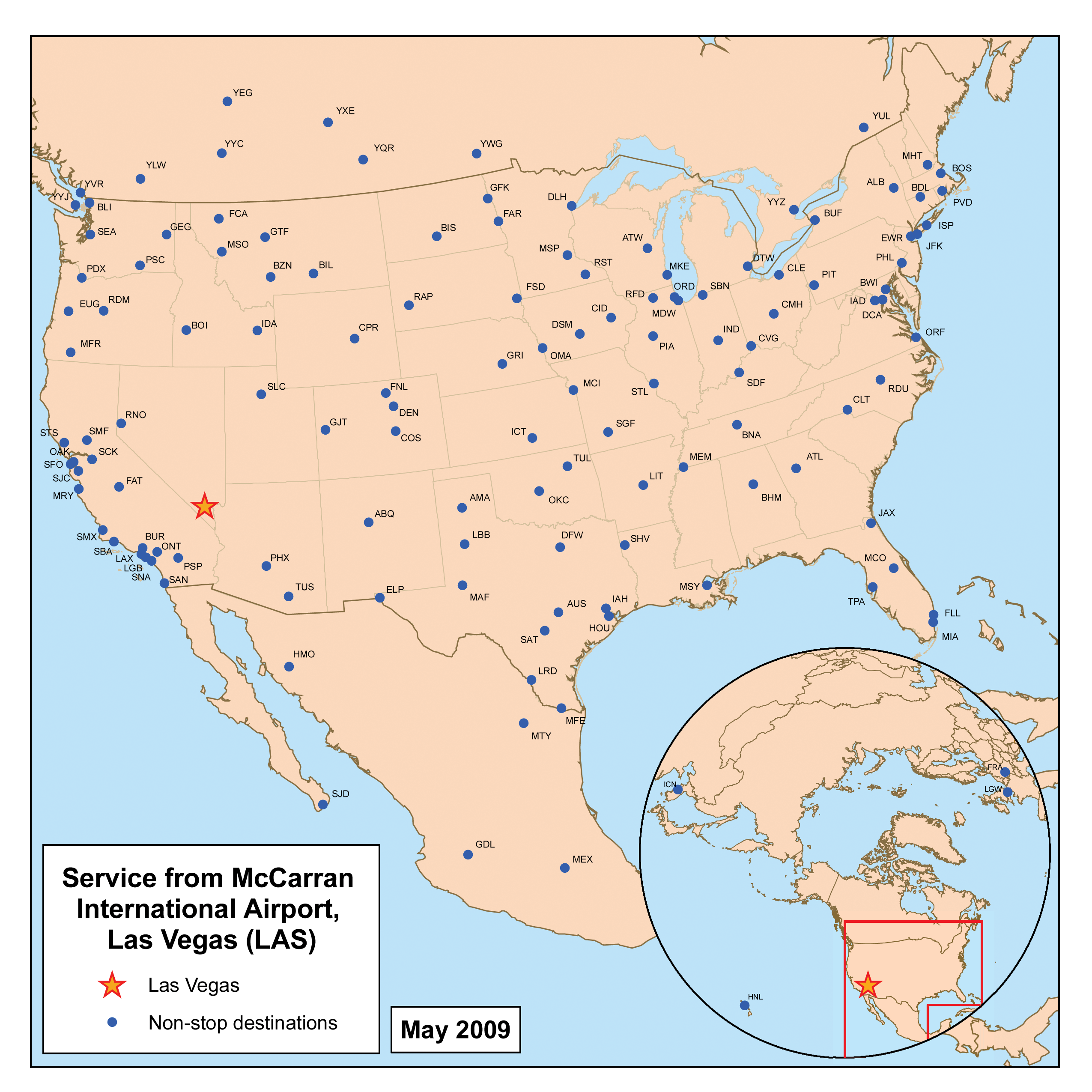
Destinations with direct service from Las Vegas
|
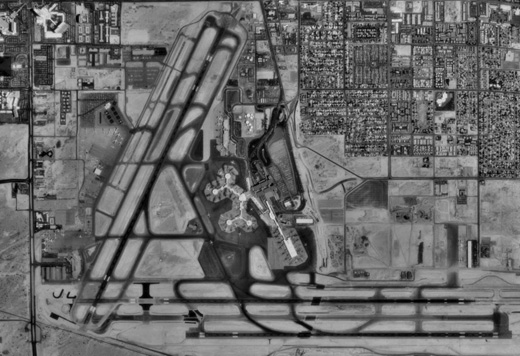 | |
USGS-image of the airport (circa 1994)
|
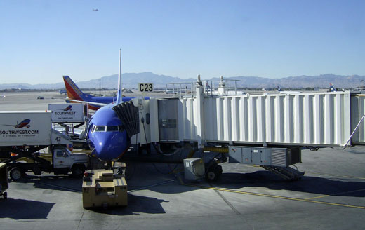 | |
Southwest Airlines passenger gates |
 | |
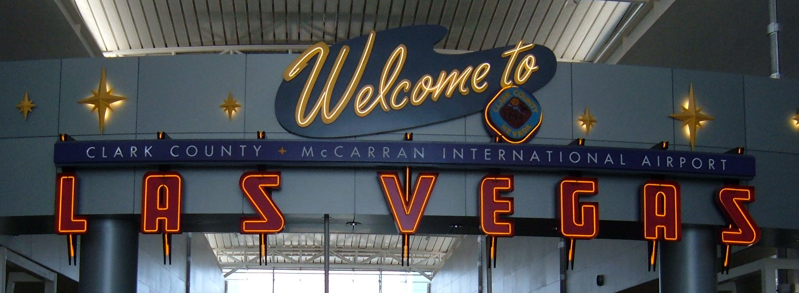
Welcome to McCarran airport sign at Concourse D
|
McCarran International Airport has two public passenger terminals. Other terminals service private aircraft, US government contractors, sightseeing flights and cargo.
- Terminal 1 handles most flights and contains an overall 96 gates in four concourses: Concourse A (A1, A3-A5, A7, A8, A10-A12, A14, A15, A17-A24), Concourse B (gates B1-B4, B6, B8-B12, B14, B15, B17, B19-B25), Concourse C (gates C1-C4, C5, C7-C9, C11, C12, C14, C16, C18, C19, C21-C25), and Concourse D (gates D1-D12, D14, D16-D26, D31-D43, D50-D58). The McCarran International Airport People Movers connect the satellite concourses C and D with the centralized check-in and baggage claim areas.
- Terminal 2 is used for all international as well as most charter flights into Las Vegas. It contains eight gates (T2-1 through T2-8), four of which are equipped with facilities for international flights.
| Airlines |
Destinations |
Terminal-Concourse |
| Aeroméxico |
Mexico City, Monterrey |
2 |
| Air Canada |
Calgary, Montréal-Trudeau, Toronto-Pearson, Vancouver |
2 |
| AirTran Airways |
Atlanta, Indianapolis [begins March 10], Milwaukee |
1-D |
| Alaska Airlines |
Bellingham, Portland (OR), Seattle/Tacoma |
1-D |
| Allegiant Air |
Appleton, Bakersfield [begins November 17], Bellingham, Billings, Bismarck, Bozeman, Casper, Cedar Rapids/Iowa City, Colorado Springs, Des Moines, Duluth, Eugene, Fargo, Fort Collins/Loveland, Fresno, Grand Forks, Grand Island, Grand Junction, Grand Rapids, Great Falls, Idaho Falls, Kalispell, Laredo, McAllen (TX), Medford, Minot [begins October 22], Missoula, Monterey, Moline/Quad Cities [begins October 14], Pasco, Peoria, Pueblo [begins October 7], Rapid City, Redmond/Bend, Rockford (IL), Santa Maria (CA), Shreveport, Sioux Falls, South Bend, Springfield (MO), Stockton, Twin Falls, Wichita |
1-D |
| American Airlines |
Chicago-O'Hare, Dallas/Fort Worth, Los Angeles, Miami, New York-JFK |
1-D |
| British Airways |
London-Heathrow |
2 |
| Condor |
Frankfurt |
2 |
| Continental Airlines |
Cleveland, Houston-Intercontinental, Newark |
1-D |
| Delta Air Lines |
Atlanta, Boston, Cincinnati/Northern Kentucky, Detroit, Fort Lauderdale, Hartford [ends October 29], Los Angeles [begins January 28], Memphis, Minneapolis/St. Paul, New York-JFK, Orlando, Salt Lake City |
1-D |
| Delta Connection operated by SkyWest Airlines |
Los Angeles, Salt Lake City |
1-D |
| Frontier Airlines |
Denver, Milwaukee |
1-D |
| Great Lakes Airlines |
Farmington (NM), Kingman (AZ), Merced |
1-B |
| Hawaiian Airlines |
Honolulu, Kahului [begins October 3] |
2 |
| Horizon Air |
Portland (OR), Santa Rosa |
1-D |
| JetBlue Airways |
Boston, Burbank, Long Beach, New York-JFK |
1-D |
| Korean Air |
Seoul-Incheon |
2 |
| Omni Air International |
Honolulu
Seasonal: Anchorage |
2 |
| Philippine Airlines |
Manila, Vancouver |
2 |
| Southwest Airlines |
Albany, Albuquerque, Amarillo, Austin, Baltimore, Birmingham (AL), Boise, Buffalo, Burbank, Chicago-Midway, Cleveland, Columbus (OH), Denver, El Paso, Fort Lauderdale, Hartford, Houston-Hobby, Indianapolis, Jacksonville (FL), Kansas City, Little Rock, Long Island/Islip [ends November 7], Los Angeles, Louisville, Lubbock, Manchester (NH), Midland/Odessa, Milwaukee, Nashville, New Orleans, Norfolk/Virginia Beach [seasonal, ends November 7], Oakland, Oklahoma City, Omaha, Ontario, Orange County, Orlando, Philadelphia, Phoenix, Pittsburgh, Portland (OR), Providence, Raleigh/Durham, Reno/Tahoe, Sacramento, St. Louis, Salt Lake City, San Antonio, San Diego, San Francisco, San Jose (CA), Seattle/Tacoma, Spokane, Tampa, Tucson, Tulsa |
1-B, 1-C |
| Spirit Airlines |
Chicago-O'Hare [begins November 11], Detroit, Fort Lauderdale |
1-B |
| Sun Country Airlines |
Minneapolis/St. Paul
Seasonal: Lansing [begins December 23] |
1-D |
| Sunwing Airlines |
Toronto-Pearson, Vancouver |
2 |
| Thomas Cook Airlines |
Glasgow-International, Manchester (UK) |
2 |
| United Airlines |
Chicago-O'Hare, Denver, Los Angeles, San Francisco, Washington-Dulles |
1-D |
| United Express operated by SkyWest Airlines |
Fresno, Los Angeles, Palm Springs |
1-D |
| US Airways |
Boston, Charlotte, Dallas/Fort Worth, Los Angeles, Philadelphia, Phoenix, Washington-Reagan |
1-A, 1-B |
| US Airways Express operated by Mesa Airlines |
Fresno, Los Angeles, Phoenix, San Francisco |
1-A |
| Virgin America |
New York-JFK, San Francisco |
1-B |
| Virgin Atlantic Airways |
London-Gatwick, Manchester (UK) [begins April 3] |
2 |
| VivaAerobus |
Hermosillo, Monterrey |
2 |
| WestJet |
Calgary, Edmonton, Montréal-Trudeau, Toronto-Pearson, Vancouver, Winnipeg
Seasonal: Kelowna, Ottawa [begins December 9], Regina, Saskatoon, Victoria |
1-B |
| XL Airways France |
Paris-Charles de Gaulle [seasonal] |
2 |
Cargo
At McCarran, there is a terminal devoted to cargo airline operations for:
| Airlines |
Destinations |
| FedEx Express |
Memphis |
| UPS Airlines |
Louisville, Ontario |
In 2004, McCarran handled 201,135,520 pounds of cargo.
Other terminal operations
- Fixed Base Operators
- Signature Flight Support, owned by BBA Aviation Services Group, provides services for private aircraft using McCarran. It also provides equipment and support to other airlines for aircraft types that do not normally fly into McCarran.
- The Las Vegas Executive Air Terminal, owned by Eagle Aviation Resources, is being purchased by Macquarie Infrastructure Company. It provides services for private aircraft using McCarran.
- Helicopter Companies:
- The EG&G Airlift Terminal, operated by defense contractor EG&G Technical Services. EG&G flies a variety of aircraft (including Boeing 737s) from McCarran to various military facilities in southern Nevada and eastern California. The civilian contractors who use this service (callsign JANET) work at the Tonopah Test Range, the Nevada Test Site, and reportedly at Area 51.
- Hughes Aviation
- Quail Aviation
- Scenic Aviation Sightseeing
TransportationGround transportation to McCarran Airport is from Tropicana Avenue (State Route 593) to the north or the Las Vegas Beltway (Interstate 215) to the south. Vehicles enter the airport via the McCarran Airport Connector, which includes Paradise Road/Swenson Street and the airport tunnel.
The airport is served by the ubiquitous taxicabs of Las Vegas operated by various firms. The airport is further served by RTC Transit, the public bus service of the Las Vegas valley. RTC Buses stop at Terminal 1 outside the Zero Level.
- Route #108 provides service to Downtown Las Vegas
- Route #109 services the South Strip Transfer Terminal, the consolidated rental car facility and Maryland Parkway.
- "ACE Gold Line" bus service along the Las Vegas Strip connects with Route 109 (south) at the South Strip Transfer Terminal; there is no direct bus service from the airport to The Strip. Both Route #109 and "ACE Gold Line" operates 24 hours a day.
The Consolidated Rental Car Facility, located 3 miles (4.8 km) from the airport at 7135 Gilespie Street, provides 5,000 parking spaces on 68 acres (280,000 m) of land. A fleet of 40 buses provides free transportation from the terminals to the facility, which upon opening housed 11 car rental companies. The Facility is not accessible by foot from the Strip. It is accessed by customers primarily via US Interstate 215, or by bus. Rental firms strongly advise customers to allow additional time to account for locating and driving to the facility, and the bus ride back to the airport. Advantage, Savmore, Payless, and Enterprise use an access control system based on single-use bar codes. Participating agencies issue a slip similar to a slot-machine voucher which activates vehicle anti-theft devices in the rental lot, permitting the single vehicle to exit the lot.
Future
As the airport continues through the process of upgrading and expanding there is a list of projects due to be completed before 2011:
Terminal 3
The new $1.6 billion Terminal 3 will be built in one phase. Its planned opening in early 2012 will provide 14 additional gates, including six designated for international travelers. Once the terminal opens, McCarran will have 117 gates. Like Terminal 2, it will be all inclusive providing bag claim, ticketing and parking facilities.
Las Vegas Monorail Connection
A plan to extend the Las Vegas Monorail to McCarran is under consideration. This proposed extension will add underground stations at Terminal 1 and at Terminal 3. The part of the extension north of the airport will be elevated.
Other projects
- Aircraft apron reconstruction and Terminal 1 rehabilitation (ongoing)
- A USO lounge for American servicemembers is scheduled to open by September 2010.
Howard W. Cannon Aviation Museum
The Howard W. Cannon Aviation Museum is located on the Esplanade, Level 2, above the baggage claim area. This small museum is open 24 hours a day, seven days a week, and concentrates on Las Vegas airline history. Items on display include a copy of the first emergency vehicle that was used on the airfield. Admittance is free. A small branch of the museum is located at the D gates, and some of the other concourses and check-in areas also have small displays. The current curator of the museum is Mark Hall-Patton, a 20th century historian and administrator of the Clark County Museum, who has frequently appeared as an appraisal expert on the reality television series, Pawn Stars.
Airport public art
Some of the public art displays in McCarran Airport includes:
- Murals in McCarran International Airport D Gates (artists include Tom Holder, Mary Warner, Robert Beckmann, Harold Bradford)
- Greg LeFevre's Flights Paths — in the D Gates rotunda's terrazzo floor
- Tony Milici's steel and glass sculpture at McCarran's D Gates
- McCarran's D Gates feature wall tiles of international skylines by sixteen Clark County fourth graders
- Wildlife sculptures of Clark County wildlife at the D Gates, by David L Phelps
Airline lounges
The airport operates a VIP room in Terminal 2 for full fare first class passengers.
On July 12, 2008, Continental Airlines added a Presidents Club in Terminal 1, Concourse D located between gates 33 and 35 on the 3rd floor. This club is open from 5:30 AM to 12:30 AM daily. All US Airways Club members can use the Presidents Club in Concourse D starting on October 25.
Media appearances
The mission "Secret Shuttle" supplied with Microsoft Flight Simulator X begins at McCarran International Airport. The airport is also due to feature as the headquarters of the New California Republic faction in the post-apocalyptic videogame Fallout: New Vegas. The airport was also featured during the cataclysmic destruction of Las Vegas in the disaster film 2012.
The above content comes from Wikipedia and is published under free licenses – click here to read more.
 |
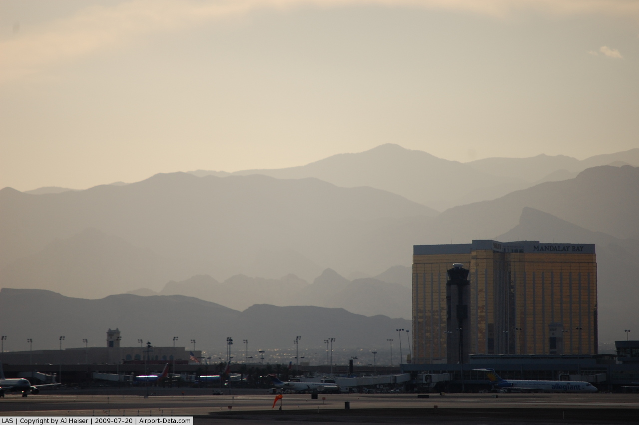
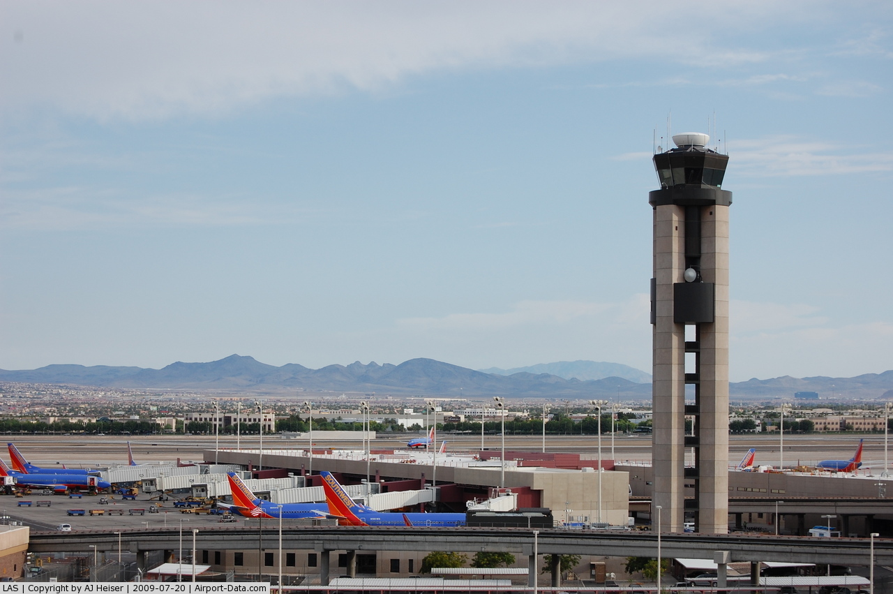
(Click on the photo to enlarge) |
 |
(Click on the photo to enlarge) |
 |
(Click on the photo to enlarge) |
 |
(Click on the photo to enlarge) |
 |
(Click on the photo to enlarge) |
 |
(Click on the photo to enlarge) |
Location & QuickFacts
| FAA Information Effective: | 2008-09-25 |
| Airport Identifier: | LAS |
| Airport Status: | Operational |
| Longitude/Latitude: | 115-09-08.1000W/36-04-48.2000N
-115.152250/36.080056 (Estimated) |
| Elevation: | 2181 ft / 664.77 m (Surveyed) |
| Land: | 2800 acres |
| From nearest city: | 5 nautical miles S of Las Vegas, NV |
| Location: | Clark County, NV |
| Magnetic Variation: | 15E (1980) |
Owner & Manager
| Ownership: | Publicly owned |
| Owner: | Clark County |
| Address: | P O Box 11005
Las Vegas, NV 89111 |
| Phone number: | 702-261-5211 |
| Manager: | Randall H. Walker
JEFF SULLIVAN (702) 261-5348. |
| Address: | 5757 Wayne Newton Blvd
Las Vegas, NV 89119 |
| Phone number: | 702-261-5211 |
Airport Operations and Facilities
| Airport Use: | Open to public |
| Wind indicator: | Yes |
| Segmented Circle: | No |
| Control Tower: | Yes |
| Lighting Schedule: | DUSK-DAWN |
| Beacon Color: | Clear-Green (lighted land airport)
ROTG BCN NOT VISIBLE 115 TO 240 DEGS SE TO SW FROM ATCT. |
| Landing fee charge: | No |
| Sectional chart: | Las Vegas |
| Region: | AWP - Western-Pacific |
| Boundary ARTCC: | ZLA - Los Angeles |
| Tie-in FSS: | RNO - Reno |
| FSS on Airport: | No |
| FSS Toll Free: | 1-800-WX-BRIEF |
| NOTAMs Facility: | LAS (NOTAM-d service avaliable) |
| Certification type/date: | I E S 05/1973 |
| Federal Agreements: | NGPSY |
Airport Communications
Airport Services
| Fuel available: | 100 100LLA1+ |
| Airframe Repair: | MAJOR |
| Power Plant Repair: | MAJOR |
| Bottled Oxygen: | HIGH |
| Bulk Oxygen: | HIGH/LOW |
Runway Information
Runway 01L/19R
| Dimension: | 8985 x 150 ft / 2738.6 x 45.7 m |
| Surface: | CONC, Good Condition |
| Surface Treatment: | Saw-cut or plastic Grooved |
| Weight Limit: | Single wheel: 30000 lbs.
Dual wheel: 145000 lbs.
Dual tandem wheel: 460000 lbs.
Dual dual tandem wheel: 833000 lbs. |
| Edge Lights: | High |
| |
Runway 01L |
Runway 19R |
| Longitude: | 115-10-13.2937W | 115-09-27.1852W |
| Latitude: | 36-04-31.1987N | 36-05-51.7640N |
| Elevation: | 2181.00 ft | 2089.00 ft |
| Alignment: | 25 | 127 |
| ILS Type: | ILS/DME
| |
| Traffic Pattern: | Left | Right |
| Markings: | Non-precision instrument, Good Condition | Non-precision instrument, Good Condition |
| Crossing Height: | 57.00 ft | 75.00 ft |
| Displaced threshold: | 584.00 ft | 0.00 ft |
| VASI: | 4-light PAPI on left side | 4-light PAPI on left side |
| Visual Glide Angle: | 3.40° | 3.00° |
| Approach lights: | MALSF | |
| Runway End Identifier: | Yes | Yes |
| Centerline Lights: | No | No |
| Touchdown Lights: | No | No |
| Obstruction: | 48 ft rr, 1225.0 ft from runway, 500 ft left of centerline, 21:1 slope to clear
APCH RATIO 34:1 TO DSPLCD THLD. | 25 ft fence, 190.0 ft from runway, 150 ft right of centerline
APCH RATIO 20:1 TO DSPLCD THLD. |
| Decleard distances: | Take off run available 8985.00 ft
Take off distance available 8985.00 ft
Actual stop distance available 8985.00 ft
Landing distance available 8401.00 ft
| Take off run available 8985.00 ft
Take off distance available 9397.00 ft
Actual stop distance available 8397.00 ft
Landing distance available 8397.00 ft
|
|
Runway 01R/19L
| Dimension: | 9775 x 150 ft / 2979.4 x 45.7 m |
| Surface: | CONC, Good Condition |
| Surface Treatment: | Saw-cut or plastic Grooved |
| Weight Limit: | Single wheel: 23000 lbs.
Dual wheel: 220000 lbs.
Dual tandem wheel: 633000 lbs.
Dual dual tandem wheel: 877000 lbs. |
| Edge Lights: | Medium |
| |
Runway 01R |
Runway 19L |
| Longitude: | 115-10-02.9467W | 115-09-12.7751W |
| Latitude: | 36-04-27.2774N | 36-05-54.9282N |
| Elevation: | 2176.00 ft | 2078.00 ft |
| Alignment: | 25 | 127 |
| Traffic Pattern: | Right | Left |
| Markings: | Non-precision instrument, Good Condition | Non-precision instrument, Good Condition |
| Crossing Height: | 75.00 ft | 75.00 ft |
| Displaced threshold: | 491.00 ft | 878.00 ft |
| VASI: | 4-light PAPI on left side | 4-light PAPI on left side |
| Visual Glide Angle: | 3.00° | 3.00° |
| Runway End Identifier: | Yes | Yes |
| Centerline Lights: | No | No |
| Touchdown Lights: | No | No |
| Obstruction: | 41 ft rr, 825.0 ft from runway, 600 ft right of centerline, 15:1 slope to clear
APCH RATIO 23:1 TO DSPLCD THLD. | 17 ft pole, 929.0 ft from runway, 17 ft right of centerline, 42:1 slope to clear
APCH RATIO 50:1 TO DSPLCD THR. |
| Decleard distances: | Take off run available 9775.00 ft
Take off distance available 10172.00 ft
Actual stop distance available 9441.00 ft
Landing distance available 8681.00 ft
| Take off run available 9775.00 ft
Take off distance available 10175.00 ft
Actual stop distance available 9685.00 ft
Landing distance available 8745.00 ft
|
|
Runway 07L/25R
| Dimension: | 14510 x 150 ft / 4422.6 x 45.7 m |
| Surface: | ASPH, Good Condition |
| Surface Treatment: | Porous Friction Course |
| Weight Limit: | Single wheel: 23000 lbs.
Dual wheel: 220000 lbs.
Dual tandem wheel: 633000 lbs.
Dual dual tandem wheel: 877000 lbs. |
| Edge Lights: | High |
| |
Runway 07L |
Runway 25R |
| Longitude: | 115-10-12.6844W | 115-07-15.9582W |
| Latitude: | 36-04-34.9196N | 36-04-35.0642N |
| Elevation: | 2179.00 ft | 2033.00 ft |
| Alignment: | 90 | 127 |
| ILS Type: | | ILS/DME
|
| Traffic Pattern: | Left | Left |
| Markings: | Precision instrument, Good Condition | Precision instrument, Good Condition |
| Crossing Height: | 75.00 ft | 84.00 ft |
| Displaced threshold: | 2139.00 ft | 1397.00 ft |
| VASI: | 4-light PAPI on left side | 4-light PAPI on left side |
| Visual Glide Angle: | 3.00° | 3.00° |
| Approach lights: | | MALSR |
| Runway End Identifier: | No | No |
| Centerline Lights: | No | No |
| Touchdown Lights: | No | No |
| Obstruction: | 25 ft hgr, 200.0 ft from runway, 500 ft left of centerline, 50:1 slope to clear
APCH RATIO 50:1 TO DSPLCD THR. | , 50:1 slope to clear |
| Decleard distances: | Take off run available 14510.00 ft
Take off distance available 15099.00 ft
Actual stop distance available 14099.00 ft
Landing distance available 11966.00 ft
| Take off run available 14510.00 ft
Take off distance available 15155.00 ft
Actual stop distance available 14155.00 ft
Landing distance available 12755.00 ft
|
|
Runway 07R/25L
| Dimension: | 10526 x 150 ft / 3208.3 x 45.7 m |
| Surface: | ASPH, Good Condition |
| Surface Treatment: | Porous Friction Course |
| Weight Limit: | Single wheel: 23000 lbs.
Dual wheel: 220000 lbs.
Dual tandem wheel: 633000 lbs.
Dual dual tandem wheel: 914000 lbs. |
| Edge Lights: | High |
| |
Runway 07R |
Runway 25L |
| Longitude: | 115-09-41.1596W | 115-07-32.9632W |
| Latitude: | 36-04-25.0574N | 36-04-25.1642N |
| Elevation: | 2157.00 ft | 2048.00 ft |
| Alignment: | 90 | 127 |
| ILS Type: | | LOC/GS
|
| Traffic Pattern: | Left | Left |
| Markings: | Non-precision instrument, Good Condition | Precision instrument, Good Condition |
| Crossing Height: | 64.00 ft | 84.00 ft |
| VASI: | 4-light PAPI on left side | 4-light PAPI on left side |
| Visual Glide Angle: | 3.00° | 3.00° |
| Approach lights: | | MALSF |
| Runway End Identifier: | Yes
REIL OTS INDEFLY. | |
| Obstruction: | 53 ft pole, 1257.0 ft from runway, 540 ft right of centerline, 19:1 slope to clear | , 50:1 slope to clear |
|
Radio Navigation Aids
| ID |
Type |
Name |
Ch |
Freq |
Var |
Dist |
| LSV | TACAN | Nellis | 012X | | 15E | 11.7 nm |
| INS | TACAN | Indian Springs | 067X | | 15E | 39.4 nm |
| LAS | VORTAC | Las Vegas | 116X | 116.90 | 15E | 0.4 nm |
| BLD | VORTAC | Boulder City | 114X | 116.70 | 15E | 14.9 nm |
| VGT | VOT | North Las Vegas | | 108.20 | | 8.3 nm |
Remarks
- EXTSV GLIDER/SOARING OPNS WKENDS & HOLS; SR-SS; LAS R187/020; ALTS UP TO BUT NOT INCLUDING FL180. GLIDERS REMAIN CLEAR OF THE TCA BUT OTHERWISE OPERATE WITHIN THE ENTIRE SW QUAD OF THE TCA VEIL.
- LIGHTED GOLF RANGE 1400 FT SOUTH OF RYS 01L/19R AND O1R/19L.
- TIEDOWN FEE.
- ALL NON-STD RY OPNS PPR FM DEPT OF AVIATION.
- ACFT USING FULL LENGTH DEP ON RY 07L USE MINIMAL POWER UNTIL PASSING THE POWER-UP POINT ON RY. POWER-UP POINT IS 348 FT EAST OF BALST PAD AND MARKED WITH SIGN AND STD MARKINGS FOR BEGINNING OF RY.
- TWY C NO CNTRLN LGTS WEST OF TWY B4, HAS EDGE LGTS ON SOUTH SIDE OF TWY IN THIS AREA.
- LARGE NUMBERS OF BIRDS AND BATS INVOF OF ARPT BTWN SUNSET AND SUNRISE.
- GEN AVIATION ACFT REQUIRING IMMIGRATION/CUSTOMS SVCS MUST CTC DEPT AVIATION FOR PARKING ARRANGEMENTS MIN 2 HRS PRIOR TO ARR (702) 261-3500 0700-1600, ALL OTHER TIMES (702) 261-4411.
- ACFT DEPARTING RY 19R USE MINIMAL POWER UNTIL PASSING THE RY THLD. RY 19R THLD HAS STANDARD RY MARKINGS AND IS 780 FT SOUTH OF THE BLAST PAD.
- OPNS ALL TERMINAL GATES CONTROLLED BY DEPT. OF AVIATION 0600-0200 LCL TIME. ALL ACFT CTC RAMP CONTROL ON FREQ 129.175 FOR OPNS AT A, B, AND C GATES AND CHARTER INTL'L GATES CTC RAMP CONTROL ON FREQ 127.9 FOR OPNS AT D GATES.
- TBJT DEPS NOT PMTD ON RY 01R/19L OR RY 01L/19R 2000-0800. EXCEPTIONS FOR WX OR OPNL NECESSITY.
- AIRCRAFT OPER NEAR THE INTERSECTION OF TWYS S, D, G AND THE NORTH END OF TWY Z SHOULD BE ALERT AS THERE ARE CLOSELY ALIGNED TWY CENTERLINES AND RADIUS TURNS.
- ACFT THAT DEPART FULL LENGTH OF RYS 01L AND 07L MUST HOLD AT THE SAME HOLD LINE AS THERE IS NO ROOM TO HOLD BETWEEN THE RUNWAY ENDS AND SUCH AIRCRAFT SHOULD VERIFY THAT THEY ARE ON THE CORRECT RUNWAY.
- GENERAL AVIATION CUSTOMS AND IMIGRATION LCTD WEST SIDE OF AIRFIELD BTWN FBO'S.
- ACFT LARGER THAN B757 PPR FM DEPT OF AVIATION TO USE TWY H.
- NUMEROUS HELICOPTER OPERATIONS ON WEST SIDE OF AIRPORT.
- ACFT MAY EXPERIENCE REFLECTION OF SUN FM GLASS HOTELS LCTD NW OF ARPT. REFLECTION MAY OCCUR AT VARIOUS ALTS HEADINGS & DSTCS FM ARPT.
- DIRECTIONAL TWY SIGNS WILL BE INCOMPLETE DUE TO CONST.
- GENERAL AVIATION PARKING VERY LTD. FOR PARKING AVAILABILITY CTC EITHER FBO (702) 736-1830 OR (702) 739-1100.
- RY 01L/19R 496000 LBS GWT FOR L-1011; 555000 LBS GWT FOR DC-10; 602500 LBS GWT FOR MD-11.
- RY 07L 589 FT CLEARWAY; RY 25R 645 FT CLEARWAY.
Images and information placed above are from
http://www.airport-data.com/airport/LAS/
We thank them for the data!
| General Info
|
| Country |
United States
|
| State |
NEVADA
|
| FAA ID |
LAS
|
| Latitude |
36-04-49.300N
|
| Longitude |
115-09-08.400W
|
| Elevation |
2181 feet
|
| Near City |
LAS VEGAS
|
We don't guarantee the information is fresh and accurate. The data may
be wrong or outdated.
For more up-to-date information please refer to other sources.
|
|