 |
|
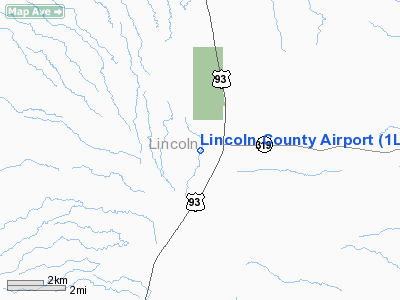
| Lincoln County Airport |
| IATA: none – ICAO: none – FAA LID: 1L1 |
| Summary |
| Airport type |
Public |
| Owner |
Lincoln County |
| Serves |
Panaca, Nevada |
| Elevation AMSL |
4,828 ft / 1,472 m |
| Coordinates |
37°47′15″N 114°25′18″W / 37.7875°N 114.42167°W / 37.7875; -114.42167 |
| Runways |
| Direction |
Length |
Surface |
| ft |
m |
| 17/35 |
4,620 |
1,408 |
Asphalt |
| Statistics (2007) |
| Aircraft operations |
1,000 |
| Based aircraft |
2 |
| Source: Federal Aviation Administration |
Lincoln County Airport (FAA LID: 1L1) is a county-owned public-use airport located two miles (3 km) west of the central business district of Panaca, a town in Lincoln County, Nevada, United States.
Facilities and aircraft
Lincoln County Airport covers an area of 190 acres (77 ha) which contains one asphalt paved runway (17/35) measuring 4,620 x 60 ft (1,408 x 18 m). For the 12-month period ending January 31, 2007, the airport had 1,000 aircraft operations, 100% of which were general aviation.
The above content comes from Wikipedia and is published under free licenses – click here to read more.
Location & QuickFacts
| FAA Information Effective: | 2008-09-25 |
| Airport Identifier: | 1L1 |
| Airport Status: | Operational |
| Longitude/Latitude: | 114-25-17.9640W/37-47-14.8720N
-114.421657/37.787464 (Estimated) |
| Elevation: | 4828 ft / 1471.57 m (Estimated) |
| Land: | 190 acres |
| From nearest city: | 2 nautical miles W of Panaca, NV |
| Location: | Lincoln County, NV |
| Magnetic Variation: | 14E (1985) |
Owner & Manager
| Ownership: | Publicly owned |
| Owner: | Lincoln County |
| Address: | P.o. Box 90
Pioche, NV 89043 |
| Phone number: | 702-334-8969 |
| Manager: | Wendy Rudder |
| Address: | P.o. Box 509
Alamo, NV 89001 |
| Phone number: | 702-334-8969
ALTERNATE CTC: ON-SITE MGR FRANCES MILLER 775-728-4409 |
Airport Operations and Facilities
| Airport Use: | Open to public |
| Wind indicator: | Yes |
| Segmented Circle: | Yes |
| Control Tower: | No |
| Lighting Schedule: | DUSK-DAWN
ACTVT MIRL RY 17/35 FREQ 122.8. |
| Beacon Color: | Clear-Green (lighted land airport) |
| Landing fee charge: | No |
| Sectional chart: | Las Vegas |
| Region: | AWP - Western-Pacific |
| Traffic Pattern Alt: | 800 ft |
| Boundary ARTCC: | ZLA - Los Angeles |
| Tie-in FSS: | RNO - Reno |
| FSS on Airport: | No |
| FSS Toll Free: | 1-800-WX-BRIEF |
| NOTAMs Facility: | RNO (NOTAM-d service avaliable) |
| Federal Agreements: | NGSY |
Airport Communications
| CTAF: | 122.800 |
| Unicom: | 122.800 |
Airport Services
| Airframe Repair: | NONE |
| Power Plant Repair: | NONE |
| Bottled Oxygen: | NONE |
| Bulk Oxygen: | NONE |
Runway Information
Runway 17/35
| Dimension: | 4620 x 60 ft / 1408.2 x 18.3 m |
| Surface: | ASPH, Fair Condition |
| Weight Limit: | Single wheel: 12500 lbs. |
| Edge Lights: | Medium |
| |
Runway 17 |
Runway 35 |
| Elevation: | 4828.00 ft | 0.00 ft |
| Traffic Pattern: | Left | Left |
| Markings: | Basic, Fair Condition
RY 17 MARKINGS FADED. | Basic, Fair Condition
RY 35 MARKINGS FADED. |
| Runway End Identifier: | No | No |
| Centerline Lights: | No | No |
| Touchdown Lights: | No | No |
| Obstruction: | 80 ft hill, 1600.0 ft from runway, 17:1 slope to clear | , 50:1 slope to clear |
|
Radio Navigation Aids
| ID |
Type |
Name |
Ch |
Freq |
Var |
Dist |
| ILC | VORTAC | Wilson Creek | 110X | 116.30 | 16E | 27.8 nm |
Images and information placed above are from
http://www.airport-data.com/airport/1L1/
We thank them for the data!
| General Info
|
| Country |
United States
|
| State |
NEVADA
|
| FAA ID |
1L1
|
| Latitude |
37-47-14.872N
|
| Longitude |
114-25-17.964W
|
| Elevation |
4828 feet
|
| Near City |
PANACA
|
We don't guarantee the information is fresh and accurate. The data may
be wrong or outdated.
For more up-to-date information please refer to other sources.
|
|


