 |
|
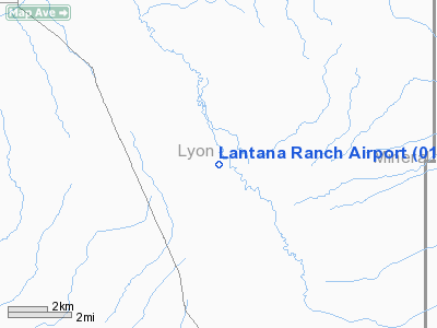
Location & QuickFacts
| FAA Information Effective: | 2008-09-25 |
| Airport Identifier: | 01NV |
| Airport Status: | Operational |
| Longitude/Latitude: | 119-01-38.0000W/38-45-50.0000N
-119.027222/38.763889 (Estimated) |
| Elevation: | 4600 ft / 1402.08 m (Estimated) |
| Land: | 0 acres |
| From nearest city: | 14 nautical miles SE of Yerington, NV |
| Location: | Lyon County, NV |
| Magnetic Variation: | 15E (2000) |
Owner & Manager
| Ownership: | Privately owned |
| Owner: | Lantana Ranch Flp |
| Address: | 531 Hugo Street
San Francisco, CA 94122 |
| Phone number: | 415-228-3387 |
| Manager: | Mike Powell |
| Address: | 150 E. Walker Road
Yerington, NV 89447 |
| Phone number: | NONE |
Airport Operations and Facilities
| Airport Use: | Private |
| Wind indicator: | Yes |
| Segmented Circle: | No |
| Control Tower: | No |
| Sectional chart: | San Francisco |
| Region: | AWP - Western-Pacific |
| Boundary ARTCC: | ZOA - Oakland |
| Tie-in FSS: | RNO - Reno |
| FSS Toll Free: | 1-800-WX-BRIEF |
Runway Information
Runway 18/36
| Dimension: | 2000 x 60 ft / 609.6 x 18.3 m |
| Surface: | GRVL, |
| |
Runway 18 |
Runway 36 |
| Traffic Pattern: | Left | Right |
|
Radio Navigation Aids
| ID |
Type |
Name |
Ch |
Freq |
Var |
Dist |
| NFL | TACAN | Fallon | 082X | | 16E | 42.0 nm |
| HZN | VORTAC | Hazen | 088X | 114.10 | 17E | 45.3 nm |
| MVA | VORTAC | Mina | 098X | 115.10 | 17E | 48.2 nm |
Remarks
- PROVIDED VFR OPERATIONS, PRIVATE USE AND SPONSOR ENSURES OBSTRUCTION FREE APPROACHES.
Images and information placed above are from
http://www.airport-data.com/airport/01NV/
We thank them for the data!
| General Info
|
| Country |
United States
|
| State |
NEVADA
|
| FAA ID |
01NV
|
| Latitude |
38-45-50.000N
|
| Longitude |
119-01-38.000W
|
| Elevation |
4600 feet
|
| Near City |
YERINGTON
|
We don't guarantee the information is fresh and accurate. The data may
be wrong or outdated.
For more up-to-date information please refer to other sources.
|
|


