|
|
 |
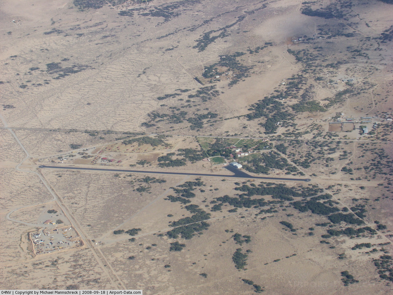
(Click on the photo to enlarge) |
 |
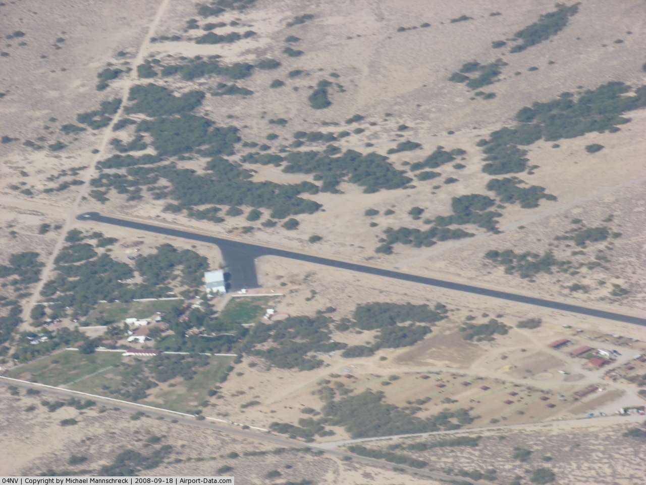
(Click on the photo to enlarge) |
Location & QuickFacts
| FAA Information Effective: | 2008-09-25 |
| Airport Identifier: | 04NV |
| Airport Status: | Operational |
| Longitude/Latitude: | 115-39-53.0210W/35-45-19.9130N
-115.664728/35.755531 (Estimated) |
| Elevation: | 2620 ft / 798.58 m (Estimated) |
| Land: | 160 acres |
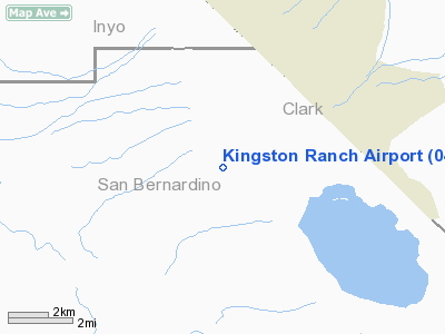
| From nearest city: | 5 nautical miles SW of Sandy Valley, NV |
| Location: | San Bernardino County, CA |
| Magnetic Variation: | 14E (1985) |
Owner & Manager
| Ownership: | Privately owned |
| Owner: | Kingston Ranch Llc |
| Address: | 10001 Park Run Dr.
Las Vegas, NV 89145 |
| Phone number: | 702-942-2127 |
| Manager: | Albert G. Marquis |
| Address: | 10001 Park Run Dr.
Las Vegas, NV 89145 |
| Phone number: | 702-942-2127 |
Airport Operations and Facilities
| Airport Use: | Private |
| Wind indicator: | Yes |
| Segmented Circle: | No |
| Control Tower: | No |
| Lighting Schedule: | RDO-CTL
ACTVT LIRL RY 02/20 FREQ 123.0. |
| Sectional chart: | Las Vegas |
| Region: | AWP - Western-Pacific |
| Boundary ARTCC: | ZLA - Los Angeles |
| Tie-in FSS: | RAL - Riverside |
| FSS on Airport: | No |
| FSS Toll Free: | 1-800-WX-BRIEF |
Runway Information
Runway 02/20
| Dimension: | 3240 x 45 ft / 987.6 x 13.7 m |
| Surface: | ASPH, |
| Edge Lights: | Low |
| |
Runway 02 |
Runway 20 |
| Traffic Pattern: | Left | Left |
|
Radio Navigation Aids
| ID |
Type |
Name |
Ch |
Freq |
Var |
Dist |
| LSV | TACAN | Nellis | 012X | | 15E | 42.8 nm |
| INS | TACAN | Indian Springs | 067X | | 15E | 49.9 nm |
| LAS | VORTAC | Las Vegas | 116X | 116.90 | 15E | 31.4 nm |
| BLD | VORTAC | Boulder City | 114X | 116.70 | 15E | 41.6 nm |
| GFS | VORTAC | Goffs | 091X | 114.40 | 15E | 44.5 nm |
| VGT | VOT | North Las Vegas | | 108.20 | | 35.4 nm |
Remarks
- DUE TO PROXIMITY TO SKY RANCH AIRPORT, PILOTS ARE ADVISED TO MONITOR FREQ 123.0.
- PROVIDED PVT USE VFR ONLY.
Images and information placed above are from
http://www.airport-data.com/airport/04NV/
We thank them for the data!
| General Info
|
| Country |
United States
|
| State |
NEVADA
|
| FAA ID |
04NV
|
| Latitude |
35-45-19.913N
|
| Longitude |
115-39-53.021W
|
| Elevation |
2620 feet
|
| Near City |
SANDY VALLEY
|
We don't guarantee the information is fresh and accurate. The data may
be wrong or outdated.
For more up-to-date information please refer to other sources.
|
|