 |
|
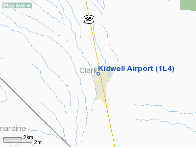
| Kidwell Airport |
| IATA: none – ICAO: none – FAA LID: 1L4 |
| Summary |
| Airport type |
Public |
| Owner |
Nancy Kidwell |
| Location |
Cal-Nev-Ari, Nevada |
| Elevation AMSL |
2,605 ft / 794 m |
| Coordinates |
35°18′20″N 114°52′58″W / 35.30556°N 114.88278°W / 35.30556; -114.88278 |
| Runways |
| Direction |
Length |
Surface |
| ft |
m |
| 15/33 |
4,140 |
1,262 |
Dirt |
| Statistics (2007) |
| Aircraft operations |
3,500 |
| Based aircraft |
19 |
| Source: Federal Aviation Administration |
Kidwell Airport (FAA LID: 1L4) is a public-use airport and residential airpark located in Cal-Nev-Ari, Clark County, Nevada, United States. It is privately-owned by Nancy Kidwell.
Facilities and aircraft
Kidwell Airport covers an area of 103 acres (42 ha) which contains one dirt runway (15/33) measuring 4,140 x 65 ft (1,262 x 20 m). For the 12-month period ending January 31, 2007, the airport had 3,500 general aviation aircraft operations, an average of 9 per day. At that time there were 19 aircraft based at this airport: 84% single-engine and 16% ultralight.
The above content comes from Wikipedia and is published under free licenses – click here to read more.
Location & QuickFacts
| FAA Information Effective: | 2008-09-25 |
| Airport Identifier: | 1L4 |
| Airport Status: | Operational |
| Longitude/Latitude: | 114-52-57.9100W/35-18-19.9780N
-114.882753/35.305549 (Estimated) |
| Elevation: | 2605 ft / 794.00 m (Estimated) |
| Land: | 103 acres |
| From nearest city: | 0 nautical miles S of Cal Nev Ari, NV |
| Location: | Clark County, NV |
| Magnetic Variation: | 14E (1985) |
Owner & Manager
| Ownership: | Privately owned |
| Owner: | Nancy Kidwell |
| Address: | Po Box 430
Cal-nev-ari, NV 89039 |
| Phone number: | 702-297-1118 |
| Manager: | Nancy Kidwell
ALTERNATE CONTACT 702-297-1228. |
| Address: | Po Box 430
Cal-nev-ari, NV 89039 |
| Phone number: | 702-297-1118 |
Airport Operations and Facilities
| Airport Use: | Open to public |
| Wind indicator: | Yes |
| Segmented Circle: | No |
| Control Tower: | No |
| Lighting Schedule: | DUSK-DAWN |
| Landing fee charge: | No |
| Sectional chart: | Phoenix |
| Region: | AWP - Western-Pacific |
| Boundary ARTCC: | ZLA - Los Angeles |
| Tie-in FSS: | RNO - Reno |
| FSS on Airport: | No |
| FSS Toll Free: | 1-800-WX-BRIEF |
| NOTAMs Facility: | RNO (NOTAM-d service avaliable) |
Airport Communications
Airport Services
| Bottled Oxygen: | NONE |
| Bulk Oxygen: | NONE |
Runway Information
Runway 15/33
| Dimension: | 4140 x 65 ft / 1261.9 x 19.8 m |
| Surface: | DIRT, Fair Condition |
| Edge Lights: | Non-standard lighting system
NSTD LIRL; THLD LGTS 6 GREEN LGTS. |
| |
Runway 15 |
Runway 33 |
| Traffic Pattern: | Left | Left |
| Markings: | None, | None, |
| Centerline Lights: | No | No |
| Touchdown Lights: | No | No |
| Obstruction: | 5 ft fence, 10.0 ft from runway, 2:1 slope to clear | 15 ft road, 560.0 ft from runway, 37:1 slope to clear |
|
Radio Navigation Aids
| ID |
Type |
Name |
Ch |
Freq |
Var |
Dist |
| IGM | VOR/DME | Kingman | 025X | 108.80 | 15E | 46.6 nm |
| GFS | VORTAC | Goffs | 091X | 114.40 | 15E | 17.8 nm |
| EED | VORTAC | Needles | 099X | 115.20 | 15E | 38.2 nm |
| BLD | VORTAC | Boulder City | 114X | 116.70 | 15E | 41.5 nm |
| LAS | VORTAC | Las Vegas | 116X | 116.90 | 15E | 48.5 nm |
Remarks
- ARPT IS RESIDENTIAL AIRPARK.
- BE ALERT TO AUTOMOBILE TFC ON RY 15/33.
- +70 FT TOWER 350 FT LEFT OF CNTRLN RY 15 AND ADJACENT TO THE THLD.
- ULTRALIGHT ACTIVITY ON AND IN VICINITY OF AIRPORT.
Images and information placed above are from
http://www.airport-data.com/airport/1L4/
We thank them for the data!
| General Info
|
| Country |
United States
|
| State |
NEVADA
|
| FAA ID |
1L4
|
| Latitude |
35-18-19.978N
|
| Longitude |
114-52-57.910W
|
| Elevation |
2605 feet
|
| Near City |
CAL NEV ARI
|
We don't guarantee the information is fresh and accurate. The data may
be wrong or outdated.
For more up-to-date information please refer to other sources.
|
|


