 |
|
Location & QuickFacts
| FAA Information Effective: | 2008-09-25 |
| Airport Identifier: | NV14 |
| Airport Status: | Operational |
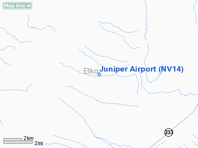
| Longitude/Latitude: | 114-13-48.0650W/41-21-19.7210N
-114.230018/41.355478 (Estimated) |
| Elevation: | 5400 ft / 1645.92 m (Estimated) |
| Land: | 160 acres |
| From nearest city: | 5 nautical miles NW of Montello, NV |
| Location: | Elko County, NV |
| Magnetic Variation: | 16E (1985) |
Owner & Manager
| Ownership: | Privately owned |
| Owner: | Tecoma Valley Land Co. Inc. |
| Address: | Po Box 09
Montello, NV 89830 |
| Phone number: | 801-392-8363 |
| Manager: | Donald Nack |
| Address: | Po Box 09
Montello, NV 89830 |
| Phone number: | 801-392-8363 |
Airport Operations and Facilities
| Airport Use: | Private |
| Segmented Circle: | No |
| Control Tower: | No |
| Sectional chart: | Salt Lake City |
| Region: | AWP - Western-Pacific |
| Boundary ARTCC: | ZLC - Salt Lake City |
| Tie-in FSS: | RNO - Reno |
| FSS Toll Free: | 1-800-WX-BRIEF |
Runway Information
Runway 07/25
| Dimension: | 2100 x 40 ft / 640.1 x 12.2 m |
| Surface: | GRVL-DIRT, |
| |
Runway 07 |
Runway 25 |
| Traffic Pattern: | Left | Left |
| Obstruction: | 26 ft bldg, 30.0 ft from runway | |
|
Radio Navigation Aids
| ID |
Type |
Name |
Ch |
Freq |
Var |
Dist |
| LWL | VOR | Wells | | 114.20 | 17E | 36.1 nm |
| LCU | VORTAC | Lucin | 083X | 113.60 | 17E | 17.6 nm |
| BVL | VORTAC | Bonneville | 070X | 112.30 | 17E | 43.5 nm |
Remarks
- LAND TO WEST, TAKE OFF TO EAST.
- 7500 FT MOUNTAINS TO WEST.
- 20 FT X 2000 FT GRAVEL OVERLAY ON CENTER OF RY.
- NSTD MARKING "X" PAINTED ON RY.
- VFR PVT USE ONLY; APPROACHES TO WEST; DEPARTURE TO THE EAST.
Images and information placed above are from
http://www.airport-data.com/airport/NV14/
We thank them for the data!
| General Info
|
| Country |
United States
|
| State |
NEVADA
|
| FAA ID |
NV14
|
| Latitude |
41-21-19.721N
|
| Longitude |
114-13-48.065W
|
| Elevation |
5400 feet
|
| Near City |
MONTELLO
|
We don't guarantee the information is fresh and accurate. The data may
be wrong or outdated.
For more up-to-date information please refer to other sources.
|
|


