|
|
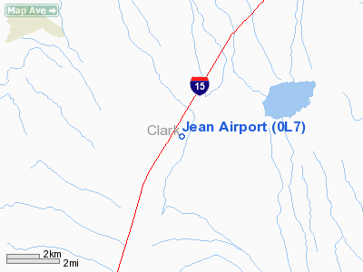
| Jean Airport |
| IATA: none – ICAO: none – FAA LID: 0L7 |
| Summary |
| Airport type |
Public |
| Operator |
Clark County |
| Location |
Jean, Nevada |
| Elevation AMSL |
2,832 ft / 863.2 m |
| Coordinates |
35°46′06″N 115°19′47″W / 35.76833°N 115.32972°W / 35.76833; -115.32972Coordinates: 35°46′06″N 115°19′47″W / 35.76833°N 115.32972°W / 35.76833; -115.32972 |
| Runways |
| Direction |
Length |
Surface |
| ft |
m |
| 2L/20R |
4,600 |
1,402 |
Asphalt |
| 2R/20L |
3,700 |
1,128 |
Asphalt |
Jean Airport (FAA LID: 0L7), also known as Jean Sport Aviation Center, is a small public airport located in Jean, in Clark County, Nevada, USA. The airport is mainly used for sports aviation like gliders and sky diving and is operated by the Clark County Department of Aviation.
Facilities
Jean Airport covers 232 acres (94 ha) and has two runways:
- Runway 2L/20R: 4,600 x 75 ft. (1,402 x 23 m), Surface: Asphalt
- Runway 2R/20L: 3,700 x 60 ft. (1,128 x 18 m), Surface: Asphalt
The above content comes from Wikipedia and is published under free licenses – click here to read more.
 |
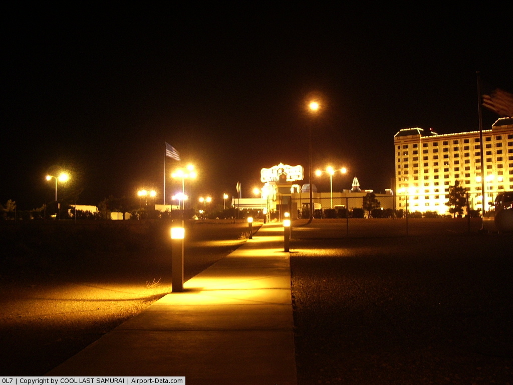
(Click on the photo to enlarge) |
 |
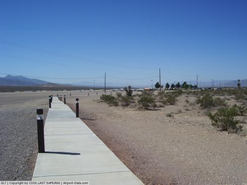
(Click on the photo to enlarge) |
Location & QuickFacts
| FAA Information Effective: | 2008-09-25 |
| Airport Identifier: | 0L7 |
| Airport Status: | Operational |
| Longitude/Latitude: | 115-19-46.6960W/35-46-05.7800N
-115.329638/35.768272 (Estimated) |
| Elevation: | 2832 ft / 863.19 m (Surveyed) |
| Land: | 232 acres |
| From nearest city: | 1 nautical miles S of Jean, NV |
| Location: | Clark County, NV |
| Magnetic Variation: | 14E (1985) |
Owner & Manager
| Ownership: | Publicly owned |
| Owner: | Clark County |
| Address: | Po Box 11005 Airport Station
Las Vegas, NV 89111 |
| Phone number: | 702-261-4800 |
| Manager: | Tom Donaldson |
| Address: | 3500 Executive Terminal Dr, Suite 100
Henderson, NV 89052 |
| Phone number: | 702-261-4802 |
Airport Operations and Facilities
| Airport Use: | Open to public |
| Wind indicator: | Yes |
| Segmented Circle: | Yes |
| Control Tower: | No |
| Lighting Schedule: | DUSK-DAWN
ACTVT MIRL RY 02L/20R - CTAF. |
| Beacon Color: | Clear-Green (lighted land airport) |
| Landing fee charge: | No |
| Sectional chart: | Las Vegas |
| Region: | AWP - Western-Pacific |
| Traffic Pattern Alt: | 800 ft |
| Boundary ARTCC: | ZLA - Los Angeles |
| Tie-in FSS: | RNO - Reno |
| FSS on Airport: | No |
| FSS Toll Free: | 1-800-WX-BRIEF |
| NOTAMs Facility: | RNO (NOTAM-d service avaliable) |
| Federal Agreements: | NGSY |
Airport Communications
Airport Services
| Fuel available: | 100LLA
SELF-SERVICE FUEL 24 HRS. |
| Airframe Repair: | NONE |
| Power Plant Repair: | NONE |
| Bottled Oxygen: | NONE |
| Bulk Oxygen: | NONE |
Runway Information
Runway 02L/20R
| Dimension: | 4600 x 75 ft / 1402.1 x 22.9 m |
| Surface: | ASPH, |
| Weight Limit: | Single wheel: 12500 lbs. |
| Edge Lights: | Medium |
| |
Runway 02L |
Runway 20R |
| Alignment: | 31 | 127 |
| Traffic Pattern: | Left | Right |
| Markings: | Basic, Good Condition | Basic, Good Condition |
| Obstruction: | 30 ft pole, 1230.0 ft from runway, 180 ft left of centerline, 34:1 slope to clear | 15 ft road, 830.0 ft from runway, 42:1 slope to clear |
|
Runway 02R/20L
| Dimension: | 3700 x 60 ft / 1127.8 x 18.3 m |
| Surface: | ASPH, |
| Weight Limit: | Single wheel: 12500 lbs. |
| |
Runway 02R |
Runway 20L |
| Alignment: | 31 | 127 |
| Traffic Pattern: | Right | Left |
| Markings: | Basic, Good Condition | Basic, Good Condition |
| Obstruction: | , 50:1 slope to clear | 85 ft pole, 1940.0 ft from runway, 510 ft left of centerline, 20:1 slope to clear |
|
Radio Navigation Aids
| ID |
Type |
Name |
Ch |
Freq |
Var |
Dist |
| LSV | TACAN | Nellis | 012X | | 15E | 32.2 nm |
| LAS | VORTAC | Las Vegas | 116X | 116.90 | 15E | 20.5 nm |
| BLD | VORTAC | Boulder City | 114X | 116.70 | 15E | 26.5 nm |
| GFS | VORTAC | Goffs | 091X | 114.40 | 15E | 39.0 nm |
| VGT | VOT | North Las Vegas | | 108.20 | | 27.3 nm |
Remarks
- GLIDER PARKING E SIDE OF FLD.
- POWER ACFT USE TFC PAT WEST OF RWY; MAKE ENTRY FROM WEST.
- AEROBATIC ACTIVITIES 2 MILES WEST.
- POWER ACFT PARKING W SIDE OF FLD.
- AVOID OVERFLIGHTS OF PRISON LOCATED 1 MILE NE.
- EXTENSIVE GLIDER ACTIVITY IN VICINITY UP TO 12,000 FT MSL.
- ULTRALIGHT ACTIVITY ON AIRPORT.
- SKYDIVING DROP ZONE 4 MILES SOUTH
- ESTABD PRIOR TO 15 MAY 1959.
Images and information placed above are from
http://www.airport-data.com/airport/0L7/
We thank them for the data!
| General Info
|
| Country |
United States
|
| State |
NEVADA
|
| FAA ID |
0L7
|
| Latitude |
35-46-05.780N
|
| Longitude |
115-19-46.696W
|
| Elevation |
2832 feet
|
| Near City |
JEAN
|
We don't guarantee the information is fresh and accurate. The data may
be wrong or outdated.
For more up-to-date information please refer to other sources.
|
|