 |
|
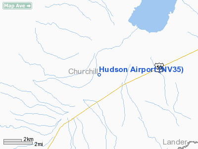
Location & QuickFacts
| FAA Information Effective: | 2008-09-25 |
| Airport Identifier: | NV35 |
| Airport Status: | Operational |
| Longitude/Latitude: | 117-45-02.4160W/39-32-39.7140N
-117.750671/39.544365 (Estimated) |
| Elevation: | 5180 ft / 1578.86 m (Estimated) |
| Land: | 480 acres |
| From nearest city: | 27 nautical miles W of Austin, NV |
| Location: | Churchill County, NV |
| Magnetic Variation: | 16E (1985) |
Owner & Manager
| Ownership: | Privately owned |
| Owner: | Hudson Oil Co, Inc |
| Address: |
Kansas City, KS 66103 |
| Phone number: | 913-362-4000 |
| Manager: | Robert Phillips |
| Address: |
|
Airport Operations and Facilities
| Airport Use: | Private |
| Wind indicator: | No |
| Segmented Circle: | No |
| Control Tower: | No |
| Landing fee charge: | No |
| Sectional chart: | Las Vegas |
| Region: | AWP - Western-Pacific |
| Boundary ARTCC: | ZOA - Oakland |
| Tie-in FSS: | RNO - Reno |
| FSS on Airport: | No |
| FSS Toll Free: | 1-800-WX-BRIEF |
Airport Services
| Airframe Repair: | NONE |
| Power Plant Repair: | NONE |
Runway Information
Runway 17/35
| Dimension: | 5050 x 100 ft / 1539.2 x 30.5 m |
| Surface: | DIRT, Poor Condition |
| |
Runway 17 |
Runway 35 |
| Traffic Pattern: | Left | Left |
| Obstruction: | , 50:1 slope to clear | 60 ft pline, 1200.0 ft from runway, 20:1 slope to clear |
|
Radio Navigation Aids
| ID |
Type |
Name |
Ch |
Freq |
Var |
Dist |
| NFL | TACAN | Fallon | 082X | | 16E | 44.9 nm |
Images and information placed above are from
http://www.airport-data.com/airport/NV35/
We thank them for the data!
| General Info
|
| Country |
United States
|
| State |
NEVADA
|
| FAA ID |
NV35
|
| Latitude |
39-32-39.714N
|
| Longitude |
117-45-02.416W
|
| Elevation |
5180 feet
|
| Near City |
AUSTIN
|
We don't guarantee the information is fresh and accurate. The data may
be wrong or outdated.
For more up-to-date information please refer to other sources.
|
|


